Air monitoring reports Russian Geran-3 jet drone over Poltava, residents told to shelter
What happened
On 18 October 2026 at about 06:45 UTC, a Telegram channel carrying Ukrainian air monitoring alerts, @kpszsu, reported a Russian jet-powered Shahed, identified as a Geran-3, flying over Poltava, the regional capital of Poltava Oblast in central Ukraine. The original Ukrainian-language alert, which reads roughly as 'Jet-powered UAV over Poltava. Stay in shelters,' told residents to take cover. The report is a single-channel alert and includes no impact details, casualty figures, or description of what the drone did after it was observed. It sits within a run of monitoring reports for Poltava over the previous 24 hours, including earlier entries about a Geran-3 passing through the oblast and about Banderol cruise missiles heading toward the city on 17 October.
Context and assessment
Poltava sits on major rail and road routes across central Ukraine and hosts industrial and logistical facilities, although the report does not identify any specific target in the city. The related events show a sustained pattern. On 17 October a Geran-3 was logged passing Poltava Oblast heading northwest at 08:17 UTC. Later that day, single and then paired Banderol mini cruise missiles were reported heading toward Poltava at 11:26 and 18:33. Early on 18 October, the monitoring stream logged a Geran-3 over the city at 06:35 and another entry at 06:37 describing a jet drone heading toward Poltava. The timestamps suggest either a second airframe or reporting lag, and the data alone cannot settle which. Taken together, the sequence points to repeated air activity routed toward the same city within a short window, mixing jet-powered drones with low-flying cruise missiles. Operationally, this may indicate a sustained strike wave aimed at the city or at infrastructure beyond it, or drones transiting the corridor toward other targets. Transit alerts confirm an aerial track, not a hit, so the pattern should be read as indicating threat activity rather than confirmed damage.
Sources and confidence
The event rests on one Telegram channel, @kpszsu, which distributes Ukrainian air monitoring alerts and is the only source logged. No independent channel, wire service, or local official confirmation is recorded, and no imagery or video is attached. The confidence score of 8.0 is relatively high for a single source because the channel is a dedicated air-alert feed with a consistent format, and the related entries come from the same monitoring stream and fit a coherent pattern. The score would fall if the alert were retracted, amended, or contradicted by later reports. It would rise with local authority statements, debris reports, or independent imagery.
Location
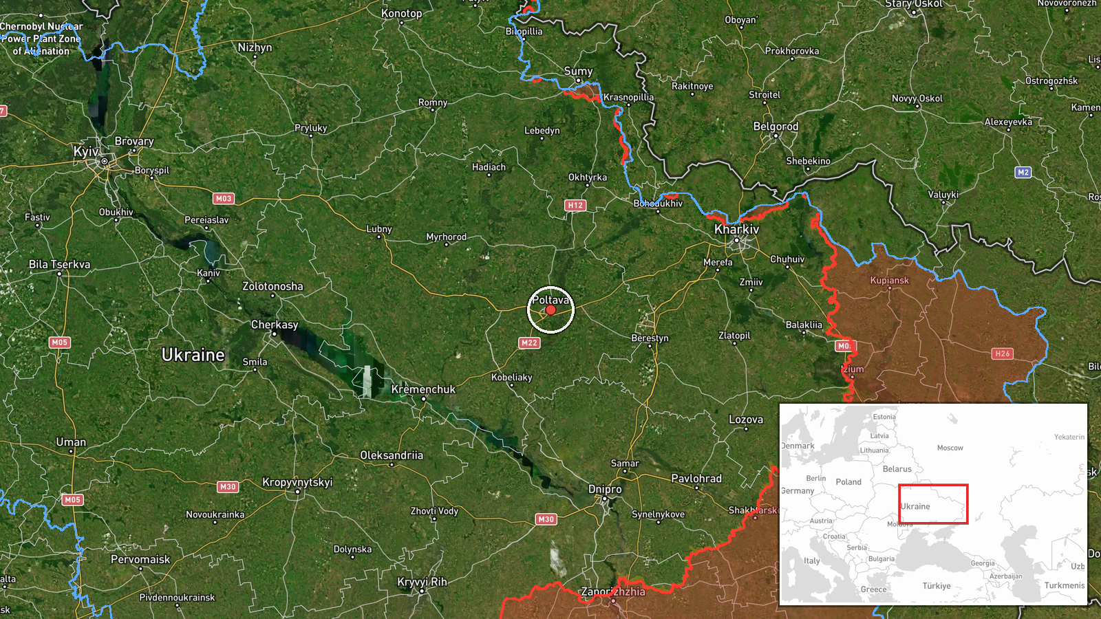
The coordinates correspond to Poltava city at settlement precision, matching the report's naming of the city itself rather than a facility or street. Location confidence is not separately scored. Poltava lies in central-eastern Ukraine on a broad, largely flat plain within Poltava Oblast, with the Vorskla River flowing through the city. Because the report names only the city, the drone's precise track and any intended target within it are unknown.
Related events nearby
- Ukrainian air monitoring: 1 Russian jet-powered Shahed (Geran-3) drone heading toward Poltava.2026-10-18 06:37 UTC · Drone Transit · Poltava, Ukraine
- Ukrainian air monitoring: 1 Russian jet-powered Shahed (Geran-3) drone over Poltava.2026-10-18 06:35 UTC · Drone Transit · Poltava, Ukraine
- Ukrainian air monitoring: 2 Russian Banderol mini cruise missiles heading toward Poltava.2026-10-17 18:33 UTC · Cruise Missile · Poltava, Ukraine
- Ukrainian air monitoring: 1 Russian Banderol mini cruise missile heading toward Poltava.2026-10-17 11:26 UTC · Cruise Missile · Poltava, Ukraine
- Ukrainian air monitoring: 1 Russian jet-powered Shahed (Geran-3) drone passing Poltava Oblast, heading northwe2026-10-17 08:17 UTC · Drone Transit · Poltava Oblast, Ukraine
▶ View this event on the live map

Intel Mapper aggregates open-source reports from monitored Telegram and X channels, geolocates them, cross-checks duplicates across sources and assigns a confidence score. Entries are updated as new confirmations arrive. Read how we verify events.