Jet-powered Shahed-type drone reported over Khmelnytskyi, western Ukraine, on 18 October
What happened
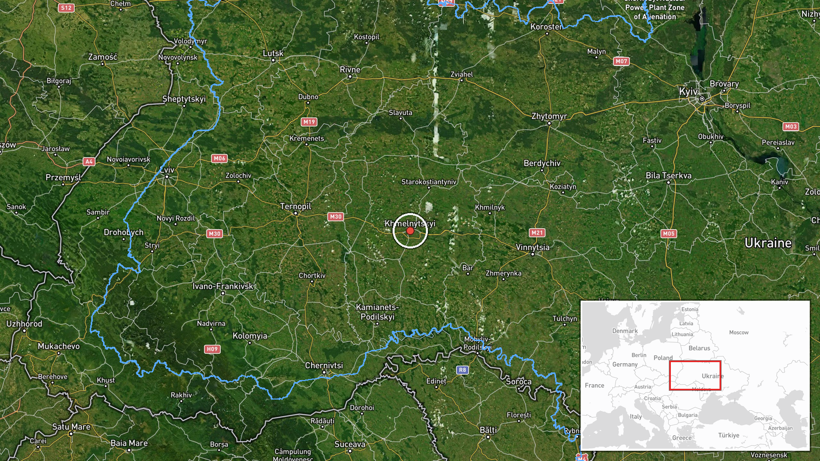
Ukraine's air monitoring channel on Telegram (@kpszsu) reported one Russian jet-powered Shahed-type drone, identified as a Geran-3, at or past Khmelnytskyi on 18 October 2026 at 06:38 UTC. The original Ukrainian post uses the phrase na/povz, which can mean either at or past the city, so the wording does not establish whether the drone struck a target, was intercepted, or simply transited the area. The report describes a drone sighting rather than an impact, and no damage, casualties or interception is mentioned. The event rests on a single channel. Earlier monitoring that morning placed a drone from Vinnytsia Oblast heading toward Khmelnytskyi, and this report sits within a sequence of similar alerts.
Context and assessment
Khmelnytskyi is a regional administrative centre in western Ukraine, on the Southern Bug river, and the surrounding oblast has hosted military aviation infrastructure. That makes the city a plausible point along long-range drone routes, although the data does not identify a specific target. The related reports show a sustained pattern rather than an isolated sighting. On 17 October, monitoring placed Shahed-type drones over Khmelnytskyi Oblast and passing Derazhnya, both described as heading toward Khmelnytskyi. On 18 October, the morning sequence moved from a drone entering from Vinnytsia Oblast toward the city at 06:34, to this report at 06:38, then to two reports over or past Krasyliv at 06:44 and 06:57, the latter describing a drone heading north. Taken together, the sequence suggests either several drones or one drone tracked across multiple reporting points, though the data cannot confirm the number of airframes. The Geran-3 is jet-powered and faster than the piston-engined Shahed-136, which would shorten warning times and narrow interception windows. Analysts would typically read this pattern as a transit corridor across western Ukraine rather than a deliberate strike on the city, though that reading remains an inference.
Sources and confidence
All information comes from one Telegram channel, @kpszsu, the only source listed for this event. No second outlet, official statement or independent monitor in the data confirms the sighting, so cross-confirmation is absent. The confidence score of 8.0 is relatively high for a single source, reflecting the channel's role in real-time air monitoring and its consistency with related reports from the same morning. It is not higher because the post is brief and does not describe any outcome. Confidence would rise with a second monitoring feed, regional military administration statements or debris reports. It would fall if corrections or conflicting route descriptions appeared.
Location
The location is assigned at settlement precision, centred on Khmelnytskyi city, a high-confidence match because the source names the city directly. The point does not represent a facility or the drone's exact position, which the source does not give. Khmelnytskyi lies in the Podillia region of western Ukraine on the Southern Bug river, surrounded by farmland and forest belts. Krasyliv and Derazhnya are nearby settlements in the same oblast, and the area borders Vinnytsia Oblast to the south.
Related events nearby
- Ukrainian air monitoring: 1 Russian jet-powered Shahed (Geran-3) drone from Vinnytsia Oblast toward Khmelnytsk2026-10-18 06:34 UTC · Drone Transit · Khmelnytskyi, Ukraine
- Ukrainian air monitoring: 1 Russian Shahed-type drone passing Derazhnya, heading toward Khmelnytskyi.2026-10-17 14:25 UTC · Drone Transit · Khmelnytskyi, Ukraine
- Ukrainian air monitoring: 1 Russian Shahed-type drone over Khmelnytskyi Oblast.2026-10-17 14:13 UTC · Drone Transit · Khmelnytskyi Oblast, Ukraine
- Ukrainian air monitoring: 1 Russian jet-powered Shahed (Geran-3) drone over Krasyliv.2026-10-18 06:57 UTC · Drone Transit · Krasyliv, Ukraine
- Ukrainian air monitoring: 1 Russian jet-powered Shahed (Geran-3) drone passing Krasyliv, heading north.2026-10-18 06:44 UTC · Drone Transit · Krasyliv, Ukraine
▶ View this event on the live map

Intel Mapper aggregates open-source reports from monitored Telegram and X channels, geolocates them, cross-checks duplicates across sources and assigns a confidence score. Entries are updated as new confirmations arrive. Read how we verify events.