Single Russian Shahed-type drone reported over Shumsk, Ternopil Oblast, Ukraine
What happened
Ukrainian air monitoring reported one Russian Shahed-type drone over or near the settlement of Shumsk in Ternopil Oblast on 18 October 2026, at about 06:57 UTC. The original Ukrainian-language post, published on the Telegram channel @kpszsu, describes a UAV at or near Shumsk approaching from the east. It does not give a variant, altitude, onward heading, or any impact. The wording is a transit notice rather than a strike report, so it records the presence of the aircraft, not damage or casualties. The summary classes the drone as Shahed-type without naming a specific model, so that label should be read as the monitoring service's classification at the time of posting.
Context and assessment
Shumsk sits in western Ukraine, a region that has seen repeated drone transits toward the north and northwest of the country as Russian long-range strike waves move across Ukrainian airspace. The related events from the same morning show a cluster of single drones tracked across several oblasts within roughly ninety minutes. Reports from Vyshnivets and Iziaslav at 05:22, 05:43 and 06:47 UTC describe jet-powered Geran-3 variants, while reports of drones moving from northern Khmelnytskyi and northwestern Zhytomyr toward Rivne Oblast at 05:52 and 06:51 UTC describe the Shahed-type airframe in similar terms. Taken together, the pattern suggests a sustained flight path through the region rather than an isolated incursion. Operationally, such sequences are often read as route reconnaissance, a deliberate decoy or saturation element, or simply the spillover of a larger raid whose main targets lie elsewhere. The data cannot establish which of these applies. Each individual report describes one aircraft, so the cluster should be treated as a flow of small, dispersed transits, not as evidence of a coordinated attack on Shumsk itself.
Sources and confidence
The event rests on one channel, the Telegram account @kpszsu, which carries the monitoring feed. No second outlet or official statement in the data independently confirms the Shumsk sighting. The confidence score of 8.0 reflects a credible, specific and routinely used alert channel, with precise settlement-level location and a consistent pattern with nearby reports, offset by the single-source basis and the absence of any corroborating track or impact report. Confidence would rise if regional military administration statements, air alert records or a second monitoring channel referenced the same drone and time. It would fall if later updates revised the track, placed the drone elsewhere, or identified the object as a different aircraft type.
Location
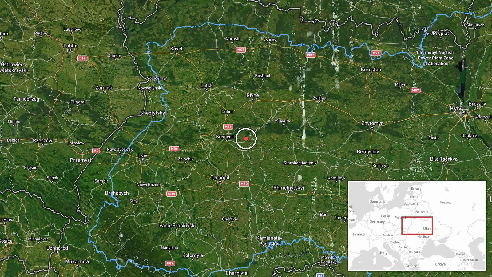
The location is recorded at settlement level, with coordinates near 50.118 N, 26.118 E, and location confidence is rated high. The post names Shumsk directly, and the coordinates correspond to the town rather than to a military or industrial facility. The reported position is 'at or near' the settlement, so the exact track over the surrounding countryside is not known. Shumsk lies in Ternopil Oblast in the western part of Ukraine, in a largely agricultural landscape of fields, small rivers and forest patches typical of the region. The town is not a major urban centre, which means the coordinates mark a reference point for the report rather than a precise target.
Related events nearby
- Ukrainian air monitoring: 1 Russian jet-powered Shahed (Geran-3) drone heading toward Vyshnivets.2026-10-18 05:22 UTC · Drone Transit · Vyshnivets, Ukraine
- Ukrainian air monitoring: 1 Russian jet-powered Shahed (Geran-3) drone over Iziaslav.2026-10-18 06:47 UTC · Drone Transit · Iziaslav, Ukraine
- Ukrainian air monitoring: 1 Russian jet-powered Shahed (Geran-3) drone heading toward Iziaslav.2026-10-18 05:43 UTC · Drone Transit · Iziaslav, Ukraine
- Ukrainian air monitoring: 1 Russian Shahed-type drone from northwestern Zhytomyr Oblast toward Rivne Oblast.2026-10-18 06:51 UTC · Drone Transit · Rivne Oblast, Ukraine
- Ukrainian air monitoring: 1 Russian jet-powered Shahed (Geran-3) drone from northern Khmelnytskyi Oblast towar2026-10-18 05:52 UTC · Drone Transit · Rivne Oblast, Ukraine
▶ View this event on the live map

Intel Mapper aggregates open-source reports from monitored Telegram and X channels, geolocates them, cross-checks duplicates across sources and assigns a confidence score. Entries are updated as new confirmations arrive. Read how we verify events.