Jet-powered Geran-3 drone reported passing Kulykivka in Chernihiv Oblast, heading south
What happened
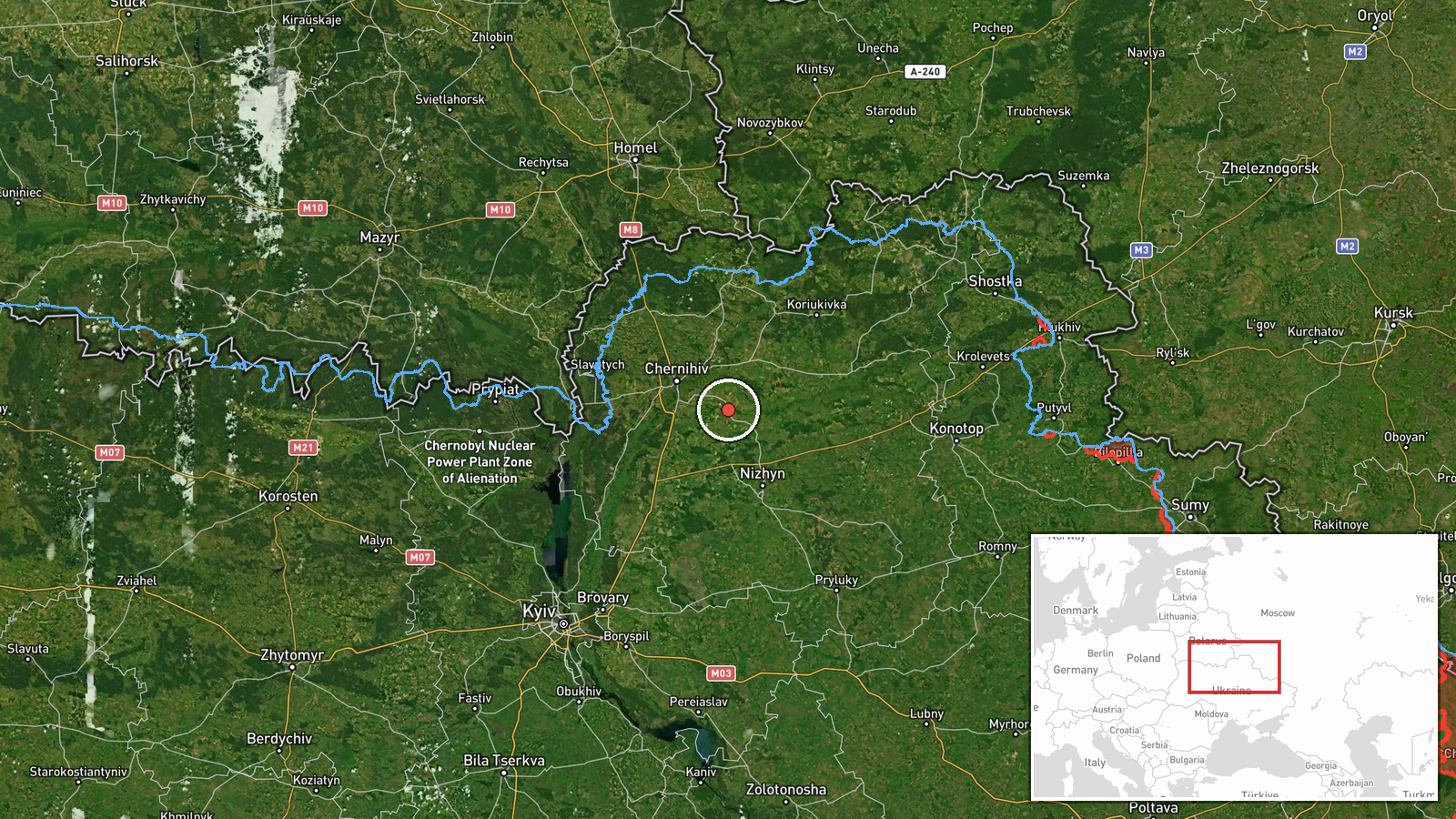
Ukrainian air monitoring reported one Russian jet-powered Shahed (Geran-3) drone passing the settlement of Kulykivka in Chernihiv Oblast on 18 October 2026, at about 07:46 UTC, on a southerly heading. The report was posted on Telegram by the channel tagged @kpszsu, with a short original-language line describing a jet-type unmanned aerial vehicle moving past Kulykivka. The wording describes a transit only. It does not say the drone struck anything, entered a target area, or caused damage, and no casualties or impacts are mentioned. The report is a single-line air alert of the kind typically issued as a track moves through monitored airspace.
Context and assessment
Chernihiv Oblast sits in northern Ukraine and borders both Belarus and Russia, so aerial tracks passing through it often reflect routes used by Russian long-range strike drones toward targets further south or west. This report belongs to a cluster of linked alerts on 17 and 18 October. On 17 October, a Geran-3 was reported heading toward Berezna at 14:42 UTC, and a separate Geran-3 was reported heading toward Chernihiv at 13:48 UTC. Later that afternoon, two or more Shahed-type drones were reported over Chernihiv Oblast at 14:59 UTC. On 18 October, a Banderol mini cruise missile was reported passing Voronizh at 07:45 UTC heading toward Chernihiv Oblast, and another was reported passing Berezna at 07:58 UTC heading toward Chernihiv. Taken together, the pattern suggests a sustained, multi-type approach through the same northern corridor over roughly a day. Operationally, such clustering may indicate a coordinated strike package or a probing run, though the data alone cannot confirm intent or the final target.
Sources and confidence
The event rests on one channel, the Telegram account @kpszsu, and no independent outlet in the dataset repeats the report. The confidence score of 8.0 reflects that the channel is an official-style air monitoring feed with a consistent format, and that the related alerts for the same day show a similar pattern. It is held below the top of the scale because there is no second source and the report does not confirm the drone's final destination. Confidence would rise with corroboration from another monitoring channel, regional military administration statements, or reports of impacts at nearby locations. It would fall if later updates revised the track, reclassified the drone type, or withdrew the alert.
Location
The coordinates correspond to the settlement of Kulykivka, which is the place the report names. The location is therefore settlement-level and carries high confidence, with no sign of an estimate or an unnamed facility. Kulykivka lies in the northern part of Chernihiv Oblast, an area of farmland, small towns, river valleys and forest belts. The Desna river system and its tributaries cross much of the wider region, and the Belarusian border lies to the north. The geography offers open terrain over which low-flying drones can be tracked without dense urban cover.
Related events nearby
- Ukrainian air monitoring: 1 Russian jet-powered Shahed (Geran-3) drone heading toward Berezna.2026-10-17 14:42 UTC · Drone Transit · Berezna, Ukraine
- Ukrainian air monitoring: 1 Russian Banderol mini cruise missile passing Berezna, heading toward Chernihiv.2026-10-18 07:58 UTC · Cruise Missile · Chernihiv, Ukraine
- Ukrainian air monitoring: 1 Russian Banderol mini cruise missile passing Voronizh, heading toward Chernihiv Ob2026-10-18 07:45 UTC · Cruise Missile · Chernihiv Oblast, Ukraine
- Ukrainian air monitoring: 2+ Russian Shahed-type drones over Chernihiv Oblast.2026-10-17 14:59 UTC · Drone Transit · Chernihiv Oblast, Ukraine
- Ukrainian air monitoring: 1 Russian jet-powered Shahed (Geran-3) drone heading toward Chernihiv.2026-10-17 13:48 UTC · Drone Transit · Chernihiv, Ukraine
▶ View this event on the live map

Intel Mapper aggregates open-source reports from monitored Telegram and X channels, geolocates them, cross-checks duplicates across sources and assigns a confidence score. Entries are updated as new confirmations arrive. Read how we verify events.