Ukrainian air monitoring reports one Russian Shahed-type drone heading toward Rivne, 18 October 2026
What happened
Ukrainian air monitoring, as posted on the Telegram channel @kpszsu, reported one Russian Shahed-type drone heading toward Rivne at 08:37 UTC on 18 October 2026. The original post is a brief Ukrainian-language notice, reading roughly as a UAV approaching Rivne from the east, and it includes a motorcycle emoji. The event summary describes the aircraft as Shahed-type, while a related report three minutes later identifies it as a jet-powered Geran-3. The report does not describe any impact, damage, or casualties, and the entry is classified as a drone transit rather than a strike. Several earlier monitoring reports that morning describe drones moving across neighbouring oblasts toward Rivne.
Context and assessment
Rivne is a regional centre in northwestern Ukraine, and its position on the route from the north and east makes it a recurring point on drone tracks heading deeper into the west of the country. The related reports form a sequence that began around 03:30 UTC and continued through the morning, with tracks described from northern Khmelnytskyi Oblast, northwestern Zhytomyr Oblast, and the Horodnytsia area toward Rivne Oblast. This pattern suggests that the city and its oblast lie on repeated flight paths, which may reflect either multiple drones using similar corridors or several monitoring observations of the same aircraft as it moved. Shahed-type drones of this kind are typically launched in groups and follow pre-set routes, so a steady stream of transit reports across one morning is consistent with a sustained raid rather than an isolated sighting. Transit reports, however, indicate only that an aircraft was seen passing or approaching. They do not establish a target, and a drone reported over an area may be intercepted, diverted, or continue elsewhere. Readers should treat the sequence as evidence of activity in the airspace over the region, not as confirmation of intent toward any specific installation.
Sources and confidence
The event rests on one channel, the Telegram account @kpszsu, which carries official Ukrainian air-threat monitoring posts and is the only source listed. The confidence score of 8.0 reflects the channel's standing for air monitoring and the internal consistency of the surrounding sequence of reports. It is held below the top of the scale because no second outlet has independently confirmed this specific track and no impact is reported. Confidence would rise with corroboration from the Ukrainian Air Force's public alerts, regional military administration statements, or independent monitoring accounts that name the same aircraft. It would fall if later updates revised the drone's type, reported it as shot down at a different location, or showed that the track had been mistaken for another object.
Location
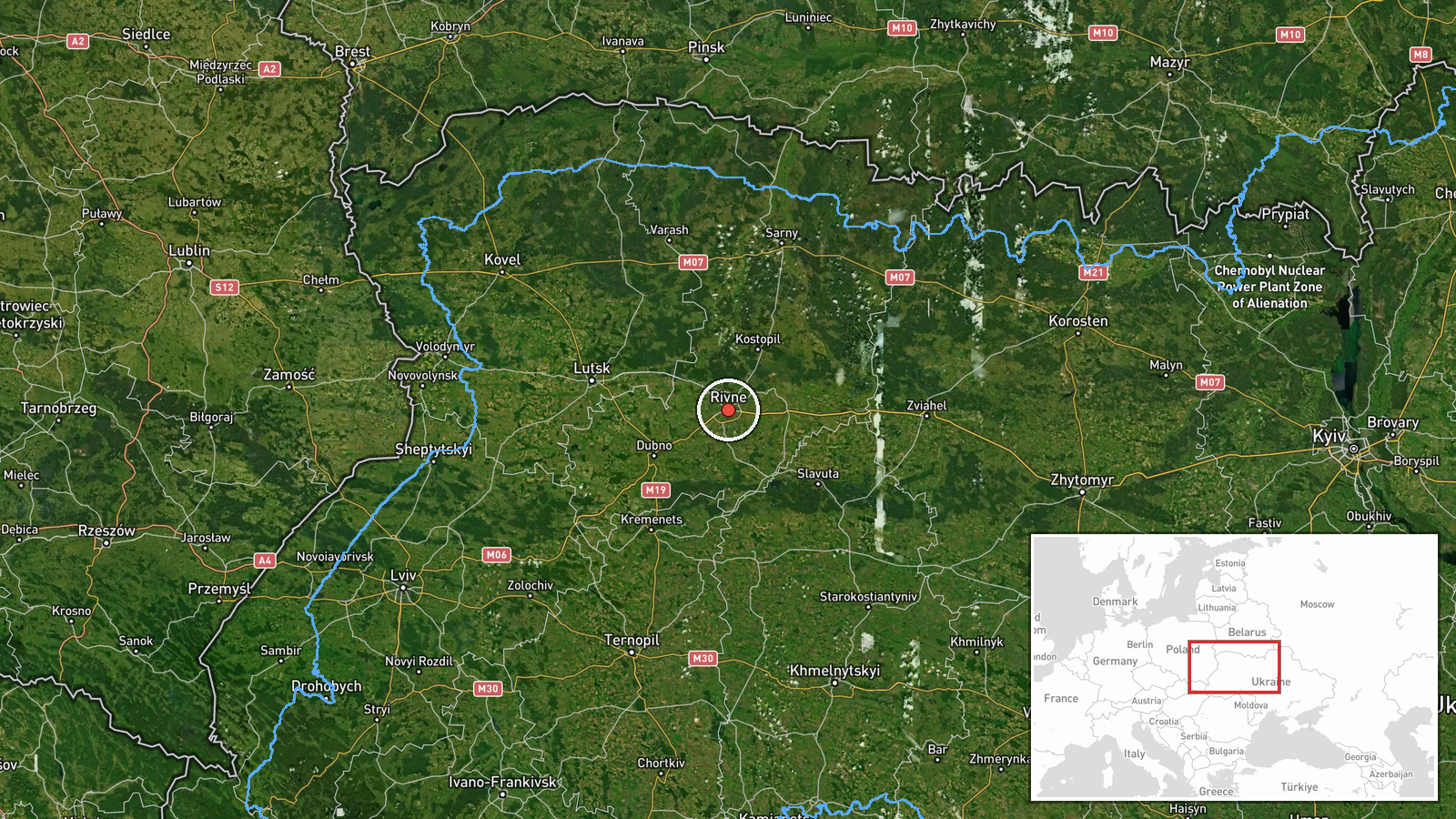
The location is set at the settlement level, using the coordinates for the city of Rivne at 50.62 N, 26.25 E, which the source gives with high location confidence. The report names the city directly rather than a facility, so the point marks the urban centre, not a specific site. Rivne lies in the Polissia lowlands of northwestern Ukraine, a region of flat terrain, forests, and wetland areas. The Horyn river basin runs through the wider oblast, and the city sits within a broad agricultural landscape that extends toward the Belarusian border to the north.
Related events nearby
- Ukrainian air monitoring: 1 Russian jet-powered Shahed (Geran-3) drone over Rivne.2026-10-18 08:40 UTC · Drone Transit · Rivne, Ukraine
- Ukrainian air monitoring: 1 Russian jet-powered Shahed (Geran-3) drone passing Horodnytsia, heading toward Riv2026-10-18 08:31 UTC · Drone Transit · Rivne Oblast, Ukraine
- Ukrainian air monitoring: 1 Russian Shahed-type drone from northwestern Zhytomyr Oblast toward Rivne Oblast.2026-10-18 06:51 UTC · Drone Transit · Rivne Oblast, Ukraine
- Ukrainian air monitoring: 1 Russian jet-powered Shahed (Geran-3) drone from northern Khmelnytskyi Oblast towar2026-10-18 05:52 UTC · Drone Transit · Rivne Oblast, Ukraine
- Ukrainian air monitoring: 1 Russian jet-powered Shahed (Geran-3) drone heading toward Rivne.2026-10-18 03:30 UTC · Drone Transit · Rivne, Ukraine
▶ View this event on the live map

Intel Mapper aggregates open-source reports from monitored Telegram and X channels, geolocates them, cross-checks duplicates across sources and assigns a confidence score. Entries are updated as new confirmations arrive. Read how we verify events.