Single Russian Shahed-type drone reported moving from Sumy toward Chernihiv Oblast
What happened
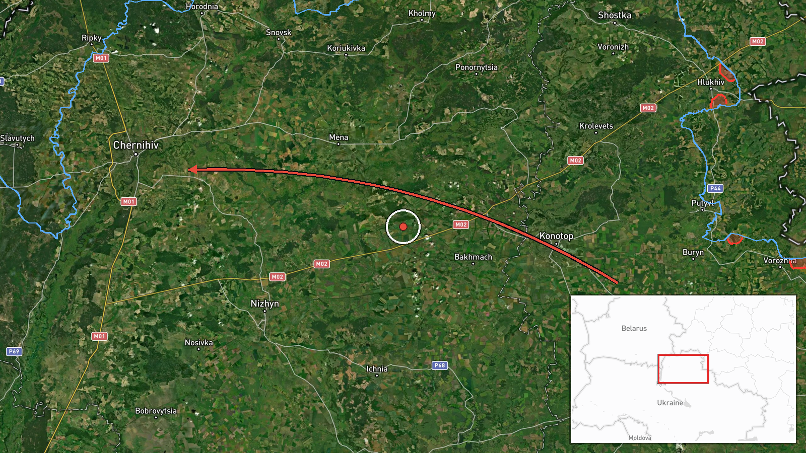
Ukrainian air monitoring reported one Russian Shahed-type drone flying from Sumy Oblast toward Chernihiv Oblast in the early hours of 19 October 2026 UTC, with the report timed at 02:44. The original Ukrainian-language post, published on the Telegram channel @kpszsu, described a UAV on the northwest direction of Sumy region on a course for Chernihiv region. The wording indicates a transit track rather than a confirmed impact, and it does not name a specific target, settlement, or outcome. No casualties, damage, or interception are described in the report. The track is recorded at regional level only, so the exact flight path and final point are not established by the source.
Context and assessment
Chernihiv Oblast lies in northern Ukraine, bordering Russia and Belarus, and it sits next to Sumy Oblast to the east. Its territory includes Chernihiv city, Slavutych, and road and rail routes that connect the north with Kyiv, which gives it operational relevance for air activity heading toward the capital region. The related records show a dense cluster on the previous day. Between roughly 07:30 and 07:58 UTC on 18 October, the monitoring log recorded a Shahed-type drone passing Slavutych heading south, a jet-powered Geran-3 passing Kulykivka heading south, and Banderol mini cruise missiles over Mena, near Voronizh, and passing Berezna, all heading toward Chernihiv or its oblast. Multiple weapon types moving through the same northern corridor within about half an hour, with a repeated focus on Chernihiv, suggests a sustained effort rather than a single isolated launch. Against that background, one drone heading toward the oblast the following day may reflect a continuing pattern of air activity aimed at or routed through the area. The related entries do not identify targets, so intent cannot be established. Operationally, mixing slow drones with low-flying cruise missiles can be used to stretch air defence and test response times. Analysts would normally treat a lone drone as low intensity, but as part of a series it may point to ongoing pressure on northern infrastructure. This reading remains provisional given the thin source base.
Sources and confidence
All reporting for this event comes from one channel, Telegram @kpszsu, which is the Ukrainian Air Force's official air monitoring account. The source count is one, and no independent outlet or secondary confirmation appears in the data. The confidence score of 8.0 reflects single-source reporting, the absence of impact or debris reports, and the lack of any geolocated track. The record is not marked as corrected. Confidence would rise with independent reports of the drone's arrival, air-raid alerts in Chernihiv Oblast, debris recovery, or statements from regional officials. It would fall if subsequent updates revised the direction, cancelled the track, or indicated a different launch origin.
Location
The coordinates 51.49 and 31.29 are an approximate center point for Chernihiv Oblast, with geo_precision set to region and location confidence rated low. No settlement or facility was identified, so the point should not be read as a target. Chernihiv Oblast occupies the northern part of Ukraine, with extensive forest, marsh and river terrain in the Polissia lowlands, drained by tributaries of the Dnipro including the Desna.
Related events nearby
- Ukrainian air monitoring: 1 Russian Banderol mini cruise missile passing Berezna, heading toward Chernihiv.2026-10-18 07:58 UTC · Cruise Missile · Chernihiv, Ukraine
- Ukrainian air monitoring: 1 Russian Banderol mini cruise missile passing Voronizh, heading toward Chernihiv Ob2026-10-18 07:45 UTC · Cruise Missile · Chernihiv Oblast, Ukraine
- Ukrainian air monitoring: 1 Russian jet-powered Shahed (Geran-3) drone passing Kulykivka, heading south.2026-10-18 07:46 UTC · Drone Transit · Kulykivka, Ukraine
- Ukrainian air monitoring: 1 Russian Shahed-type drone passing Slavutych, heading south.2026-10-18 07:30 UTC · Drone Transit · Slavutych, Ukraine
- Ukrainian air monitoring: 1 Russian Banderol mini cruise missile over Mena.2026-10-18 07:53 UTC · Cruise Missile · Mena, Ukraine
▶ View this event on the live map

Intel Mapper aggregates open-source reports from monitored Telegram and X channels, geolocates them, cross-checks duplicates across sources and assigns a confidence score. Entries are updated as new confirmations arrive. Read how we verify events.