Ukraine reports Russian jet-powered Shahed drones moving through Chernihiv Oblast toward Kyiv region
What happened
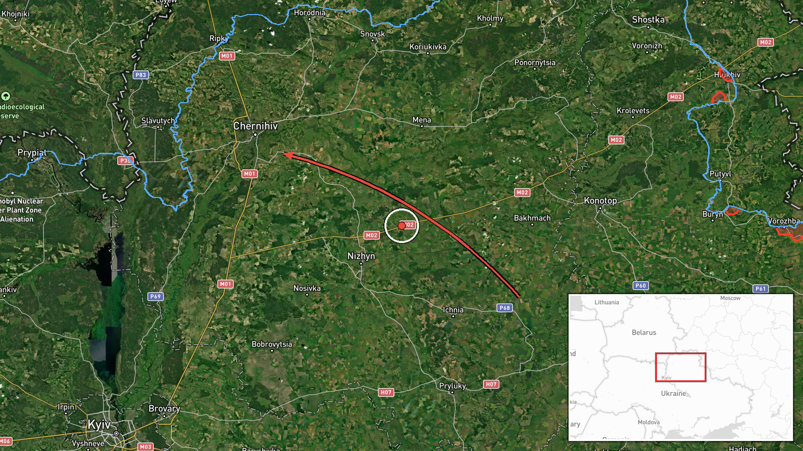
Ukraine's air monitoring, relayed through a single Telegram channel (@kpszsu), reported at 23:44 UTC on 19 October 2026 that three or more Russian jet-powered Shahed (Geran-3) drones were passing the settlement of Nova and heading toward Chernihiv Oblast. The original Ukrainian-language post describes new groups of jet-powered unmanned aerial vehicles arriving from Bryansk Oblast in Russia into Chernihiv Oblast, in the direction of the Kyiv region. The report names no confirmed impact point, casualties, or damage assessment, and Nova is the only settlement mentioned. The event is classified as a drone transit rather than a strike, so the information concerns the movement of the aircraft, not detonations on the ground.
Context and assessment
Chernihiv Oblast lies in northern Ukraine and borders Russia's Bryansk Oblast, so it sits on one of the main air corridors that Russian drones have used to approach Kyiv from the north. Related reports from the same day show a sustained pattern rather than an isolated sighting. Earlier, at 02:43 and 02:44 UTC, single Shahed-type drones were logged crossing southern Chernihiv Oblast and moving from Sumy Oblast. At 03:43 a cruise missile was reported heading toward Kozelets. At 16:17 a further group of at least two Geran-3 drones was reported from Bryansk toward northern Chernihiv Oblast, and at 21:01 at least two more were reported heading toward Chernihiv city. One related entry also mentions a Geran-3 from Poltava, though its details are incomplete. Operationally, the repeated waves from several directions may suggest continued use of the northern corridor, possibly to reach targets further south or to saturate air defenses. Jet-powered variants are generally faster than piston-engined Shaheds, which could shorten warning times. These inferences rest on the timing and routing of reports and do not establish intent.
Sources and confidence
All of the information comes from one Telegram channel, @kpszsu, and the dataset records no independent confirmation from another outlet, official statement, or local authority. The confidence score of 8.0 is relatively high because the channel is an established Ukrainian air-monitoring feed, the post is specific about drone type and route, and the same day's related entries describe a consistent pattern. It is still held below the top range because the report is a single-source transit track with no impact data, and the location is approximate. Confidence would rise with corroboration from Ukrainian Air Force statements, regional military administration posts, or Kyiv-region alert records. It would fall if later updates revised the number or type of drones, or if the track was attributed to a different route.
Location
The location is region-level. The coordinates (51.49 N, 31.29 E) are an approximate central point for Chernihiv Oblast rather than a geocoded settlement, and the data gives location confidence as low. Nova is named in the report but is not precisely placed in the dataset. Chernihiv Oblast is in northern Ukraine, bordered to the north by Russia's Bryansk Oblast and by Belarus to the north-west. The Desna River and its valley cross the region, and the north is marked by forests and wetlands. Kyiv Oblast lies to the south.
Related events nearby
- Ukrainian air monitoring: 2+ Russian jet-powered Shahed (Geran-3) drones heading toward Chernihiv.2026-10-19 21:01 UTC · Drone Transit · Chernihiv, Ukraine
- Ukrainian air monitoring: 1 Russian Shahed-type drone from Sumy Oblast toward Chernihiv Oblast.2026-10-19 02:44 UTC · Drone Transit · Chernihiv Oblast, Ukraine
- Ukrainian air monitoring: 1 Russian cruise missile heading toward Kozelets.2026-10-19 03:43 UTC · Cruise Missile · Kozelets, Ukraine
- Ukrainian air monitoring: 2+ Russian jet-powered Shahed (Geran-3) drones from northern Kyiv Oblast toward nort2026-10-20 00:14 UTC · Drone Transit · northern Chernihiv Oblast, Ukraine
- Ukrainian air monitoring: 2+ Russian jet-powered Shahed (Geran-3) drones from Bryansk (Russia) toward northern2026-10-19 16:17 UTC · Drone Transit · northern Chernihiv Oblast, Ukraine
▶ View this event on the live map

Intel Mapper aggregates open-source reports from monitored Telegram and X channels, geolocates them, cross-checks duplicates across sources and assigns a confidence score. Entries are updated as new confirmations arrive. Read how we verify events.