One jet-powered Geran-3 drone reported transiting northern Kyiv Oblast, heading west
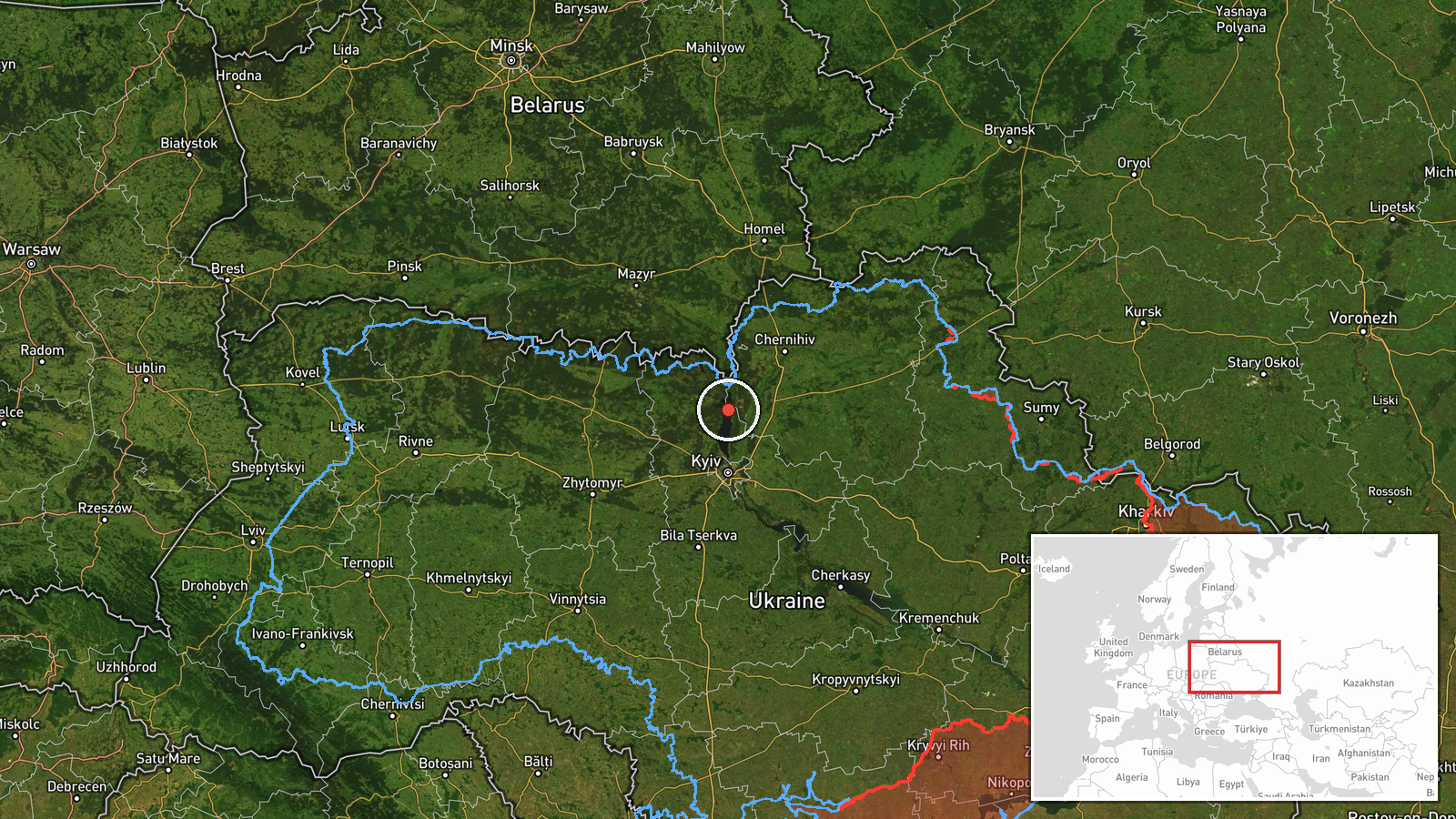
What happened
Ukrainian air monitoring reported one Russian jet-powered Shahed (Geran-3) drone passing through northern Kyiv Oblast at about 02:45 UTC on 19 October 2026. The source, a Ukrainian-language Telegram post from the @kpszsu channel, reads roughly as 'jet-type UAV in the north of Kyiv region, course west.' The post names no settlement, gives no altitude or speed, and reports no impact or interception. The event is a transit sighting, not a confirmed strike. The Russian attribution comes from the designation used in the channel's summary rather than from any separate statement.
Context and assessment
The location matters because northern Kyiv Oblast sits on the air approach to the capital, and the drones and missiles in this sequence follow the same northern corridor. The 18 October reports are the most relevant recent pattern. At 05:57 UTC, two or more jet-powered Geran-3 drones were reported over the same northern area heading west. At 06:56 and 07:01, single Shahed-type drones were tracked from the north toward Dymer and then Vyshhorod. Later that evening, at 19:40 and 19:41, Banderol mini cruise missiles were reported near the Brovary district and the Kyiv Reservoir, both heading for Vyshhorod. Taken together, the sequence suggests repeated probing or routing through the northern approaches over a single day. It may indicate attempts to saturate or test air defenses, or it may reflect routing toward targets further west or south. The data does not show what those targets were, so any operational reading remains provisional.
Sources and confidence
The event rests on one Telegram channel with no independent confirmation in the dataset. Ukrainian air monitoring channels usually relay sightings from official air alerts and radar-based reporting, which gives the account some reliability, but the post itself is brief and carries no independent detail. The confidence score of 8.0 reflects a credible monitoring source with a clear, specific report, tempered by the absence of a second source and the lack of a precise track. Confidence would rise with corroboration from other monitoring accounts, an official Ukrainian Air Force statement, or matching alert records. It would fall if the channel corrected or withdrew the report, or if the track could not be matched to the wider sequence. The event is not marked as corrected.
Location
The location is recorded at region level, not as a settlement or facility, and the location confidence is rated low. The coordinates, roughly 50.995 N and 30.52 E, are an approximate centre point for the northern part of Kyiv Oblast rather than a verified position on the drone's track. The area is a transition zone between the Polissia forests to the north and the forest-steppe farther south, with the Dnipro and Desna river valleys and the Kyiv Reservoir in the broader region. Those features help explain why the corridor is used for approaches toward Kyiv.
Related events nearby
- Ukrainian air monitoring: 2+ Russian jet-powered Shahed (Geran-3) drones passing northern Kyiv Oblast, heading2026-10-18 05:57 UTC · Drone Transit · northern Kyiv Oblast, Ukraine
- Ukrainian air monitoring: 1 Russian Shahed-type drone from northern Kyiv Oblast toward Dymer.2026-10-18 06:56 UTC · Drone Transit · Dymer, Ukraine
- Ukrainian air monitoring: 1 Russian Banderol mini cruise missile passing Kyiv Reservoir, heading toward Vyshho2026-10-18 19:41 UTC · Cruise Missile · Vyshhorod, Ukraine
- Ukrainian air monitoring: 1 Russian Banderol mini cruise missile passing Brovary district, heading toward Vysh2026-10-18 19:40 UTC · Cruise Missile · Vyshhorod, Ukraine
- Ukrainian air monitoring: 1 Russian Shahed-type drone passing Dymer, heading toward Vyshhorod.2026-10-18 07:01 UTC · Drone Transit · Vyshhorod, Ukraine
▶ View this event on the live map

Intel Mapper aggregates open-source reports from monitored Telegram and X channels, geolocates them, cross-checks duplicates across sources and assigns a confidence score. Entries are updated as new confirmations arrive. Read how we verify events.