Ukrainian Air Force reports cruise missile moving west through eastern Chernihiv Oblast
What happened
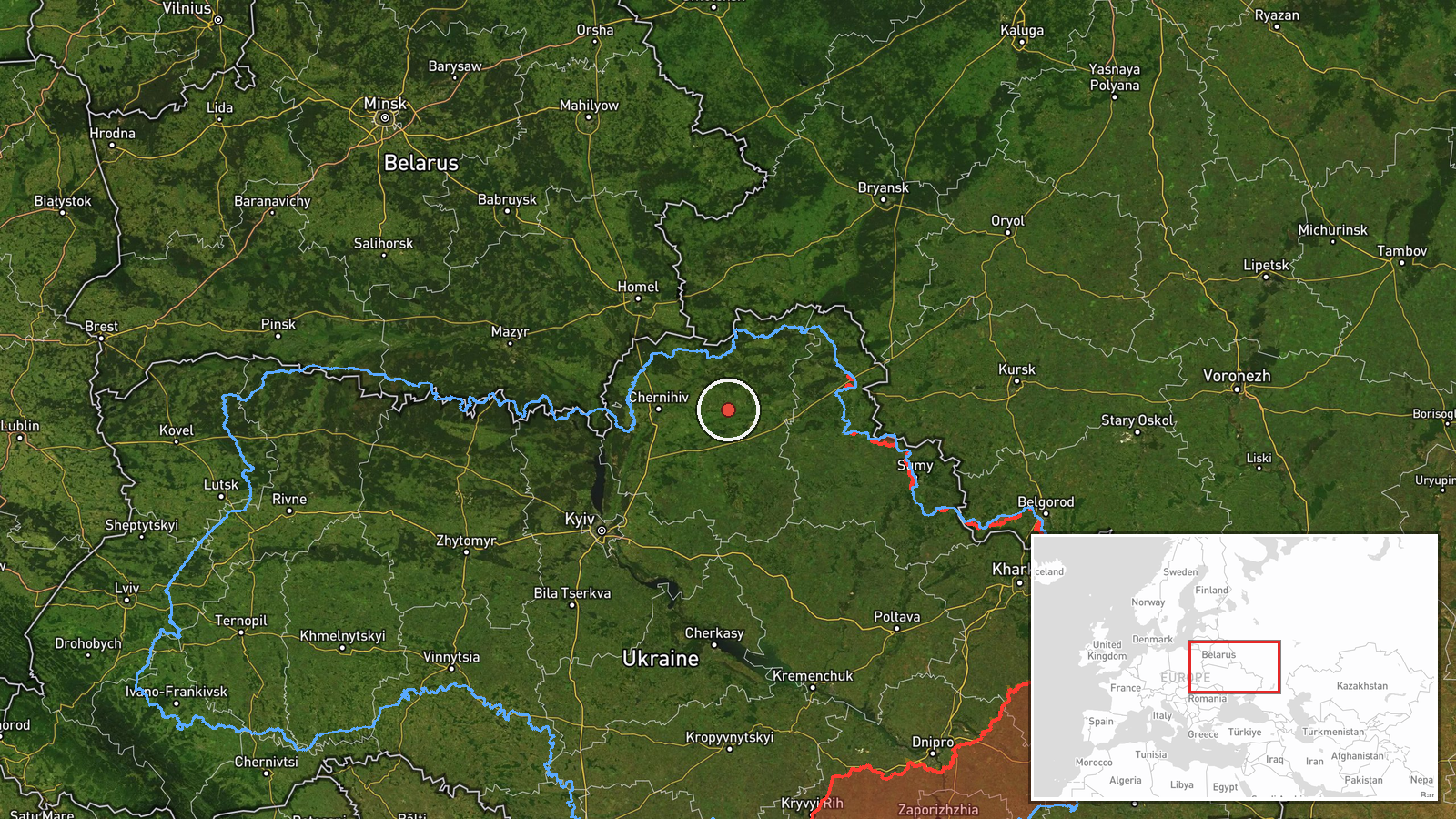
Ukraine's Air Force monitoring channel on Telegram (@kpszsu) reported on 19 October 2026 at 03:38 UTC that cruise missiles were passing through eastern Chernihiv Oblast on a westward heading. The original Ukrainian post reads 'Крилаті ракети на сході Чернігівщини, курс на захід' and uses the plural, while the structured event record summarizes it as one Russian cruise missile, so the count is not settled by the wording. The post describes an air-monitoring track only. It names no impact site, casualties, or damage, and it gives no altitude, speed, or specific settlement along the route. The event record attributes the launch to Russia, though the post itself does not name a launch point.
Context and assessment
Chernihiv Oblast sits in northern Ukraine and borders Belarus to the north and Russia's Bryansk region to the northeast, which makes its eastern districts a frequent path for Russian air activity heading toward the oblast's centre and the city of Chernihiv. The related events show a dense sequence over roughly 24 hours. On 18 October, a Geran-3 jet-powered Shahed-type drone was tracked from northern Chernihiv Oblast toward Mena at 07:36 UTC, a second Geran-3 passed Kulykivka heading south at 07:46, and a Banderol mini cruise missile was reported over Mena at 07:53 and then passing Berezna toward Chernihiv at 07:58. Early on 19 October a Shahed-type drone was logged moving from Sumy Oblast toward Chernihiv Oblast at 02:44. Taken together, these reports suggest that Russian drones and low-flying cruise missiles were being routed through the same northern corridor over successive hours. Operationally, this pattern may indicate an effort to reach targets in or near Chernihiv city or its surrounding infrastructure, though the reports do not identify any intended target. It may also reflect routine saturation of air defence across a wide front. The overlap in timing and track makes the October 19 missile report plausibly part of this wider wave rather than an isolated launch.
Sources and confidence
Only one source is involved. The Telegram channel @kpszsu is the official air-monitoring feed of Ukraine's Air Force, which is a primary authority for alerts of this kind, so its reporting carries institutional weight. The confidence score of 8.0 reflects that official origin and the specificity of the direction and region. It is held below the maximum because no second independent outlet or open-source tracker in the dataset confirms the track, the missile count conflicts between the original text and the summary, and the post gives no timestamp for the sighting itself. Confidence would rise with corroborating reports from other Ukrainian military or regional authorities, debris or impact reporting, or radar-based tracks from independent monitors. It would fall if the count were revised, if later statements retracted the track, or if the report were shown to refer to a different airspace event.
Location
The location is region-level only. The coordinates, 51.49 N and 32.24 E, approximate the eastern part of Chernihiv Oblast rather than a specific settlement, facility, or point on a flight path, and the location confidence is recorded as low. The post names only the oblast. The area is largely lowland, with forest and marsh of the Polissia belt, and the Desna River system running through the region. The Belarusian border lies to the north, and the Sumy Oblast boundary is to the east. These features shape the approach routes for air activity.
Related events nearby
- Ukrainian air monitoring: 1 Russian Banderol mini cruise missile over Mena.2026-10-18 07:53 UTC · Cruise Missile · Mena, Ukraine
- Ukrainian air monitoring: 1 Russian jet-powered Shahed (Geran-3) drone from northern Chernihiv Oblast toward M2026-10-18 07:36 UTC · Drone Transit · Mena, Ukraine
- Ukrainian air monitoring: 1 Russian jet-powered Shahed (Geran-3) drone passing Kulykivka, heading south.2026-10-18 07:46 UTC · Drone Transit · Kulykivka, Ukraine
- Ukrainian air monitoring: 1 Russian Shahed-type drone from Sumy Oblast toward Chernihiv Oblast.2026-10-19 02:44 UTC · Drone Transit · Chernihiv Oblast, Ukraine
- Ukrainian air monitoring: 1 Russian Banderol mini cruise missile passing Berezna, heading toward Chernihiv.2026-10-18 07:58 UTC · Cruise Missile · Chernihiv, Ukraine
▶ View this event on the live map

Intel Mapper aggregates open-source reports from monitored Telegram and X channels, geolocates them, cross-checks duplicates across sources and assigns a confidence score. Entries are updated as new confirmations arrive. Read how we verify events.