Jet-powered Shahed drones tracked over Vinnytsia and Zhytomyr oblasts, Ukraine
What happened
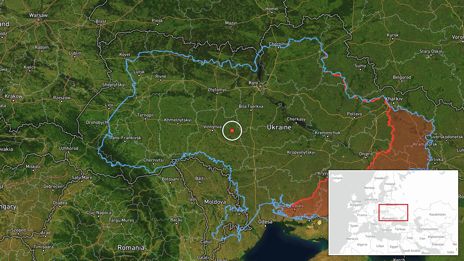
Ukraine's Air Force monitoring channel on Telegram (@kpszsu) reported on 19 October 2026 at 04:12 UTC that one Russian jet-powered Shahed (Geran-3) drone was passing through the eastern part of Vinnytsia Oblast on a northerly heading. A second line in the same update said two or more similar jet-powered drones were passing through northern Zhytomyr Oblast on a westerly heading. The original Ukrainian wording uses the term 'реактивний БпЛА' (jet-powered unmanned aircraft) and describes the aircraft only as transiting. It does not mention impacts, damage, casualties, or interceptions. The report is a single-source air-monitoring notice, and no location more precise than the regional level has been published.
Context and assessment
The report fits a sustained pattern of Russian long-range strikes against central and northern Ukraine. In the preceding day, related entries record a Shahed (Geran-3) drone over Pohrebyshche and another passing Kozyatyn toward Vinnytsia Oblast, followed by several Banderol mini cruise missiles tracked toward Volodarka, Pohrebyshche and Kalynivka. Taken together, these entries suggest that the air corridor over Vinnytsia is being used repeatedly, and that the transit route runs toward the north and west, where Zhytomyr Oblast lies on the approach to Kyiv and the Belarusian border. The jet-powered Geran-3 variant is generally understood to be faster than the older piston-engine Shahed models, which can make interception harder and shorten warning times. Tracks like these are commonly used by Ukrainian air defence to allocate fighter, mobile fire group and electronic warfare assets. A transit with no reported impact does not show the target, which may be a city, an energy site, a military facility, or simply a route to a different area. Recurring tracks of this kind can indicate either a broader strike campaign or reconnaissance and saturation activity, but the available data does not establish which.
Sources and confidence
Only one channel reported this event: the Telegram account @kpszsu, which belongs to the Ukrainian Air Force and is the usual official source for real-time aerial threat notices. No independent outlet, second military channel or local authority has yet been matched to this specific track. The confidence score of 8.0 reflects the official origin and the consistent wording with other Air Force notices in the same period. It is not higher because the post is unconfirmed by a second source, gives no precise coordinates, and has no published follow-up. Confidence would rise with a corroborating notice from Zhytomyr or Vinnytsia regional authorities or a documented sighting. It would fall if later updates revise the drone count or the direction of travel.
Location
The location is recorded only at regional level, eastern Vinnytsia Oblast, and the coordinates on the map are a representative point for that region rather than a settlement or facility. The geo precision is classified as region and the location confidence as low. The wider Zhytomyr reference is treated as a separate line in the same update. Eastern Vinnytsia lies in the central-western part of Ukraine, with broad farmland, river valleys and forest belts. Zhytomyr Oblast lies to the north and west, and it borders Belarus. Neither position shows a specific target.
Related events nearby
- Ukrainian air monitoring: 1 Russian Banderol mini cruise missile passing Volodarka, heading toward Pohrebyshch2026-10-18 19:10 UTC · Cruise Missile · Pohrebyshche, Ukraine
- Ukrainian air monitoring: 1 Russian jet-powered Shahed (Geran-3) drone over Pohrebyshche.2026-10-18 08:53 UTC · Drone Transit · Pohrebyshche, Ukraine
- Ukrainian air monitoring: 1 Russian Banderol mini cruise missile heading toward Volodarka.2026-10-18 19:02 UTC · Cruise Missile · Volodarka, Ukraine
- Ukrainian air monitoring: 1 Russian jet-powered Shahed (Geran-3) drone passing Kozyatyn, heading toward Vinnyt2026-10-18 06:29 UTC · Drone Transit · Vinnytsia Oblast, Ukraine
- Ukrainian air monitoring: 1 Russian Banderol mini cruise missile heading toward Kalynivka.2026-10-18 19:18 UTC · Cruise Missile · Kalynivka, Ukraine
▶ View this event on the live map

Intel Mapper aggregates open-source reports from monitored Telegram and X channels, geolocates them, cross-checks duplicates across sources and assigns a confidence score. Entries are updated as new confirmations arrive. Read how we verify events.