Ukrainian monitoring reports 2+ jet-powered Shahed drones passing Cherkasy Oblast westward
What happened
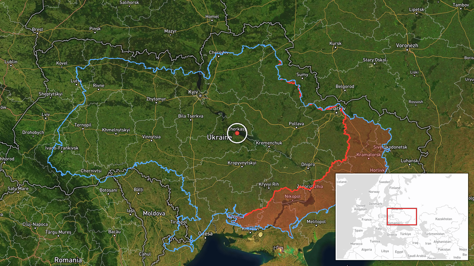
Ukrainian air monitoring reported on 19 October 2026 at 07:26 UTC that at least two Russian jet-powered Shahed-type drones, described in the event summary as Geran-3 models, were passing near Tal'ne in Cherkasy Oblast, central Ukraine, and moving in a westerly direction. The report was published on the Telegram channel @kpszsu. Its original wording uses the phrase 'jet-powered UAVs' without naming a specific model, so the Geran-3 identification comes from the summary rather than the quoted text. The original post also notes the drones were heading toward Vinnytsia Oblast. No impact, casualties, or damage were reported in the available material. The event is logged as a transit rather than a strike, meaning the drones were tracked in flight and no target was named.
Context and assessment
Cherkasy Oblast lies in central Ukraine, an area that Russian long-range strike packages have crossed repeatedly on routes toward western regions. The Tal'ne area sits within that corridor, so a transit report there is consistent with routing rather than a local attack. The preceding events show a similar pattern. Between 18:48 and 19:37 UTC on 18 October, Ukrainian monitoring logged single Russian Banderol mini cruise missiles over Zolotonosha district, then passing near Myrhorod and heading toward Zolotonosha district and Cherkasy Oblast. A siren at 17:02 UTC ended a ballistic missile threat alert, and a further preliminary reconnaissance entry on Banderol missiles gave no location. Taken together, the sequence suggests a mixed package of cruise missiles and jet-powered drones moving across central Ukraine over roughly twelve hours. Operationally, this could indicate an effort to stretch air defenses along a long axis, or it could point to targets in western Ukraine, although the reports themselves name no destinations. Transit reports alone cannot confirm intent, and the sequence may also reflect routine tracking of separate launches.
Sources and confidence
The report comes from a single channel, Telegram @kpszsu, and the provided data contains no independent outlet or second monitoring source covering the same drones. The event is not marked as corrected. The confidence score of 8.0 is high because the channel is a recognised Ukrainian air-monitoring source and the related events form a coherent timeline. It is held below the maximum because there is only one source, the geographic precision is regional, and location confidence is low. Confirmation from a second monitoring channel, a radar or flight-path track, or an official statement naming specific settlements would raise confidence. A correction, conflicting reports of a different route, or no further corroboration would lower it.
Location
The location was taken from the settlement named in the original post, Tal'ne, a town in Cherkasy Oblast, and is recorded at regional precision with approximate coordinates of 49.44 N, 32.06 E. The point is a general reference within the oblast rather than an exact drone position. The setting is largely agricultural, in the central Ukrainian plain. Because the drones were only noted in passing, the location confidence is rated low.
Related events nearby
- Ukrainian air monitoring: 1 Russian Banderol mini cruise missile passing Myrhorod, heading toward Cherkasy Obl2026-10-18 19:37 UTC · Cruise Missile · Cherkasy Oblast, Ukraine
- Ukrainian air monitoring: 1 Russian Banderol mini cruise missile passing Myrhorod, heading toward Zolotonosha 2026-10-18 19:19 UTC · Cruise Missile · Zolotonosha district, Ukraine
- Ukrainian air monitoring: 1 Russian Banderol mini cruise missile over Zolotonosha district.2026-10-18 18:48 UTC · Cruise Missile · Zolotonosha district, Ukraine
- Ukrainian air monitoring preliminary reconnaissance on Russian Banderol mini cruise missiles; no specific loca2026-10-18 19:45 UTC · Cruise Missile · Ukraine (location not reported)
- Ukrainian monitoring issues all-clear, ending the ballistic missile threat alert.2026-10-18 17:02 UTC · Siren · Ukraine (location not reported)
▶ View this event on the live map

Intel Mapper aggregates open-source reports from monitored Telegram and X channels, geolocates them, cross-checks duplicates across sources and assigns a confidence score. Entries are updated as new confirmations arrive. Read how we verify events.