Jet-powered Shahed drones reported transiting Vinnytsia toward Khmelnytskyi Oblast, 19 Oct
What happened
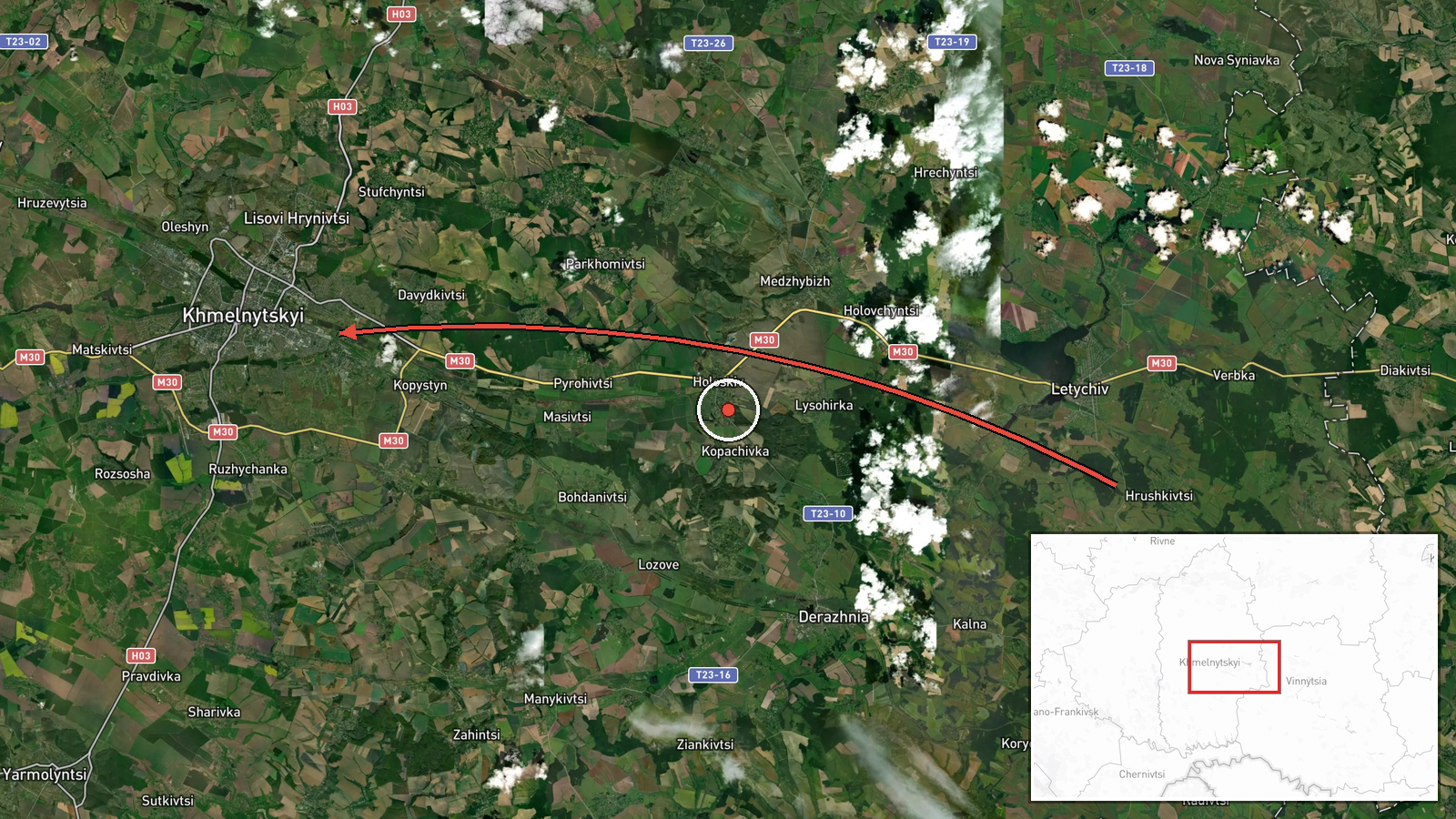
Ukraine's Air Force monitoring channel, Telegram account @kpszsu, reported on 19 October 2026 at about 07:57 UTC that two or more Russian jet-powered Shahed (Geran-3) drones were moving past Murovani Kurylivtsi in Vinnytsia Oblast toward Khmelnytskyi Oblast. The original Ukrainian wording, marked with a jet-drone icon and an arrow, describes the drones as 'passing' the settlement and heading into Khmelnytskyi. The report does not mention impacts, casualties, or damage, and it does not confirm where the drones ended their flight. The event is logged as a drone transit rather than a strike, and the attribution to Russia follows the channel's standard labeling of Shahed-type systems.
Context and assessment
This report sits within a sequence of Air Force alerts across the same corridor. Late on 18 October, a Banderol mini cruise missile was reported heading toward Kalynivka at 19:18 UTC and toward Khmelnytskyi Oblast at 19:33 UTC. The next morning, a single jet-powered Geran-3 was reported passing Voronovytsya toward Zhmerynka at 05:17, another was reported heading toward Vinnytsia at 05:22, and at least two were reported heading toward Khmilnyk at 06:27. The present report, at 07:57, continues that pattern of successive waypoint reports moving westward through Vinnytsia and into Khmelnytskyi. Khmelnytskyi Oblast contains rail nodes, energy infrastructure including the Khmelnytskyi nuclear power plant near Netishyn, and military airfields, so the route could reflect interest in several possible target sets. The jet-powered variant is faster and harder to intercept than older propeller-driven Shahed models, which is consistent with long-range attack planning. The routing alone does not establish a specific target, and the pattern may describe a transit toward areas further west rather than an intended strike in this oblast.
Sources and confidence
The event rests on one Telegram channel, with no cross-confirmation from a second outlet, regional administration, or independent monitoring source in the available data. The confidence score of 8.0 reflects the official status and consistent timing of the Air Force channel, along with the fit between this report and related alerts from the same morning. It does not reflect independent verification of the drone path. Confidence would rise with corroboration from regional authorities, open-source flight-tracking or radar-based reporting, or a later Air Force statement that confirms the route or reports an impact. It would fall if subsequent reports contradict the heading or if no further sightings or effects are recorded.
Location
The location is recorded at region level with low confidence. The coordinates (49.42, 26.98) mark a general point within Khmelnytskyi Oblast rather than a specific settlement or facility. The named reference point, Murovani Kurylivtsi, lies in neighboring Vinnytsia Oblast, so the coordinates should not be read as that village. The setting is the Podillia upland of west-central Ukraine, a mostly agricultural landscape of rolling terrain, river valleys, and scattered towns, with rail and road links that run through the region.
Related events nearby
- Ukrainian air monitoring: 1 Russian Banderol mini cruise missile heading toward Khmelnytskyi Oblast.2026-10-18 19:33 UTC · Cruise Missile · Khmelnytskyi Oblast, Ukraine
- Ukrainian air monitoring: 2+ Russian jet-powered Shahed (Geran-3) drones heading toward Khmilnyk.2026-10-19 06:27 UTC · Drone Transit · Khmilnyk, Ukraine
- Ukrainian air monitoring: 1 Russian jet-powered Shahed (Geran-3) drone passing Voronovytsya, heading toward Zh2026-10-19 05:17 UTC · Drone Transit · Zhmerynka, Ukraine
- Ukrainian air monitoring: 1 Russian jet-powered Shahed (Geran-3) drone heading toward Vinnytsia.2026-10-19 05:22 UTC · Drone Transit · Vinnytsia, Ukraine
- Ukrainian air monitoring: 1 Russian Banderol mini cruise missile heading toward Kalynivka.2026-10-18 19:18 UTC · Cruise Missile · Kalynivka, Ukraine
▶ View this event on the live map

Intel Mapper aggregates open-source reports from monitored Telegram and X channels, geolocates them, cross-checks duplicates across sources and assigns a confidence score. Entries are updated as new confirmations arrive. Read how we verify events.