Single jet-powered Shahed drone reported heading toward Bila Tserkva, Kyiv Oblast, per Ukrainian monitoring
What happened
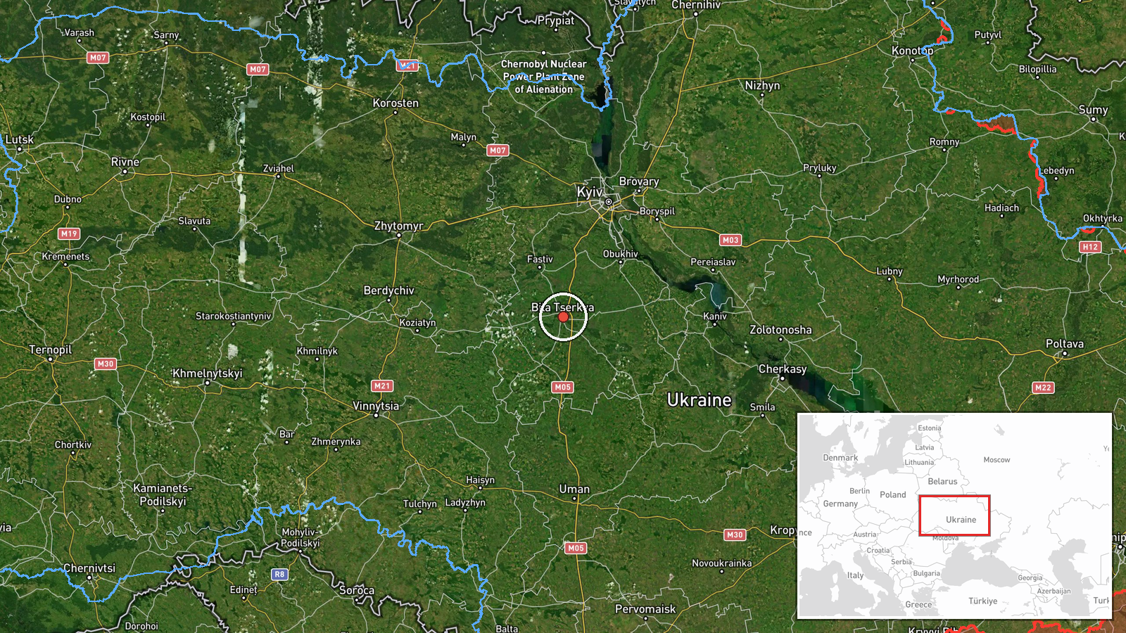
At about 19:23 UTC on 19 October 2026, the Ukrainian Telegram channel @kpszsu, which relays Ukrainian air monitoring, reported a single Russian jet-powered Shahed, designated Geran-3, heading toward Bila Tserkva, a city in Kyiv Oblast about 80 kilometres southwest of the capital. The original Ukrainian post is brief, describing a jet-type unmanned aerial vehicle approaching Bila Tserkva from the east. The report does not state a confirmed impact, damage, or casualties, and it is recorded as a drone transit rather than a strike. It came amid several other air-monitoring alerts that evening about drones moving toward Bila Tserkva and Obukhiv, and followed ballistic missile strikes on Kyiv-area power infrastructure the previous evening.
Context and assessment
Bila Tserkva lies on the approach routes between Kyiv and the south-west, so drones heading toward it are often part of broader raids on the capital region rather than isolated flights. The related reports show a pattern across the evening. A drone from Kyiv Oblast was logged toward Fastiv at 15:43 UTC, and at 16:04 two or more drones were reported passing Rzhyshchiv toward Obukhiv. At 17:52 a single drone was logged heading toward Bila Tserkva, and at 18:25 monitors reported two or more drones from Kyiv Oblast moving toward the same city. This event at 19:23 continues that sequence. The day before, ballistic missiles reportedly struck thermal power plants in Vydubychi and Troyeschyna and hit southern Kyiv, with up to sixteen missiles estimated available. Operationally, the sequence may suggest that Shahed-type drones are being used to saturate air defence and keep alert levels high across the region, while reconnaissance or follow-on strikes remain possible. The data does not establish the drones' intended targets, so these readings remain tentative.
Sources and confidence
Only one source is recorded, the @kpszsu Telegram channel, which reports Ukrainian air-monitoring alerts. It is an official-style channel with a generally consistent record of such alerts, but no independent outlet, radar statement or second channel has confirmed this specific track, so the confidence score is 8.0 rather than higher. Confidence would rise with corroboration from another monitoring channel, a regional military administration statement, or matching reports of the same drone from neighbouring areas. It would fall if the track were revised, withdrawn, or contradicted by later official accounts.
Location
Location is recorded at settlement level for Bila Tserkva, with high location confidence. The coordinates of 49.8 north and 30.12 east fall within the city, which is a regional centre in Kyiv Oblast. The city sits on the Ros River, a tributary of the Dnipro, in a largely open, low-relief landscape with rail and road links to Kyiv. The event does not specify a facility, so the point marks the city rather than a particular site.
Related events nearby
- Ukrainian air monitoring: 2+ Russian jet-powered Shahed (Geran-3) drones from Kyiv Oblast toward Bila Tserkva.2026-10-19 18:25 UTC · Drone Transit · Bila Tserkva, Ukraine
- Ukrainian air monitoring: 1 Russian jet-powered Shahed (Geran-3) drone heading toward Bila Tserkva.2026-10-19 17:52 UTC · Drone Transit · Bila Tserkva, Ukraine
- Ukrainian air monitoring: 1 Russian jet-powered Shahed (Geran-3) drone from Kyiv Oblast toward Fastiv.2026-10-19 15:43 UTC · Drone Transit · Fastiv, Ukraine
- Ukrainian air monitoring: 2+ Russian jet-powered Shahed (Geran-3) drones passing Rzhyshchiv, heading toward Ob2026-10-19 16:04 UTC · Drone Transit · Obukhiv, Ukraine
- Ballistic missiles directly struck TPP-5 in Vydubychi and TPP-6 in Troyeschyna, with further strikes on southe2026-10-18 20:04 UTC · Ballistic Missile · TPP-5, Vydubychi, Kyiv, Ukraine
▶ View this event on the live map

Intel Mapper aggregates open-source reports from monitored Telegram and X channels, geolocates them, cross-checks duplicates across sources and assigns a confidence score. Entries are updated as new confirmations arrive. Read how we verify events.