Single jet-powered Shahed (Geran-3) drone reported in transit toward Bila Tserkva, Ukraine
What happened
Ukrainian air monitoring reported one Russian jet-powered Shahed, designated Geran-3, heading toward Bila Tserkva, a city in Kyiv Oblast, at approximately 17:52 UTC on 19 October 2026. The original Ukrainian-language post, which reads roughly as 'Jet-powered UAV toward Bila Tserkva,' is brief and does not describe impact, damage or casualties. It was published on Telegram by the account @kpszsu, which is linked to Ukrainian air-monitoring reporting. The event is classified as a drone transit rather than a strike, so the record documents a track toward the city, not a confirmed detonation. No other channel in the dataset has independently reported this track.
Context and assessment
Bila Tserkva sits on the Ros River roughly 80 km southwest of Kyiv, on rail and road links that connect the capital with western and southern Ukraine, and it hosts industrial and energy-related sites. The track fits a sequence of reports across Kyiv Oblast in the same few hours. At 15:43 UTC a Geran-3 was reported moving from Kyiv Oblast toward Fastiv, and at 16:04 two or more Geran-3 drones were reported passing Rzhyshchiv toward Obukhiv. Earlier, on 18 October, Banderol mini cruise missiles were tracked toward Volodarka and then Pohrebyshche, and that evening ballistic missiles reportedly struck TPP-5 in Vydubychi and TPP-6 in Troyeschyna, with further strikes on southern Kyiv. The pattern suggests a sustained, multi-axis effort against the Kyiv region using mixed platforms. Operationally, the jet-powered Geran-3 is faster than piston-engine Shaheds, which can shorten warning times and complicate interception. The track may indicate either a route toward the capital or a separate targeting objective in the oblast, but the single-source data cannot establish intent or the eventual target.
Sources and confidence
The only source is one Telegram post from @kpszsu, which carries the report's wording and time. No second outlet, official statement or independent monitoring feed in the dataset corroborates the track. Confidence is set at 8.0 out of 10 rather than higher because the record is single-channel, though the report is specific in type, direction and destination and sits within a well-documented regional pattern. Confidence would rise with corroboration from another Ukrainian air-monitoring source, a regional military administration statement or a subsequent report of impact. It would fall if later reporting showed the track was misidentified or diverted.
Location
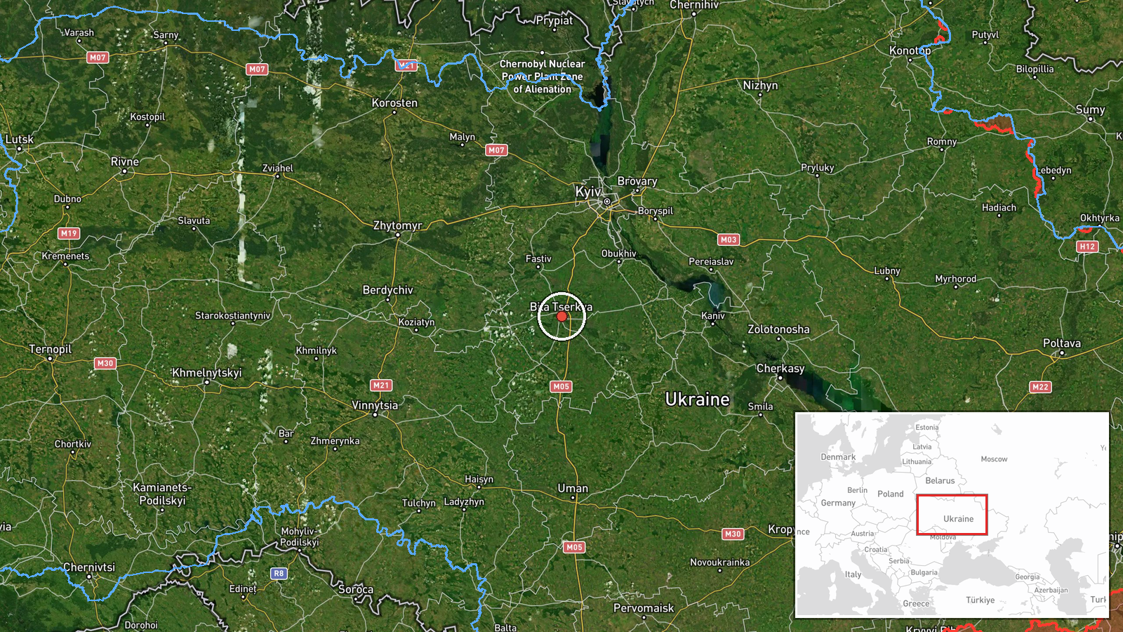
The location is recorded at settlement precision for Bila Tserkva, Ukraine, at approximately 49.8 N, 30.12 E, with high location confidence. This is the city centre level, not a specific facility, and the report names no site. Bila Tserkva lies in Kyiv Oblast on the Ros River, in gently rolling terrain of the Dnipro basin. Notable nearby features include the river valley and the transport corridors leading to Kyiv, roughly an hour's drive northeast.
Related events nearby
- Ukrainian air monitoring: 2+ Russian jet-powered Shahed (Geran-3) drones from Kyiv Oblast toward Bila Tserkva.2026-10-19 18:25 UTC · Drone Transit · Bila Tserkva, Ukraine
- Ukrainian air monitoring: 1 Russian jet-powered Shahed (Geran-3) drone from Kyiv Oblast toward Fastiv.2026-10-19 15:43 UTC · Drone Transit · Fastiv, Ukraine
- Ukrainian air monitoring: 1 Russian Banderol mini cruise missile heading toward Volodarka.2026-10-18 19:02 UTC · Cruise Missile · Volodarka, Ukraine
- Ukrainian air monitoring: 2+ Russian jet-powered Shahed (Geran-3) drones passing Rzhyshchiv, heading toward Ob2026-10-19 16:04 UTC · Drone Transit · Obukhiv, Ukraine
- Ukrainian air monitoring: 1 Russian Banderol mini cruise missile passing Volodarka, heading toward Pohrebyshch2026-10-18 19:10 UTC · Cruise Missile · Pohrebyshche, Ukraine
▶ View this event on the live map

Intel Mapper aggregates open-source reports from monitored Telegram and X channels, geolocates them, cross-checks duplicates across sources and assigns a confidence score. Entries are updated as new confirmations arrive. Read how we verify events.