Russian jet-powered Shahed reported in transit over Kyiv Oblast toward Hlevakha
What happened
Ukrainian air monitoring reported one Russian jet-powered Shahed, designated Geran-3, flying from Kyiv Oblast on a course toward Hlevakha, a settlement southwest of the capital. The report was posted at 10:06 UTC on 20 October 2026 by the Telegram channel @kpszsu. The original Ukrainian wording describes a jet-powered UAV in Kyiv Oblast heading toward Hlevakha or Vasylkiv, with a slash between the two names, so the second direction is ambiguous. The report does not mention impacts, casualties, or damage, and no interception outcome is recorded in the data. The item is categorized as drone transit rather than strike.
Context and assessment
Hlevakha lies in the Kyiv Oblast belt around the capital, an area that Russian long-range drones have repeatedly crossed on routes toward Kyiv city. Its significance here is less about the settlement itself than its position on a flight path. The drone is described as jet-powered, which distinguishes it from the piston-engine Shahed-type drones that dominated earlier campaigns. Jet-powered variants are generally faster and harder for slower air defense systems to engage, though the data gives no performance figures. Five related reports from the same morning, posted between 10:19 and 10:24 UTC, track single Geran-3 drones heading toward Vydubychi, Shuliavka, Akademmistechko, Horenychi and Zhuliany, all in or around Kyiv. These are timed after the Hlevakha item, which suggests either the same airframe or separate drones following a similar approach through the capital's districts within minutes. Operationally, such a sequence may indicate a sustained approach toward the city, a probing pattern, or simply individual drones that air defense is tracking. The data alone cannot distinguish these readings. What it does show is a dense, short-interval tracking pattern over the capital region during a single morning.
Sources and confidence
Only one channel, the Telegram account @kpszsu, is listed for this item, so cross-confirmation is absent. The confidence score of 8.0 is high for a single-source report because the channel is an official-style Ukrainian air monitoring account that posts routinely, and the record is consistent with the related Kyiv-area reports. It is not higher because no second outlet, radar record, or official statement has been matched to this track. Confidence would rise if independent media or an official statement confirmed the flight path or an interception, and would fall if later updates contradicted the course or drone type.
Location
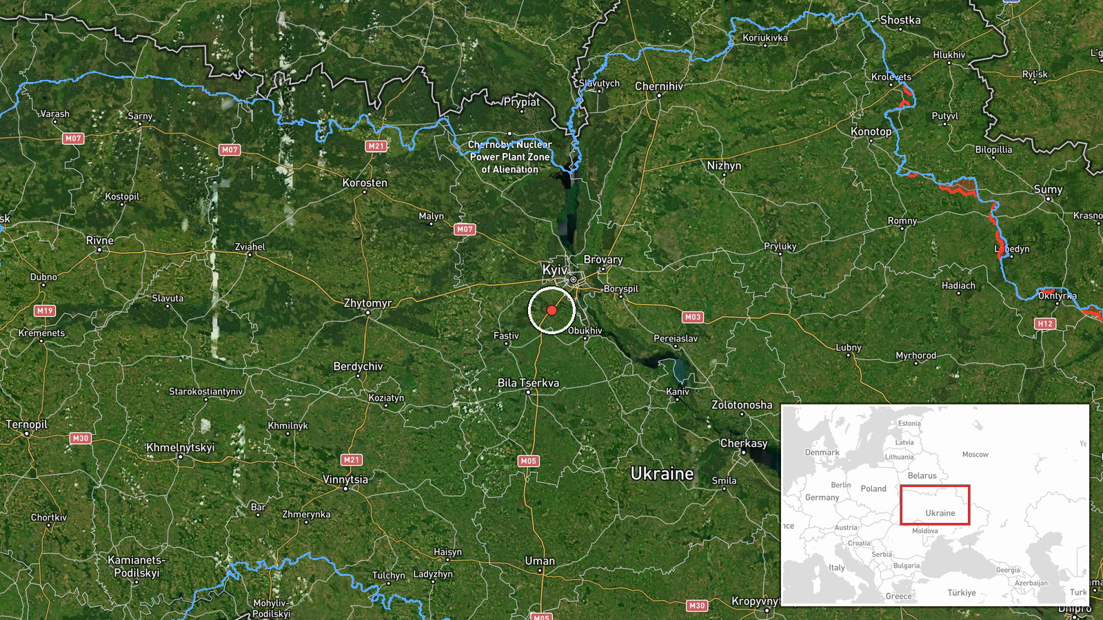
The coordinates are settlement-level, placing the marker at the centre of Hlevakha in Kyiv Oblast, with high location confidence. The settlement lies southwest of Kyiv in a largely flat, suburban and agricultural landscape along transport links toward Vasylkiv. Because the drone was reported in transit toward a named waypoint, the marker reflects that waypoint rather than the drone's actual position, which the data does not provide.
Related events nearby
- Ukrainian air monitoring: 1 Russian Shahed-type drone heading toward Boyarka.2026-10-20 10:34 UTC · Drone Transit · Boyarka, Ukraine
- Ukrainian air monitoring: 1 Russian jet-powered Shahed (Geran-3) drone heading toward Chabany.2026-10-20 10:48 UTC · Drone Transit · Chabany, Ukraine
- Ukrainian air monitoring: 1 Russian jet-powered Shahed (Geran-3) drone from Kyiv Oblast toward Vyshneve.2026-10-20 10:40 UTC · Drone Transit · Vyshneve, Ukraine
- Ukrainian air monitoring: 1 Russian jet-powered Shahed (Geran-3) drone heading toward Teremky, Kyiv.2026-10-20 10:55 UTC · Drone Transit · Teremky, Kyiv, Ukraine
- Ukrainian air monitoring: 1 Russian jet-powered Shahed (Geran-3) drone heading toward Zhuliany, Kyiv.2026-10-20 11:31 UTC · Drone Transit · Zhuliany, Kyiv, Ukraine
▶ View this event on the live map

Intel Mapper aggregates open-source reports from monitored Telegram and X channels, geolocates them, cross-checks duplicates across sources and assigns a confidence score. Entries are updated as new confirmations arrive. Read how we verify events.