Jet-powered Shahed (Geran-3) drone reported heading toward Rivne Oblast, Ukraine
What happened
On 19 October 2026 at 19:54 UTC, the Telegram channel @kpszsu, which carries Ukrainian air-monitoring alerts, reported one jet-powered unmanned aerial vehicle in Khmelnytskyi Oblast, in the Slavuta area, moving on a course toward Rivne Oblast. The original Ukrainian wording describes a reactive UAV (реактивний БпЛА), a description that matches the Geran-3 jet variant of the Shahed family named in the summary. The report gives no altitude, speed, or track confirmation, and it describes no impact, casualties, or intended target. It is a transit warning rather than a strike report. The event is recorded as a single-source report.
Context and assessment
Rivne Oblast lies in northwestern Ukraine, bordering Belarus to the north, and it sits on routes that drones may use to move between the south-east and the western regions. The related reports from the same day show a sustained pattern. Single Geran-3 drones were logged passing Adyn' heading toward Rivne at 06:39 and 07:31 UTC. At 16:36 one was seen passing the oblast heading west. At 17:35 two or more were reported passing Olevsk toward Rivne Oblast, and at 17:53 one was logged heading toward Rivne city. The present report, about two hours later, continues this movement, with the drone now placed near Slavuta, south-east of Rivne. Taken together, the sequence suggests either several separate drones or repeated use of a northwest-bound route, rather than one isolated event. Operationally, transit reports of this kind usually prompt air-defence alerts and the positioning of mobile fire groups. They may also indicate routing toward western targets or the use of decoys. The data does not establish which, and the sequence of place names should be read as approximate sighting points rather than a confirmed flight path.
Sources and confidence
The event rests on one Telegram channel, @kpszsu, the Ukrainian Air Force monitoring account that serves as a standard early-warning feed. No second outlet, wire service, or official statement in the data corroborates the sighting, so cross-confirmation is absent. The score of 8.0 is high for a single source, reflecting the channel's role in routine air alerts and the specific, time-stamped wording. It is tempered by the lack of independent confirmation and the region-level location. Confidence would rise with matching alerts from Rivne or Khmelnytskyi regional authorities, debris reports, or a follow-up from the same channel. It would fall if the location were revised or the transit were not repeated.
Location
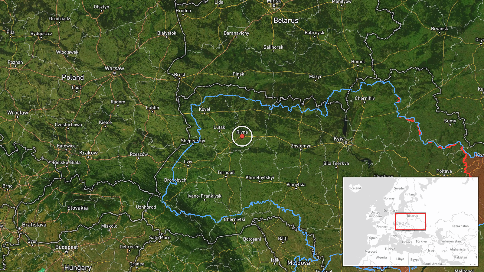
The coordinates (50.62, 26.25) correspond to the centre of Rivne city, and geo precision is recorded only at region level. The point is therefore a reference marker rather than the drone's position. The original text places the sighting near Slavuta in Khmelnytskyi Oblast, roughly south-east of that marker. The terrain is flat to gently rolling Polissian lowland with forest, marsh, and river valleys. Location confidence is recorded as low.
Related events nearby
- Ukrainian air monitoring: 2+ Russian jet-powered Shahed (Geran-3) drones from northern Zhytomyr Oblast toward 2026-10-19 21:27 UTC · Drone Transit · Rivne Oblast, Ukraine
- Ukrainian air monitoring: 1 Russian jet-powered Shahed (Geran-3) drone heading toward Rivne.2026-10-19 17:53 UTC · Drone Transit · Rivne, Ukraine
- Ukrainian air monitoring: 2+ Russian jet-powered Shahed (Geran-3) drones passing Olevsk, heading toward Rivne 2026-10-19 17:35 UTC · Drone Transit · Rivne Oblast, Ukraine
- Ukrainian air monitoring: 1 Russian jet-powered Shahed (Geran-3) drone passing Rivne Oblast, heading west.2026-10-19 16:36 UTC · Drone Transit · Rivne Oblast, Ukraine
- Ukrainian air monitoring: 1 Russian jet-powered Shahed (Geran-3) drone passing Adyn’, heading toward Rivne.2026-10-19 07:31 UTC · Drone Transit · Rivne, Ukraine
▶ View this event on the live map

Intel Mapper aggregates open-source reports from monitored Telegram and X channels, geolocates them, cross-checks duplicates across sources and assigns a confidence score. Entries are updated as new confirmations arrive. Read how we verify events.