3+ jet-powered Shahed drones reported moving from Chernihiv toward Kyiv Oblast
What happened
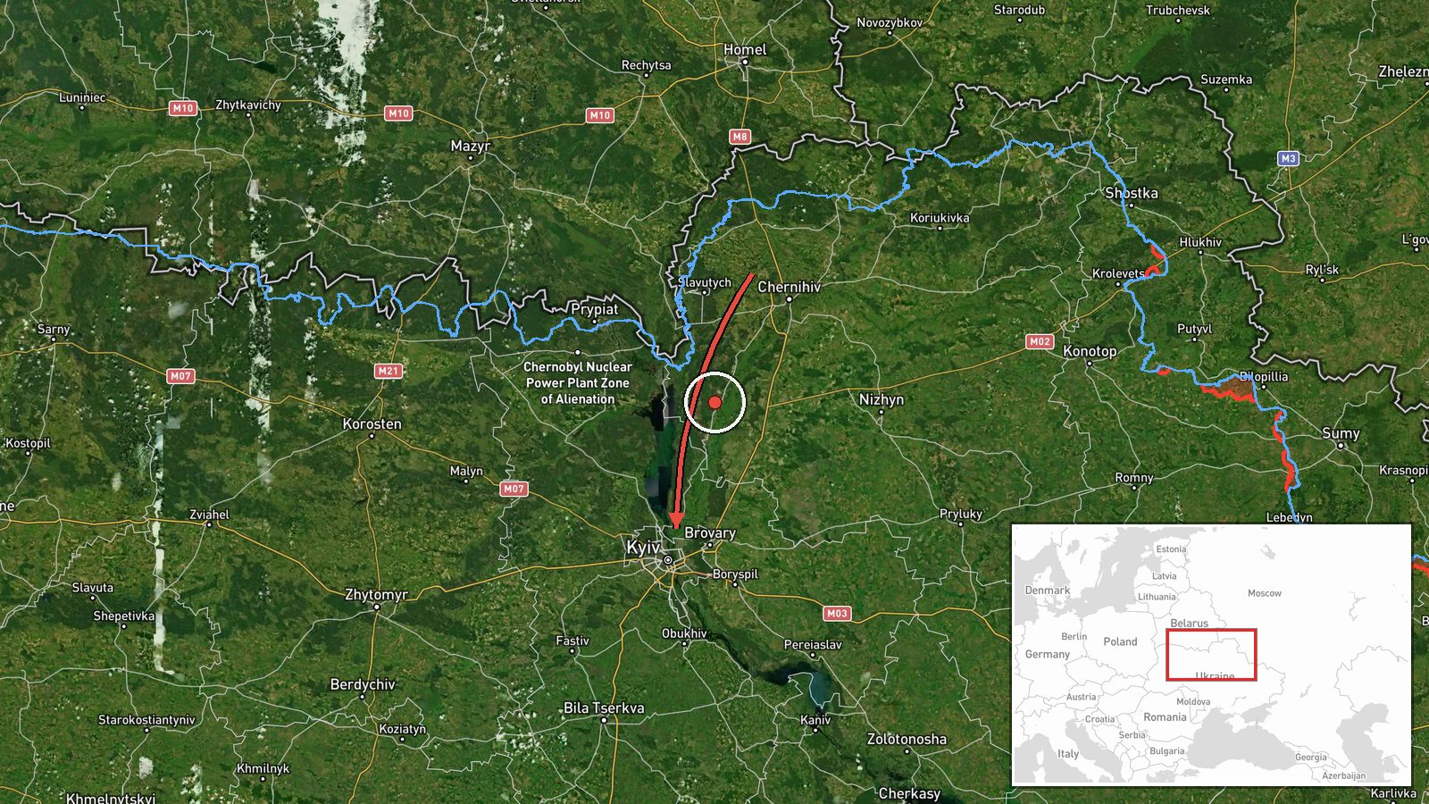
Ukrainian air monitoring, relayed through the Telegram channel @kpszsu, reported on 19 October 2026 at 20:55 UTC that three or more Russian jet-powered Shahed (Geran-3) drones were moving from northern Chernihiv Oblast toward Kyiv Oblast. The original Ukrainian-language post describes 'groups of jet-powered UAVs' on the northern edge of Chernihiv region heading in the direction of Kyiv region. The report names no specific settlement for the drones' position, gives no timing beyond the posting time, and says nothing about impacts, interceptions, or damage. It is classified as a drone transit rather than a strike. The attribution to Russia rests on the channel's identification of the drones as Geran-3 type. Because the wording describes a flight path rather than a target, this should be read as tracking information, not confirmed impact.
Context and assessment
Kyiv Oblast surrounds the capital and sits on the main approach routes from the north, so drones tracked toward it are typically assessed as a threat to the capital's air defense zone, critical infrastructure, and government districts. Chernihiv Oblast borders Belarus and the northern corridor, and drones entering from that direction have been a recurring feature of Russian long-range campaigns. The related events show a sustained pattern on the same day. At 06:47 UTC two or more jet-powered drones were reported passing Slavutych, followed by single tracks passing Kozelets at 14:01 and Kulykivka at 14:10, then one heading toward Kyiv at 15:33. A further single drone was reported from Cherkasy Oblast, far to the south-east, at 16:07. Operationally, repeated tracks over roughly fourteen hours, approaching from several directions, may indicate rolling launches designed to keep air defenses engaged and to probe for gaps. The data cannot confirm intent or whether these tracks belong to one coordinated wave.
Sources and confidence
The report comes from a single Telegram channel, @kpszsu, and the source count is one, so no independent cross-confirmation is recorded. The confidence score of 8.0 reflects a specific, attributable monitoring post with a clear type and direction, but it is held below the top range because it lacks corroboration and a named settlement. Confidence would rise if the Ukrainian Air Force, regional military administrations, or independent flight-tracking reports confirmed the same tracks. It would fall if later official statements contradicted the count or the direction, or if the post were edited or withdrawn. The related events share the same monitoring framing, but the data does not state whether they come from the same channel.
Location
The coordinates (50.45, 30.52) fall in central Kyiv city, so they act as an approximate marker for Kyiv Oblast rather than a drone position, and location confidence is recorded as low. The precision is region-level, meaning the point is not a settlement or facility. The surrounding area is flat to gently rolling northern Ukraine, with the Dnipro River running through the region and extensive forest and wetland in the Polissia lowlands to the north. Chernihiv Oblast lies to the north and borders Belarus.
Related events nearby
- Ukrainian air monitoring: 1 Russian jet-powered Shahed (Geran-3) drone from Cherkasy Oblast toward Kyiv Oblast2026-10-19 16:07 UTC · Drone Transit · Kyiv Oblast, Ukraine
- Ukrainian air monitoring: 1 Russian jet-powered Shahed (Geran-3) drone heading toward Kyiv.2026-10-19 15:33 UTC · Drone Transit · Kyiv, Ukraine
- Ukrainian air monitoring: 1 Russian jet-powered Shahed (Geran-3) drone passing Kulykivka, heading toward Kyiv 2026-10-19 14:10 UTC · Drone Transit · Kyiv Oblast, Ukraine
- Ukrainian air monitoring: 1 Russian jet-powered Shahed (Geran-3) drone passing Kozelets, heading toward Kyiv O2026-10-19 14:01 UTC · Drone Transit · Kyiv Oblast, Ukraine
- Ukrainian air monitoring: 2+ Russian jet-powered Shahed (Geran-3) drones passing Slavutych, heading toward Kyi2026-10-19 06:47 UTC · Drone Transit · Kyiv Oblast, Ukraine
▶ View this event on the live map

Intel Mapper aggregates open-source reports from monitored Telegram and X channels, geolocates them, cross-checks duplicates across sources and assigns a confidence score. Entries are updated as new confirmations arrive. Read how we verify events.