Groups of Russian jet-powered Shahed-type drones tracked south of Kamianske, heading west
What happened
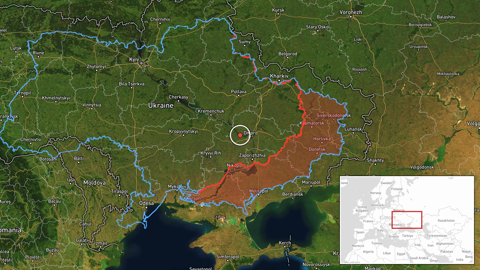
Ukrainian air monitoring reported groups of Russian jet-powered Shahed-type drones tracked south of Kamianske on a westward course. The report was posted on Telegram by the channel @kpszsu at 23:02 UTC on 19 October 2026. The original Ukrainian wording places the sighting south of Kamianske and adds a parenthetical reference to Kirovohrad Oblast, which differs from the Dnipropetrovsk Oblast label applied to this map entry. The message describes the drones as transiting, not striking, and reports no impacts, casualties, or damage. Neither a launch point nor an intended target is named. The post is a brief transit alert, so its value lies in the reported direction of travel rather than any outcome.
Context and assessment
Kamianske sits in the Dnipro River corridor of central-eastern Ukraine, an area that Russian long-range drone traffic has repeatedly crossed on routes toward the Dnipro city area and points further west. Earlier reports on the same day fit that pattern. At 04:45 a single jet-powered Shahed, identified as a Geran-3, was reported moving from Dnipropetrovsk Oblast toward Kamyanske. At 06:49 another was reported passing the oblast heading west, and at 07:42 two or more were reported heading toward Dnipro. Later, at 17:09, a guided glide bomb was reported heading toward the oblast, and at 17:54 tactical aviation was reported moving in the same direction. Operationally, a westward track through this area may indicate that drones are being routed around air defence concentrations near Dnipro, or that the groups are part of a larger saturation or decoy effort. Combining drones with glide bombs and tactical aviation in one oblast over a single day could suggest coordinated activity, though the reports alone do not establish intent or a specific target.
Sources and confidence
Only one channel, Telegram @kpszsu, is listed for this event, and no independent corroboration appears in the related data. The handle is generally associated with Ukraine's air force monitoring, which lends the post an official-style character, but that does not substitute for cross-confirmation. The confidence score of 8.0 reflects a credible, specialised channel and consistency with other same-day reports, offset by the single source, the lack of a confirmed track, and the regional label conflict. Confidence would rise with corroboration from other monitoring channels, a later official statement, or reports of sightings or impacts in the named areas. It would fall if the track were revised, the oblast reference were corrected in a way that changes the location, or the report were retracted.
Location
The location is a region-level approximation: the coordinates point to Kamianske itself, but the source places the drones south of the town, so the pin marks a broad area rather than a precise track. Location confidence is rated low. Kamianske lies on the Dnipro River in central-eastern Ukraine, in open steppe terrain. The Kirovohrad Oblast border is to the west and northwest, which is consistent with the westward heading and the parenthetical in the original text.
Related events nearby
- Ukrainian air monitoring: 1 Russian jet-powered Shahed (Geran-3) drone from Dnipropetrovsk Oblast toward Kamya2026-10-19 04:45 UTC · Drone Transit · Kamyanske, Ukraine
- Ukrainian air monitoring: Russian tactical aircraft (tac. aviation) heading toward Dnipropetrovsk Oblast.2026-10-19 17:54 UTC · Combat Aircraft · Dnipropetrovsk Oblast, Ukraine
- Ukrainian air monitoring: 1 Russian guided glide bomb (KAB) heading toward Dnipropetrovsk Oblast.2026-10-19 17:09 UTC · Airstrike · Dnipropetrovsk Oblast, Ukraine
- Ukrainian air monitoring: 2+ Russian jet-powered Shahed (Geran-3) drones heading toward Dnipro.2026-10-19 07:42 UTC · Drone Transit · Dnipro, Ukraine
- Ukrainian air monitoring: 1 Russian jet-powered Shahed (Geran-3) drone passing Dnipropetrovsk Oblast, heading 2026-10-19 06:49 UTC · Drone Transit · Dnipropetrovsk Oblast, Ukraine
▶ View this event on the live map

Intel Mapper aggregates open-source reports from monitored Telegram and X channels, geolocates them, cross-checks duplicates across sources and assigns a confidence score. Entries are updated as new confirmations arrive. Read how we verify events.