Ukrainian air monitoring reports jet-powered Shahed drone heading toward Brovary, Kyiv Oblast
What happened
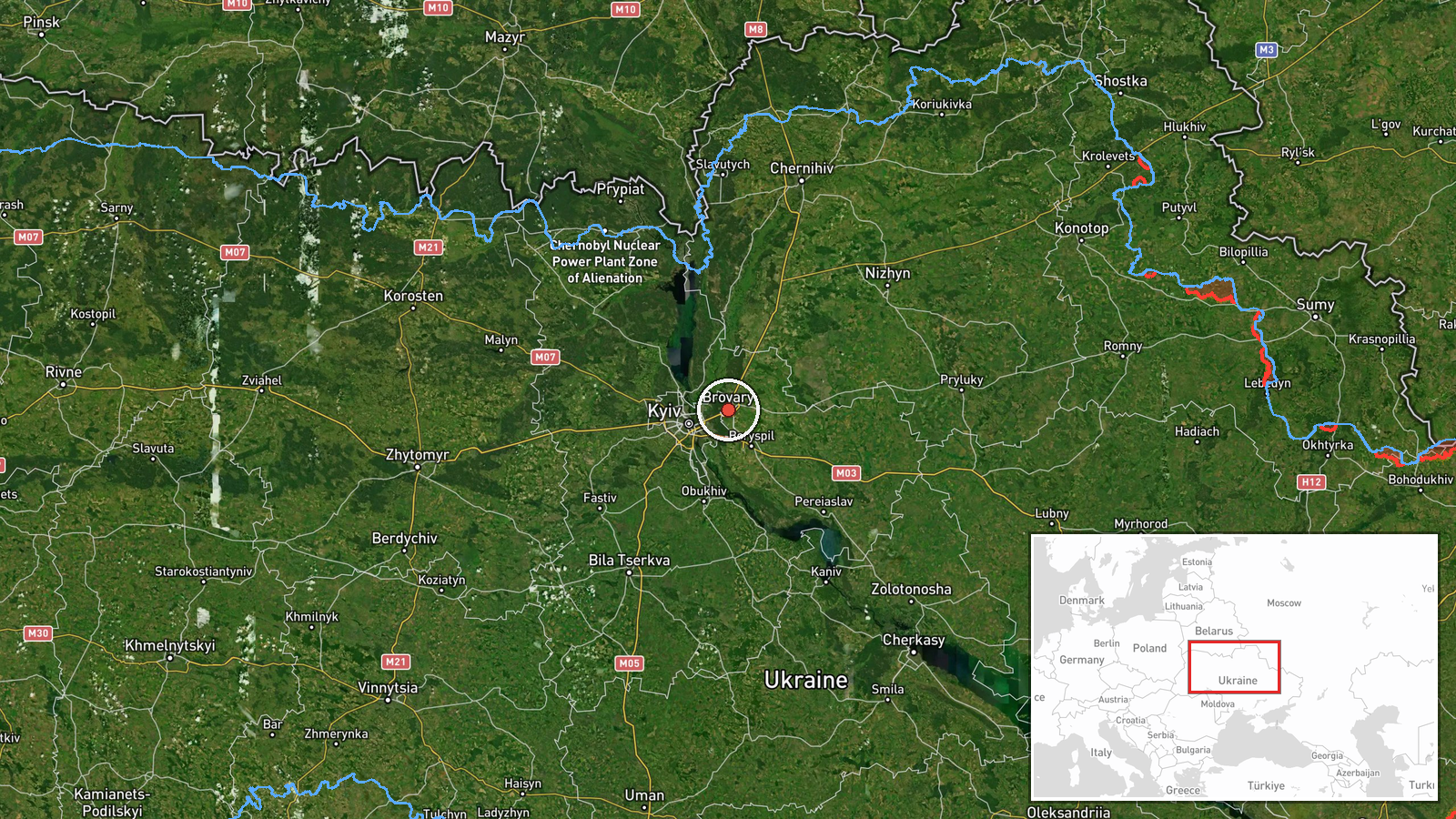
Ukrainian air monitoring channel @kpszsu reported on Telegram at 00:30 UTC on 20 October 2026 that one Russian jet-powered Shahed (Geran-3) drone was heading toward Brovary, a city east of Kyiv in Kyiv Oblast. The original post, written in Ukrainian as a short alert headed 'Reactive UAV toward Brovary', gives no information about impact, damage, casualties, or interception. The report is a transit warning rather than a confirmed strike. It is the only source recorded for this event, and the wording describes the drone's direction of travel, not a detonation. Coordinates correspond to the settlement of Brovary.
Context and assessment
Brovary sits on the eastern approaches to Kyiv, along the Dnipro corridor, and its position makes it a frequent waypoint for drones routed toward the capital and its industrial and logistical zones. The event belongs to a sequence logged over roughly 24 hours. Earlier that night, a drone was reported heading toward Desna at 00:27 UTC, a settlement on the Desna River north of Kyiv. Earlier still, on 19 October, separate Geran-3 reports tracked drones from Chernihiv Oblast toward Desna at 07:23 and from Kyiv Oblast toward Velyka Dymerka at 07:31. These entries suggest a single or small group of jet-powered Shaheds moving through northern and eastern Kyiv approaches rather than an isolated incident. The same day, Russia reportedly launched an overnight multi-wave attack with 16 ballistic missiles and over 200 drones against Kyiv and Kyiv Oblast, including energy sites. Taken together, the pattern points to sustained pressure on the Kyiv region, with drones used both as standalone strike assets and to saturate air defences alongside larger salvos. Jet-powered Geran-3 variants are faster than earlier piston-engine Shaheds, which shortens warning time for civilians and mobile fire groups.
Sources and confidence
The report comes from one Telegram channel, @kpszsu, which is the official channel of the Ukrainian Air Force and is generally treated as a primary source for air-threat alerts. No independent channel, wire service, or Ukrainian or Russian official statement in the dataset corroborates this specific track. The confidence score of 8.0 reflects an official origin and a clear, specific alert, offset by the single-source status and the absence of any follow-up confirming the drone's path or outcome. Confidence would rise with a subsequent Air Force update naming an interception or impact in Brovary, or with local officials' reports. It would fall if later alerts retract or redirect the track, or if the drone is shown to have followed a different route.
Location
The location is recorded at settlement level for Brovary, a city in Kyiv Oblast on the Dnipro River's left bank, roughly 20 kilometres east of Kyiv's city limits. The coordinates, 50.51 N and 30.79 E, are assigned to the settlement centre rather than to any specific facility, and the location confidence is rated high because the alert names the settlement directly. The terrain is largely flat, with river floodplains, forest belts and dense residential and industrial zones near the M-02 highway corridor leading toward the capital.
Related events nearby
- Ukrainian air monitoring: 1 Russian jet-powered Shahed (Geran-3) drone heading toward Desna.2026-10-20 00:27 UTC · Drone Transit · Desna, Ukraine
- Ukrainian air monitoring: 1 Russian jet-powered Shahed (Geran-3) drone from Chernihiv Oblast toward Desna.2026-10-19 07:23 UTC · Drone Transit · Desna, Ukraine
- Ukrainian air monitoring: 1 Russian jet-powered Shahed (Geran-3) drone from Kyiv Oblast toward Velyka Dymerka.2026-10-19 07:31 UTC · Drone Transit · Velyka Dymerka, Ukraine
- Russia launched overnight multi-wave ballistic attack: 16 ballistic missiles targeting Kyiv and Kyiv Oblast, p2026-10-19 04:20 UTC · Ballistic Missile · Chernihivska metro station, Kyiv, Ukraine
- Ukrainian Foreign Minister warns a proposed Trump-Xi-Putin trilateral summit could encourage Putin to continue2026-10-19 09:24 UTC · Statement · Kyiv, Kyiv Oblast, Ukraine
▶ View this event on the live map

Intel Mapper aggregates open-source reports from monitored Telegram and X channels, geolocates them, cross-checks duplicates across sources and assigns a confidence score. Entries are updated as new confirmations arrive. Read how we verify events.