Single jet-powered Shahed (Geran-3) drone reported heading toward Kryvyi Rih from northeast
What happened
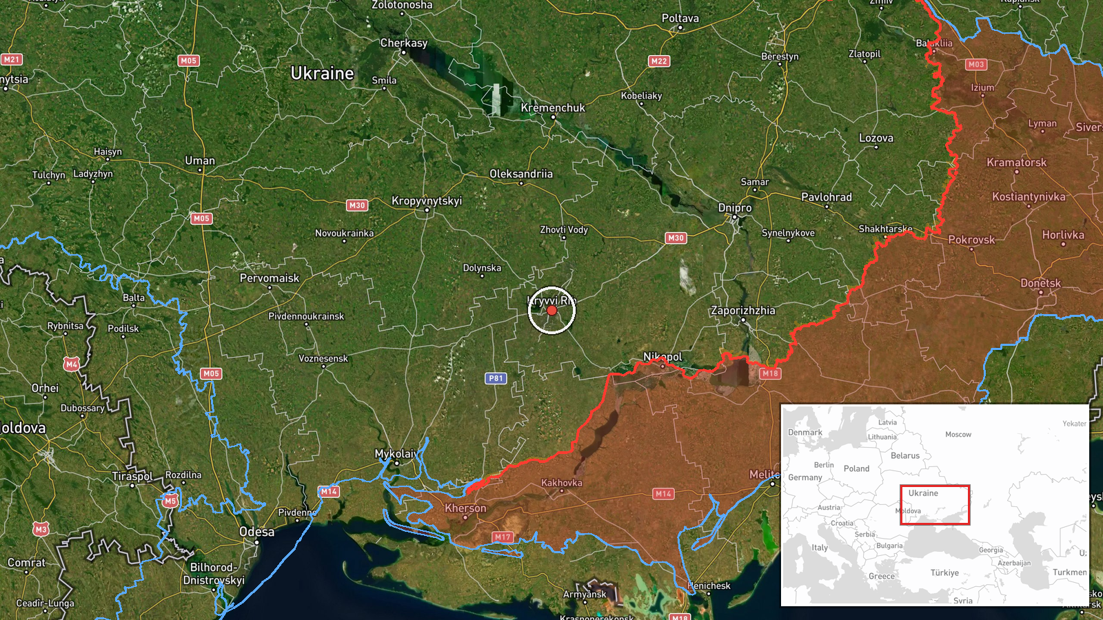
Ukraine's Air Force monitoring channel on Telegram, @kpszsu, reported at 00:35 UTC on 20 October 2026 that one jet-powered drone was heading toward Kryvyi Rih from the northeast. The Ukrainian-language original reads 'Реактивний БпЛА на Кривий Ріг з північного сходу', and the summary classifies it as a Russian Shahed-type drone, specifically the Geran-3 variant. The report is a transit or threat warning. It does not describe an impact, damage, casualties, or whether the drone was intercepted or diverted. Kryvyi Rih is a large city in Dnipropetrovsk Oblast, central Ukraine. The entry rests on this single channel, and no independent confirmation appears in the related material.
Context and assessment
Kryvyi Rih is a major industrial city with iron ore mining and steel production, and it lies on a corridor that drones have repeatedly crossed in recent days. Earlier on 19 October, the same monitoring channel reported a jet-powered Shahed passing south of Kirovohrad Oblast heading north at 03:13 UTC, another passing north of Kryvyi Rih heading west at 03:30, and a third passing Adzhamka after Kropyvnytskyi at 03:19. A later report that morning described two or more drones south of Kropyvnytskyi heading west. This pattern suggests drones moving through central Ukraine on several overlapping routes, with some tracks turning or passing through the Kryvyi Rih area. The 12:38 UTC Telegram claim of a Ukrainian drone strike on a Russian division's loading operation in occupied Zaporizhzhia is unverified and occurs in a different area, so it should not be read as a direct link. Operationally, transit reports like this one may reflect a mix of routing, decoy or saturation tactics, and monitoring coverage, but the record alone cannot show intent or whether the drone's track was actually toward the city.
Sources and confidence
The entry cites one source, the Telegram channel @kpszsu, which posts Ukrainian air-threat monitoring alerts. Those alerts are generally treated as time-sensitive operational notices, but this record has no cross-confirmation from another channel, outlet, or official statement. The confidence score of 8.0 reflects the channel's role and the specific, dated, typed content, while the single-source status and absence of follow-up reporting keep it below the top of the scale. Confidence would rise with corroboration from additional monitoring posts, local Dnipropetrovsk authority statements, or reports of an interception or impact. It would fall if a later correction, retraction, or revised track appeared.
Location
The location is Kryvyi Rih, a city in Dnipropetrovsk Oblast, and the coordinates (47.91, 33.39) mark a settlement-level point rather than a specific facility. The location confidence is rated high because the city is named directly in the report. The city sits in central Ukraine along the Inhulets River, in a broad steppe landscape with a long, elongated urban layout. Its large mining and metallurgical sites are notable nearby features.
Related events nearby
- Ukrainian air monitoring: 1 Russian jet-powered Shahed (Geran-3) drone passing north of Kryvyi Rih, heading we2026-10-19 03:30 UTC · Drone Transit · north of Kryvyi Rih, Ukraine
- Ukrainian air monitoring: 1 Russian jet-powered Shahed (Geran-3) drone passing southern Kirovohrad Oblast, hea2026-10-19 03:13 UTC · Drone Transit · southern Kirovohrad Oblast, Ukraine
- Ukrainian air monitoring: 1 Russian jet-powered Shahed (Geran-3) drone passing Oleksandriia district, heading 2026-10-20 01:25 UTC · Drone Transit · Oleksandriia district, Ukraine
- Unverified Telegram claim that a Ukrainian drone struck a Russian 42nd Guards Motor Rifle Division loading ope2026-10-19 12:38 UTC · UAS Strike · Kamianka-Dniprovska, Zaporizhzhia, Ukraine
- Ukrainian air monitoring: 2+ Russian jet-powered Shahed (Geran-3) drones passing south of Kropyvnytskyi, headi2026-10-19 04:36 UTC · Drone Transit · south of Kropyvnytskyi, Ukraine
▶ View this event on the live map

Intel Mapper aggregates open-source reports from monitored Telegram and X channels, geolocates them, cross-checks duplicates across sources and assigns a confidence score. Entries are updated as new confirmations arrive. Read how we verify events.