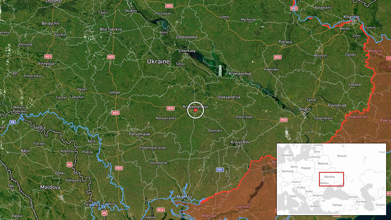
Single Russian jet-powered Shahed drone reported heading toward Kropyvnytskyi from the south, per Ukrainian monitoring
What happened
On 20 October 2026, at about 04:49 UTC, the Ukrainian Air Force monitoring channel Telegram (@kpszsu) reported one Russian jet-powered Shahed (Geran-3) drone approaching Kropyvnytskyi from the south. A second drone was reported in the same post passing near Klembivka in Vinnytsia Oblast, moving in a northwest direction. The post is a brief monitoring alert and does not describe any impact, casualties, or damage. The wording is a tracking update, not a confirmed strike report. The alert was relayed through a single channel, and no other source is attached to this event at the time of writing.
Context and assessment
Kropyvnytskyi, the administrative centre of Kirovohrad Oblast in central Ukraine, lies on a regular flight path for drones launched from the south and southwest. Related events on the same day show a recurring pattern: earlier reports on 19 and 20 October describe groups of two or more Geran-3 drones passing through Kirovohrad Oblast and the Kropyvnytskyi district, mostly heading west, and a separate single drone was reported moving from Odesa Oblast toward Kirovohrad Oblast. The earlier tracks cluster across the same corridor, which suggests drones were routed through central Ukraine rather than aimed at one specific settlement. Transit reports of this kind are usually consistent with long-range drones moving toward western or northwestern targets. A drone heading northwest through Vinnytsia Oblast, as in the second part of this post, fits the same broad movement. The pattern points to operational routing and tracking rather than a confirmed target at Kropyvnytskyi, although the city's position on the corridor makes it a point of ongoing concern for air defence.
Sources and confidence
The event rests on one Telegram channel, @kpszsu, which is the official Ukrainian Air Force alert feed for the southern operational zone. Its reports are generally a primary monitoring source, but they are not yet matched by a second independent outlet in the dataset. The confidence score is 8.0 out of 10 because the channel is official and the timing and direction are specific, yet there is only one source and the alert describes movement rather than a verified impact. Confidence would rise with corroboration from another monitoring channel, a regional military administration statement, or a follow-up report confirming the drone's track or fate. It would fall if later updates revised the direction or showed the drone was intercepted elsewhere.
Location
The location is placed at the centre of Kropyvnytskyi, a city in central Ukraine on the Inhul and Inhulets rivers, with coordinates given at settlement precision. The post names the city as the drone's destination, so the point reflects the city rather than a specific facility. The second drone's reference to Klembivka in Vinnytsia Oblast is a separate settlement mentioned in the same post and is not mapped as this event's primary point. The surrounding area is open steppe and farmland with rivers and reservoirs, which is typical of the terrain across central Ukraine.
Related events nearby
- Ukrainian air monitoring: 2+ Russian jet-powered Shahed (Geran-3) drones passing Kropyvnytskyi district, headi2026-10-20 02:09 UTC · Drone Transit · Kropyvnytskyi district, Ukraine
- Ukrainian air monitoring: 1 Russian jet-powered Shahed (Geran-3) drone passing Kropyvnytskyi district, heading2026-10-20 00:53 UTC · Drone Transit · Kropyvnytskyi district, Ukraine
- Ukrainian air monitoring: 2+ Russian jet-powered Shahed (Geran-3) drones passing Kirovohrad Oblast, heading no2026-10-20 05:22 UTC · Drone Transit · Kirovohrad Oblast, Ukraine
- Ukrainian air monitoring: 1 Russian jet-powered Shahed (Geran-3) drone passing Kirovohrad Oblast, heading nort2026-10-20 02:54 UTC · Drone Transit · Kirovohrad Oblast, Ukraine
- Ukrainian air monitoring: 1 Russian jet-powered Shahed (Geran-3) drone from Odesa Oblast toward Kirovohrad Obl2026-10-20 01:08 UTC · Drone Transit · Kirovohrad Oblast, Ukraine
▶ View this event on the live map

Intel Mapper aggregates open-source reports from monitored Telegram and X channels, geolocates them, cross-checks duplicates across sources and assigns a confidence score. Entries are updated as new confirmations arrive. Read how we verify events.