Single Russian Geran-3 jet drone reported transiting eastern Kirovohrad Oblast heading west
What happened
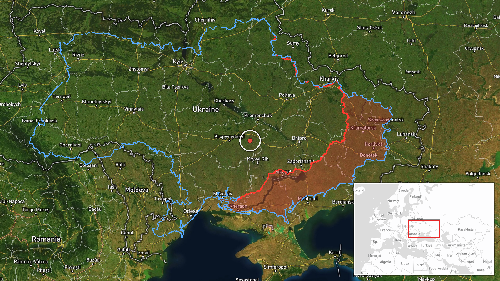
Ukrainian air monitoring reported one Russian jet-powered Shahed (Geran-3) drone passing through eastern Kirovohrad Oblast on a westward heading on 20 October 2026, at about 08:13 UTC. The only source is a Telegram channel, @kpszsu, which posted a short Ukrainian-language alert describing a jet drone in the east of the oblast on a western course. The post gives no exact settlement, no altitude or speed, and reports no impact, damage, or casualties. The event is logged as a drone transit rather than a strike. The Ukrainian wording, which translates roughly as 'jet-type UAV in eastern Kirovohrad region, course west,' is brief, and the event record marks the location as regional rather than precise.
Context and assessment
Kirovohrad Oblast sits in central Ukraine, on the main corridor that Russian long-range drones have used to move between the south and the western half of the country. Within the same window, the event log holds a cluster of related transit reports. Between roughly 00:53 and 04:49 UTC on 20 October, monitoring channels tracked several Geran-3 drones over Kropyvnytskyi and its district, Oleksandriia district, and Nova Praha, with headings that shift between west and northwest. Taken together, the sequence suggests a multi-drone package moving through the region along several routes rather than a single stray aircraft. Jet-powered Geran-3 variants are faster than the older piston-engine Shaheds and are generally treated as harder to intercept, so their presence in a transit corridor is of interest to air defence planners. The pattern itself does not reveal a target. Transit reports of this kind often precede strikes elsewhere in western Ukraine, but they are also common when drones are simply routed past the region. Analysts would need subsequent impact reports to establish what the package was aimed at.
Sources and confidence
The event rests on a single Telegram channel, @kpszsu, with no independent confirmation in the event data. Its Ukrainian air-monitoring reports are generally used as early warnings, but a single post cannot be cross-checked against other sensors or official statements. The confidence score of 8.0 out of 10 reflects a credible, specific, and internally consistent alert that matches several other transit reports from the same morning. It is held below the maximum because there is no second source, no sighting from a separate monitoring network, and no later update. Confidence would rise if other Ukrainian air-force channels or regional officials confirmed the track, or if wreckage or impact reports matched it. It would fall if the track was revised or if later reporting placed the drone outside the oblast.
Location
The location is recorded only at regional level, eastern Kirovohrad Oblast, and the coordinates (48.51 N, 33.08 E) are a centroid rather than a settlement or facility. The source did not name a town, so the precise position of the drone is unknown and the location confidence is rated low. The oblast is largely agricultural steppe, with river valleys, including the Inhul and Ingulets systems, running through its southern and central parts. Its eastern portion lies toward the Dnipro basin. The area has few large urban centres, though Kropyvnytskyi, the regional capital, lies to the west of the transit track.
Related events nearby
- Ukrainian air monitoring: 1 Russian jet-powered Shahed (Geran-3) drone passing Nova Praha, heading northwest.2026-10-20 01:31 UTC · Drone Transit · Nova Praha, Ukraine
- Ukrainian air monitoring: 1 Russian jet-powered Shahed (Geran-3) drone passing Oleksandriia district, heading 2026-10-20 01:25 UTC · Drone Transit · Oleksandriia district, Ukraine
- Ukrainian air monitoring: 1 Russian jet-powered Shahed (Geran-3) drone heading toward Kropyvnytskyi; 1 Russian2026-10-20 04:49 UTC · Drone Transit · Kropyvnytskyi, Ukraine
- Ukrainian air monitoring: 2+ Russian jet-powered Shahed (Geran-3) drones passing Kropyvnytskyi district, headi2026-10-20 02:09 UTC · Drone Transit · Kropyvnytskyi district, Ukraine
- Ukrainian air monitoring: 1 Russian jet-powered Shahed (Geran-3) drone passing Kropyvnytskyi district, heading2026-10-20 00:53 UTC · Drone Transit · Kropyvnytskyi district, Ukraine
▶ View this event on the live map

Intel Mapper aggregates open-source reports from monitored Telegram and X channels, geolocates them, cross-checks duplicates across sources and assigns a confidence score. Entries are updated as new confirmations arrive. Read how we verify events.