Single Russian Shahed-type drone reported heading toward Kryvyi Rih from the south
What happened
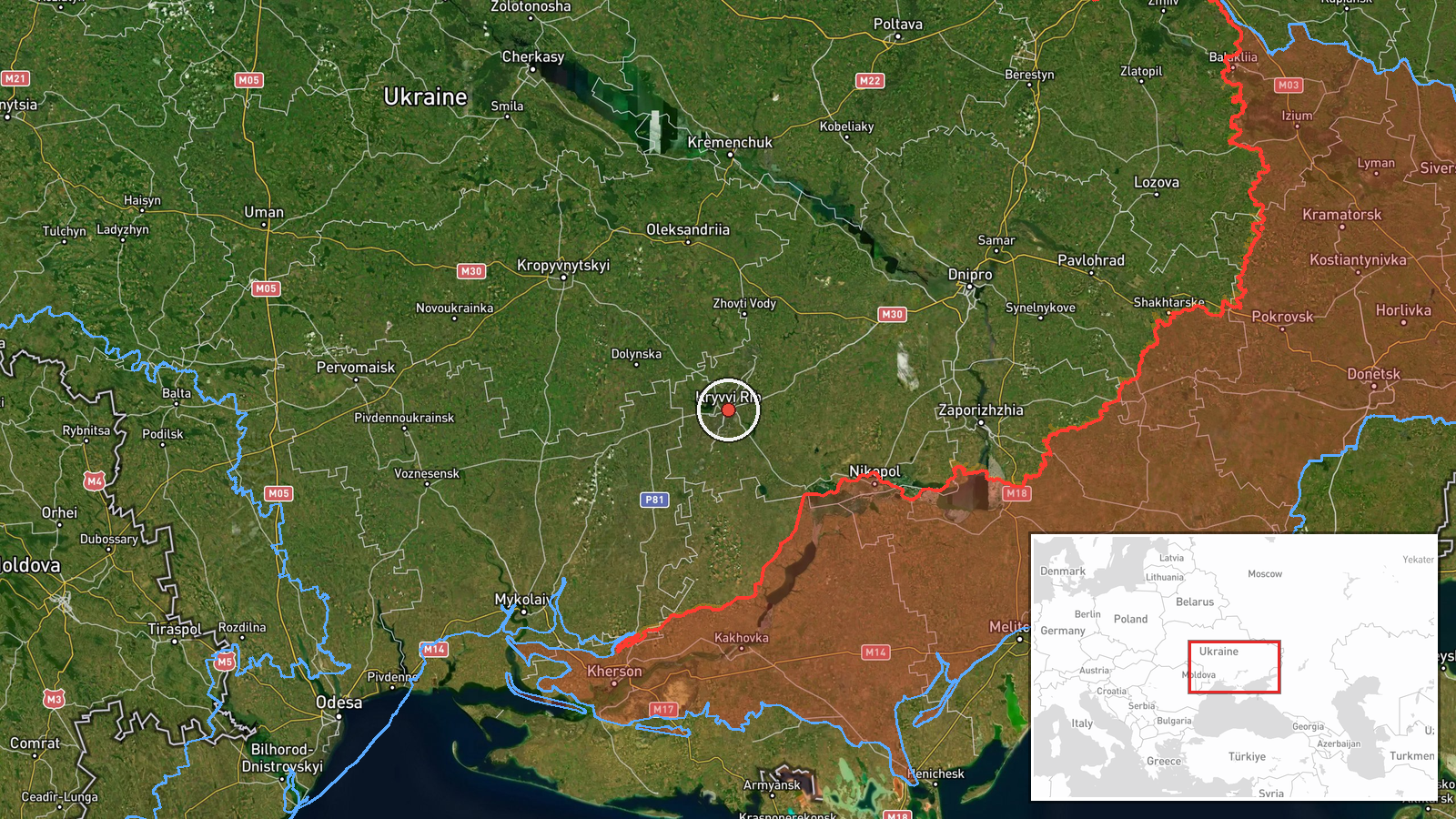
Ukrainian air monitoring reported through the Telegram channel @kpszsu that one Russian Shahed-type drone was heading toward Kryvyi Rih, a city in central Ukraine in Dnipropetrovsk Oblast. The post, timestamped 09:52 UTC on 20 October 2026, was brief. Its original wording, "БпЛА на Кривий Ріг з півдня," translates roughly as a UAV toward Kryvyi Rih from the south. The message did not describe any impact, damage, or casualties, and it does not say whether the drone was intercepted or continued past the city. The event is logged as a drone transit, not a confirmed strike. The source names only a Shahed-type aircraft, so the specific variant is not established by this post. Earlier alerts from the same channel that morning describe a jet-powered Geran-3 variant on a related track.
Context and assessment
Kryvyi Rih is a large industrial city with iron ore mining and steel production, and it lies on a north-south axis in central Ukraine. Its industrial importance has made it a recurring subject of Russian long-range drone activity during the wider war, which is why a single approaching drone there draws attention even without reported impact. The four related transit reports from 00:35 to 08:13 UTC describe a track moving from the Oleksandriia district through Nova Praha and eastern Kirovohrad Oblast before the Kryvyi Rih alert. That sequence may reflect one airframe reported repeatedly as it moved, or several drones on overlapping routes; the reports alone cannot separate these possibilities. Operationally, transit alerts of this kind are commonly associated with reconnaissance, saturation attempts, or strikes on nearby infrastructure, but a single alert does not indicate which purpose applies. A separate unverified Telegram claim from 19 October concerning Kamianka-Dniprovska in occupied Zaporizhzhia relates to a different axis and does not directly bear on this track.
Sources and confidence
The report rests on one channel, @kpszsu, and no second outlet has independently confirmed the drone's presence or path. The confidence score of 8.0 reflects that the channel is an official Ukrainian air monitoring source with a consistent timestamped format, and that it is corroborated internally by a sequence of related alerts on the same trajectory. It is held below the maximum because the report is single-sourced and describes a track rather than an observed outcome. Confidence would rise with confirmation from regional military administration statements, local sightings, or a reported interception or impact. It would fall if later updates withdraw the alert or if the track is revised.
Location
The location is recorded at settlement level for Kryvyi Rih, with coordinates 47.91 N and 33.39 E, and the location confidence is high. The city is an elongated urban area in the Inhulets River valley, surrounded by open steppe and extensive mining pits and waste heaps. Its linear layout means that a drone heading toward the city could be tracked over a wide north-south corridor before reaching its urban core.
Related events nearby
- Ukrainian air monitoring: 1 Russian jet-powered Shahed (Geran-3) drone heading toward Kryvyi Rih.2026-10-20 00:35 UTC · Drone Transit · Kryvyi Rih, Ukraine
- Ukrainian air monitoring: 1 Russian jet-powered Shahed (Geran-3) drone passing eastern Kirovohrad Oblast, head2026-10-20 08:13 UTC · Drone Transit · eastern Kirovohrad Oblast, Ukraine
- Ukrainian air monitoring: 1 Russian jet-powered Shahed (Geran-3) drone passing Nova Praha, heading northwest.2026-10-20 01:31 UTC · Drone Transit · Nova Praha, Ukraine
- Ukrainian air monitoring: 1 Russian jet-powered Shahed (Geran-3) drone passing Oleksandriia district, heading 2026-10-20 01:25 UTC · Drone Transit · Oleksandriia district, Ukraine
- Unverified Telegram claim that a Ukrainian drone struck a Russian 42nd Guards Motor Rifle Division loading ope2026-10-19 12:38 UTC · UAS Strike · Kamianka-Dniprovska, Zaporizhzhia, Ukraine
▶ View this event on the live map

Intel Mapper aggregates open-source reports from monitored Telegram and X channels, geolocates them, cross-checks duplicates across sources and assigns a confidence score. Entries are updated as new confirmations arrive. Read how we verify events.