Air monitoring reports 2+ Geran-3 jet drones passing Pereiaslav toward Boryspil, Kyiv area
What happened
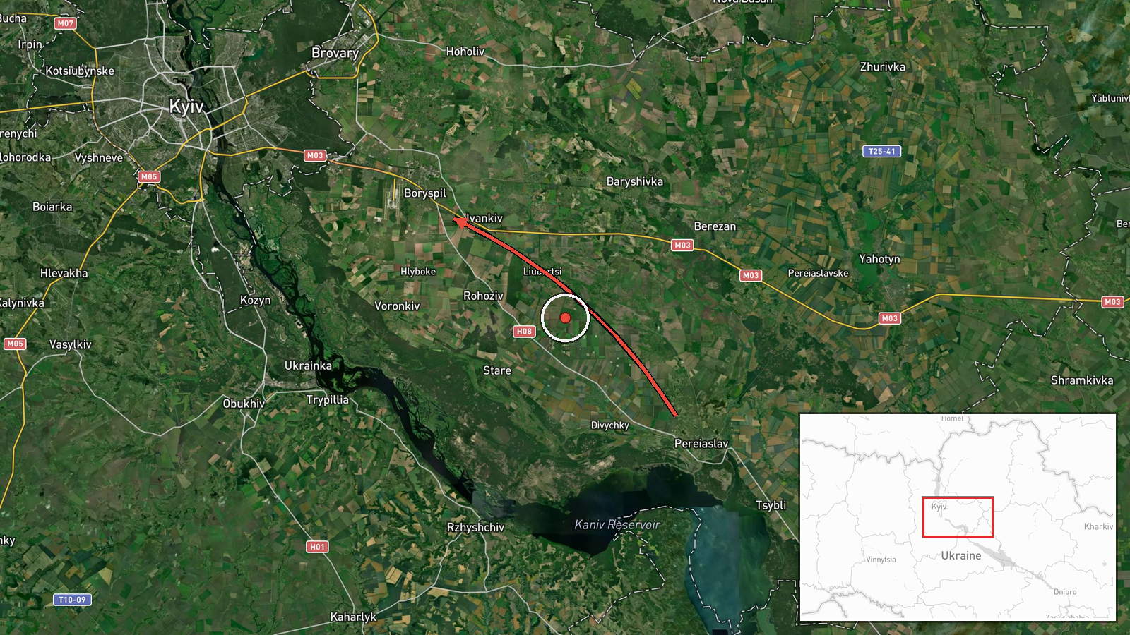
Ukraine's air monitoring channel on Telegram (@kpszsu) reported at 11:49 UTC on 20 October 2026 that a group of two or more Russian jet-powered Shahed drones, designated Geran-3 in the report, was passing through Pereiaslav in Kyiv Oblast and heading toward Boryspil and Kyiv. The original Ukrainian wording describes a group of jet-type unmanned aerial vehicles moving through Pereiaslav toward Boryspil or Kyiv, which the English summary renders as a transit. The post does not report impacts, casualties, or interceptions, so the event is recorded as a drone transit rather than a strike. The map pin sits at Boryspil, the stated destination, not at Pereiaslav, where the drones were observed.
Context and assessment
Boryspil lies just east of the Kyiv agglomeration and is home to Boryspil International Airport, Ukraine's main international air gateway, which gives the town strategic relevance beyond its size. Its position on the approach to the capital means drones tracked toward it are part of the wider pressure on Kyiv's air defence. The related events on the same day follow a visible pattern. Earlier tracks were logged near Desna at 00:27 and Brovary at 00:30, a further track at Velyka Dymerka and Brovary at 03:29, and then single and paired drones toward Rembaza at 10:18 and Kalynivka at 10:33. Taken together, these reports show repeated Geran-3 movements across the northern and eastern approaches to Kyiv over many hours rather than one isolated flight. Operationally, this spacing may indicate multiple waves routed along different corridors, a tactic that can stretch radar coverage and interceptor response. It may also reflect flights aimed at targets beyond the reported settlements, though the data does not identify those targets. Jet-powered variants are generally faster than the older piston-engine Shahed models, which would shorten warning time, but the report itself gives no speed or altitude.
Sources and confidence
The event rests on a single Telegram channel, @kpszsu, which is the reported source for this entry, so cross-confirmation is absent and the confidence score of 8.0 reflects a credible official-style channel with specific wording rather than independent verification. Confidence would rise with corroboration from other Ukrainian air force posts, regional military administration statements, or independent flight-tracking and radar-based reporting covering the same corridor. It would fall if later updates contradicted the route, if the drones were identified as another type, or if the channel issued a correction. The record is not marked as corrected.
Location
The coordinates correspond to Boryspil city, about 35 kilometres east of central Kyiv, which gives settlement-level precision with high location confidence. The reported drone route passed through Pereiaslav, roughly 45 to 50 kilometres to the southeast, so the pin marks the stated destination rather than the observation point. The area is largely flat, part of the left-bank plain of the Dnipro, with farmland, forest belts, and river valleys. Boryspil International Airport sits adjacent to the town and is the most prominent nearby feature.
Related events nearby
- Ukrainian air monitoring: 1 Russian jet-powered Shahed (Geran-3) drone heading toward Rembaza, Kyiv.2026-10-20 10:18 UTC · Drone Transit · Rembaza, Kyiv, Ukraine
- Ukrainian air monitoring: 1 Russian jet-powered Shahed (Geran-3) drone heading toward Brovary.2026-10-20 00:30 UTC · Drone Transit · Brovary, Ukraine
- Ukrainian air monitoring: 2+ Russian jet-powered Shahed (Geran-3) drones heading toward Kalynivka.2026-10-20 10:33 UTC · Drone Transit · Kalynivka, Ukraine
- Ukrainian air monitoring: Russian jet-powered Shahed (Geran-3) drone tracked toward Velyka Dymerka/Brovary, Ky2026-10-20 03:29 UTC · Drone Transit · Velyka Dymerka, Brovary, Ukraine
- Ukrainian air monitoring: 1 Russian jet-powered Shahed (Geran-3) drone heading toward Desna.2026-10-20 00:27 UTC · Drone Transit · Desna, Ukraine
▶ View this event on the live map

Intel Mapper aggregates open-source reports from monitored Telegram and X channels, geolocates them, cross-checks duplicates across sources and assigns a confidence score. Entries are updated as new confirmations arrive. Read how we verify events.