Ukraine reports jet-powered Geran-3 drone heading toward Liubar, Zhytomyr Oblast
What happened
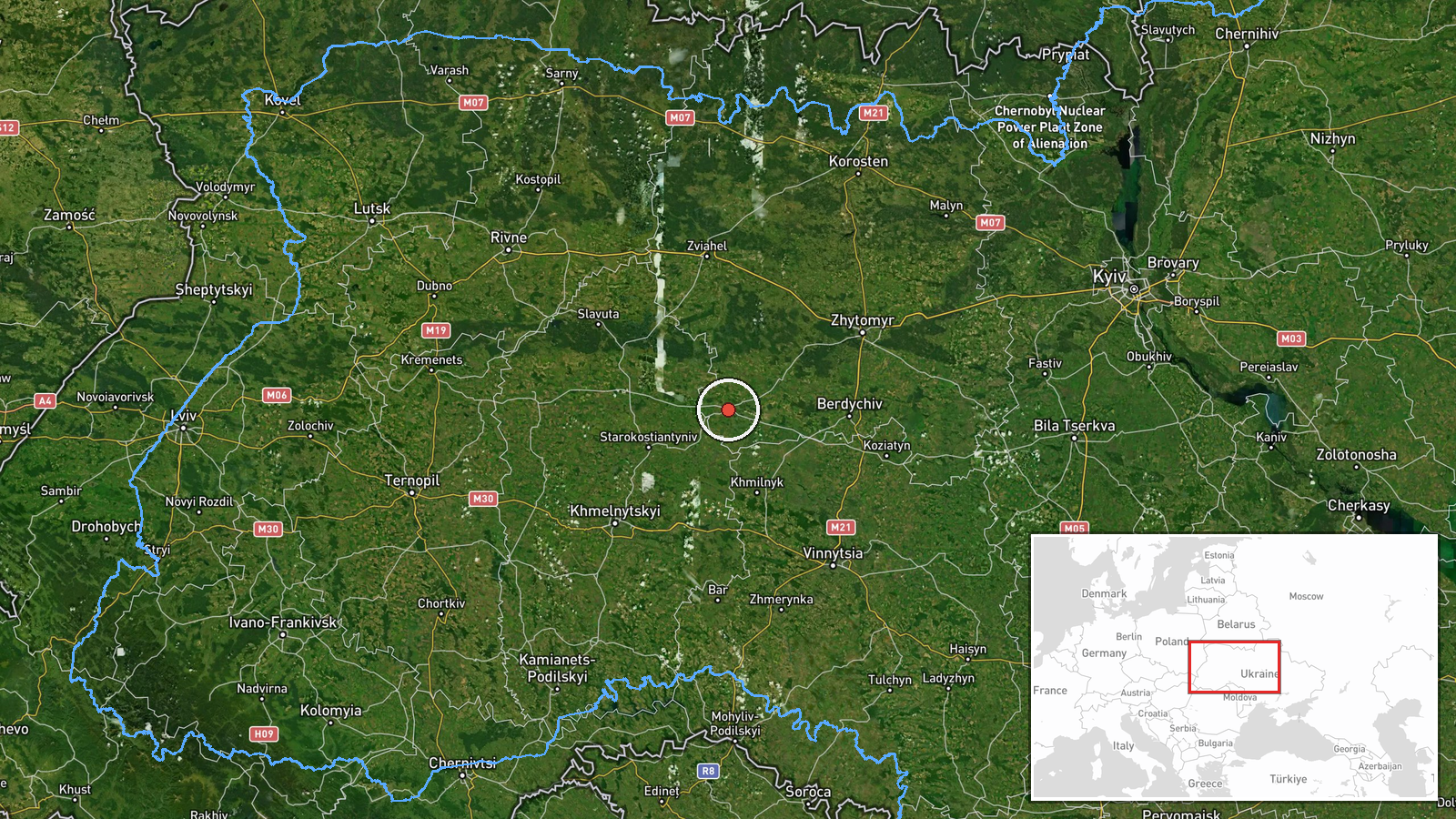
Ukrainian air monitoring reported on Telegram that one Russian jet-powered Shahed, designated Geran-3, was heading toward Liubar, a settlement in Zhytomyr Oblast in northwestern Ukraine. The alert was posted on 20 October 2026 at 12:26 UTC by the channel @kpszsu, which is associated with Ukraine's Air Force monitoring activity. The original Ukrainian-language post is brief, reading roughly as 'Zhytomyr Oblast: jet-powered UAV on course for Liubar.' It does not describe impact, damage, casualties, or interception. The wording indicates a direction of travel rather than a confirmed strike, so this entry records an aerial track, not a detonation.
Context and assessment
Liubar sits in the western part of Zhytomyr Oblast, a region that borders Belarus to the north and lies on routes that Russian long-range drones have used to cross western Ukraine toward Kyiv, Khmelnytskyi, and Volyn. The related events show a sequence of single-drone reports from the same oblast over roughly twelve hours on 19 and 20 October. Tracks were logged toward Liubar at 14:00 on 19 October, Baranivka at 16:46, Starokostyantyniv at 18:44 and 21:36, and Chudniv at 01:38 on 20 October. The repeated movement across several settlements suggests either a sustained flight corridor or a set of drones moving through the area in stages. Operationally, such a pattern may reflect reconnaissance of air defense coverage, route testing, or an effort to stretch defensive responses. The data does not establish a specific target for the Liubar track. The Geran-3 jet variant is generally faster than the older piston-engined Geran-2, which shortens warning times for local air defense and mobile fire groups.
Sources and confidence
The event rests on a single Telegram channel, @kpszsu, with a source count of one and no independent corroboration in the data. The confidence score of 8.0 is high for a monitoring alert because the channel is an official Ukrainian air monitoring source with a consistent record of such reports, but it is not a perfect score since no second channel, official statement, or imagery confirms the track. Confidence would rise if regional military administrations, another Ukrainian channel, or a Russian statement corroborated the flight. It would fall if subsequent alerts contradicted the route or if the track was revised or withdrawn.
Location
Coordinates place the event at settlement-level precision, and the location confidence is recorded as high. Liubar is a small town and the coordinates correspond to its populated area rather than a specific facility. The surrounding terrain is largely flat to gently rolling, with a mix of farmland, forest patches, and river valleys typical of the Polissia and Volhynia transition zone. Such open terrain allows drones to be tracked over long distances, though it also limits concealment for ground-based air defense.
Related events nearby
- Ukrainian air monitoring: 1 Russian jet-powered Shahed (Geran-3) drone from Zhytomyr Oblast toward Liubar.2026-10-19 14:00 UTC · Drone Transit · Liubar, Ukraine
- Ukrainian air monitoring: 1 Russian jet-powered Shahed (Geran-3) drone from Zhytomyr Oblast toward Chudniv.2026-10-20 01:38 UTC · Drone Transit · Chudniv, Ukraine
- Ukrainian air monitoring: 1 Russian jet-powered Shahed (Geran-3) drone from Zhytomyr Oblast toward Baranivka.2026-10-19 16:46 UTC · Drone Transit · Baranivka, Ukraine
- Ukrainian air monitoring: 1 Russian jet-powered Shahed (Geran-3) drone heading toward Starokostyantyniv.2026-10-19 21:36 UTC · Drone Transit · Starokostyantyniv, Ukraine
- Ukrainian air monitoring: 1 Russian jet-powered Shahed (Geran-3) drone over Starokostyantyniv.2026-10-19 18:44 UTC · Drone Transit · Starokostyantyniv, Ukraine
▶ View this event on the live map

Intel Mapper aggregates open-source reports from monitored Telegram and X channels, geolocates them, cross-checks duplicates across sources and assigns a confidence score. Entries are updated as new confirmations arrive. Read how we verify events.