Single Russian Geran-3 drone reported heading toward Starokostyantyniv, Khmelnytskyi Oblast
What happened
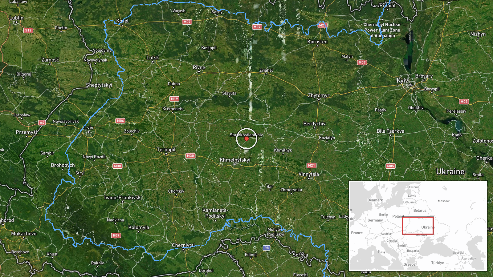
Ukrainian air monitoring channel @kpszsu reported on Telegram on 19 October 2026, at 21:36 UTC, that one Russian jet-powered Shahed (Geran-3) drone was heading toward Starokostyantyniv from the north. The original post, written in Ukrainian, uses the phrasing 'Реактивний БпЛА на Старокостянтинів з півночі', which describes a jet-powered unmanned aerial vehicle approaching the city from the north. The report does not mention impacts, casualties, or damage, and it does not specify the drone's exact track or altitude. The event is classed as a drone transit, meaning the report concerns a aircraft in flight rather than a confirmed strike. Because the message is a single-channel alert, its details reflect the monitoring post's wording rather than independent observation.
Context and assessment
Starokostyantyniv is a city in Khmelnytskyi Oblast in western-central Ukraine, a regional hub that lies well west of the front line and is used as a logistics and administrative centre. Its appearance in this sequence is notable because it recurs across five alerts on the same afternoon and evening. Earlier reports from 14:01 onward tracked single Geran-3 drones moving toward Khmelnytskyi, then from northern Vinnytsia Oblast and northern Khmelnytskyi Oblast toward Starokostyantyniv, and one report describing two or more drones from southwestern Zhytomyr Oblast. The repeated tracks suggest a sustained series of individual drones crossing the region from the north and northwest rather than one large salvo. Such patterns are often consistent with long-range drones being routed across western Ukraine, though the reports alone do not establish intent or target selection. Operationally, the spacing of alerts could reflect staggered launches or drones being re-tasked, but this remains a hedged inference.
Sources and confidence
All five related alerts come from Ukrainian air monitoring messages, and this event rests on one Telegram channel, @kpszsu, with no independent cross-confirmation in the data. The confidence score of 8.0 reflects a credible official-style monitoring source with a precise location and high location confidence, but it is reduced from the maximum because only one channel reported it and no secondary outlet or impact report is available. Confidence would rise with corroboration from other Ukrainian air force or regional military administration channels, or from wire services citing official statements. It would fall if later updates retracted the track or if the drone was reported as shot down or lost without a local confirmation.
Location
The coordinates correspond to the settlement of Starokostyantyniv at settlement precision, with high location confidence, so the marker reflects the city centre rather than a specific facility. The city sits on the Horyn River basin in Khmelnytskyi Oblast, in gently rolling terrain typical of the Podillia region. Nearby features include river valleys and agricultural land, and the city is roughly in the western-central part of Ukraine, well away from the active front line.
Related events nearby
- Ukrainian air monitoring: 1 Russian jet-powered Shahed (Geran-3) drone over Starokostyantyniv.2026-10-19 18:44 UTC · Drone Transit · Starokostyantyniv, Ukraine
- Ukrainian air monitoring: 2+ Russian jet-powered Shahed (Geran-3) drones from southwestern Zhytomyr Oblast tow2026-10-19 18:41 UTC · Drone Transit · Starokostyantyniv, Ukraine
- Ukrainian air monitoring: 1 Russian jet-powered Shahed (Geran-3) drone from northern Khmelnytskyi Oblast towar2026-10-19 17:28 UTC · Drone Transit · Starokostyantyniv, Ukraine
- Ukrainian air monitoring: 1 Russian jet-powered Shahed (Geran-3) drone from northern Vinnytsia Oblast toward S2026-10-19 14:45 UTC · Drone Transit · Starokostyantyniv, Ukraine
- Ukrainian air monitoring: 1 Russian jet-powered Shahed (Geran-3) drone heading toward Khmelnytskyi.2026-10-19 14:01 UTC · Drone Transit · Khmelnytskyi, Ukraine
▶ View this event on the live map

Intel Mapper aggregates open-source reports from monitored Telegram and X channels, geolocates them, cross-checks duplicates across sources and assigns a confidence score. Entries are updated as new confirmations arrive. Read how we verify events.