Geran-3 drone reported heading toward Starokostyantyniv from northern Khmelnytskyi Oblast
What happened
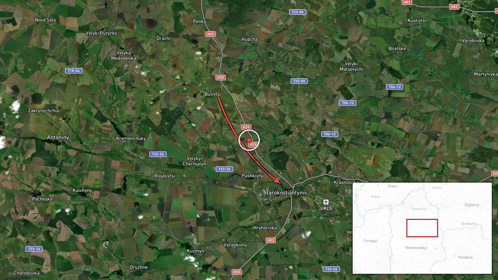
Ukrainian air monitoring, relayed through the Telegram channel @kpszsu, reported at about 17:28 UTC on 19 October 2026 that one Russian jet-powered Shahed, designated Geran-3, was moving on a course toward Starokostyantyniv from the north of Khmelnytskyi Oblast. The original Ukrainian-language post uses the phrasing typical of regional air alerts and describes the object as a jet-type unmanned aerial vehicle. The report names no impact, damage, or casualties and does not say whether the drone was later intercepted or lost track of. The event is classified as a drone transit rather than a strike. Attribution to Russia rests on the report's identification of the system as a Russian Geran-3.
Context and assessment
Starokostyantyniv lies in Khmelnytskyi Oblast in western-central Ukraine, a region that has repeatedly appeared on air-alert routes as Russian long-range drones and missiles travel westward from southern and eastern launch corridors toward targets deeper in the country. The city is home to a military airfield and serves as a regional hub for logistics and defence-related activity, which makes it a plausible destination for monitoring attention, although the report does not specify a target. The related events in this feed show a sequence on 18 and 19 October 2026: a Banderol mini cruise missile heading toward Khmelnytskyi Oblast at 19:33 on 18 October, a cluster of at least two Geran-3 drones from Vinnytsia Oblast at 07:57, several more passing Khmelnytskyi between 14:01 and 14:45, and a further drone from Vinnytsia Oblast toward Starokostyantyniv at 14:45. The repeated routing through the same oblast suggests a sustained pattern rather than an isolated launch. Operationally, a northern approach may reflect a route chosen to avoid concentrations of air defence or to reach western targets, but a single transit report cannot confirm intent. Caution is warranted, since similar corridors are used for decoys within mixed salvos.
Sources and confidence
The item rests on a single Telegram channel, @kpszsu, which is the official account of the Ukrainian Air Force and is generally regarded as a primary source for air-alert information. No independent outlet, monitoring account, or second channel in the data cross-confirms the transit. The confidence score of 8.0 reflects the official origin and specific system identification, offset by the lack of corroboration and the brief, outcome-free nature of the report. Confidence would rise with confirmation from regional military administration statements, radar-based tracking reports, or a reported interception or impact. It would fall if the Air Force later revised or withdrew the track.
Location
Coordinates are at settlement precision for Starokostyantyniv, with high location confidence. The report names the city as the destination rather than any specific facility, so the point marks the town rather than an installation. The city sits in the western-central plains of Ukraine, along the Horyn River, in a largely agricultural landscape. Nearby features are mainly rural terrain and river valleys, with the wider oblast stretching across farmland and forest belts.
Related events nearby
- Ukrainian air monitoring: 1 Russian jet-powered Shahed (Geran-3) drone over Starokostyantyniv.2026-10-19 18:44 UTC · Drone Transit · Starokostyantyniv, Ukraine
- Ukrainian air monitoring: 2+ Russian jet-powered Shahed (Geran-3) drones from southwestern Zhytomyr Oblast tow2026-10-19 18:41 UTC · Drone Transit · Starokostyantyniv, Ukraine
- Ukrainian air monitoring: 1 Russian jet-powered Shahed (Geran-3) drone from northern Vinnytsia Oblast toward S2026-10-19 14:45 UTC · Drone Transit · Starokostyantyniv, Ukraine
- Ukrainian air monitoring: 1 Russian jet-powered Shahed (Geran-3) drone heading toward Khmelnytskyi.2026-10-19 14:01 UTC · Drone Transit · Khmelnytskyi, Ukraine
- Ukrainian air monitoring: 1 Russian jet-powered Shahed (Geran-3) drone over Khmelnytskyi.2026-10-19 14:01 UTC · Drone Transit · Khmelnytskyi, Ukraine
▶ View this event on the live map

Intel Mapper aggregates open-source reports from monitored Telegram and X channels, geolocates them, cross-checks duplicates across sources and assigns a confidence score. Entries are updated as new confirmations arrive. Read how we verify events.