Ukrainian air monitoring reports a Russian Geran-3 jet drone heading toward Khmelnytskyi
What happened
Ukrainian air monitoring, relayed through the Telegram channel @kpszsu, reported at 14:01 UTC on 19 October 2026 that one Russian jet-powered Shahed, identified in the report as a Geran-3, was heading toward Khmelnytskyi. The original Ukrainian wording is brief and describes a jet-type unmanned aerial vehicle moving toward the city from the east. The alert is a transit notice rather than a strike report, so it confirms only the drone's reported direction of travel at that moment. It has no reported impact, damage or casualties. The channel attributes the drone to Russia. The report does not specify altitude, speed, or whether the drone was intercepted.
Context and assessment
Khmelnytskyi is a regional capital in western Ukraine, and the wider oblast has drawn repeated air alerts in the sources provided. The same day's related events show a sequence. At 06:27 UTC, two or more Geran-3 drones were reported heading toward Khmilnyk. At 07:57, two or more drones were reported moving from Vinnytsia Oblast toward Khmelnytskyi Oblast. At 14:25, one Geran-3 was reported moving from Vinnytsia Oblast toward Vinkivtsi. The evening before, at 19:33 UTC on 18 October, a Banderol mini cruise missile was reported heading toward Khmelnytskyi Oblast. Taken together, these reports suggest sustained activity crossing the oblast from the neighbouring region over roughly a day, with drones and a cruise missile appearing in the same airspace. Operationally, repeated transits through one area may point to launches meant to saturate or probe air defences, to routing toward targets elsewhere in the region, or to a mix of both. The data does not identify intended targets, so these readings remain tentative.
Sources and confidence
All of the information comes from one Telegram channel, @kpszsu, with no second channel, official statement or independent imagery in the dataset to confirm it. The confidence score of 8.0 reflects a precise timestamp, a specific drone type, and consistency with several earlier alerts in the same sequence. It is held below the maximum because the report has a single origin and carries no outcome data. Confidence would rise with corroboration from a second official air monitoring source, regional military administration statements, or verified reports of sightings or debris. It would fall if the alert were later retracted, revised, or contradicted by official accounts.
Location
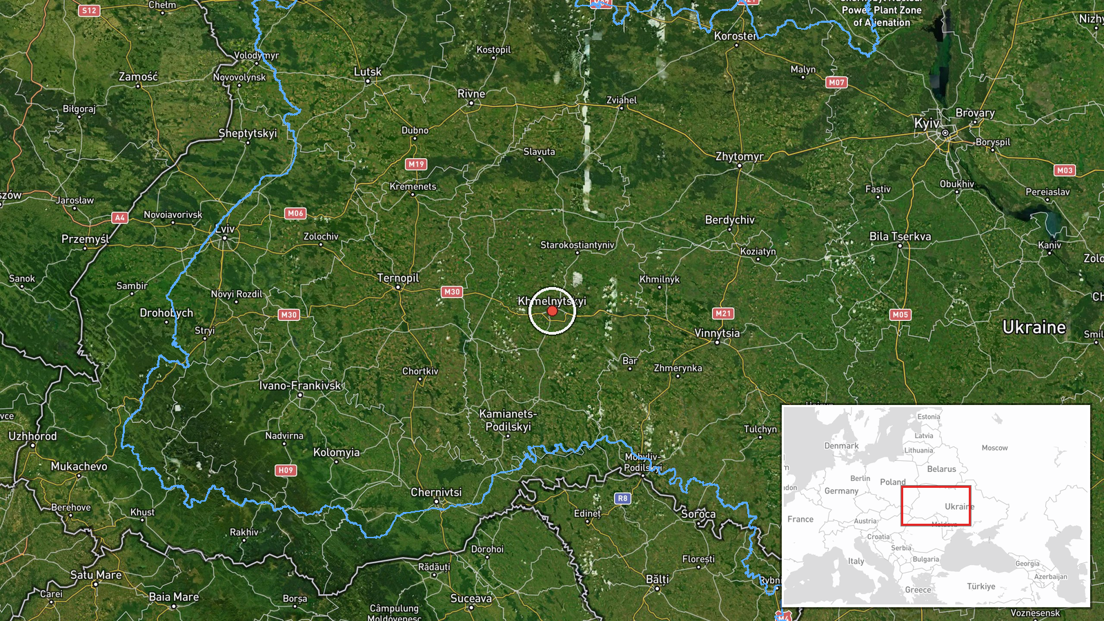
The location was geocoded to the centre of Khmelnytskyi at settlement precision, and location confidence is rated high. The point marks the city as a whole, not a specific facility or impact site. Khmelnytskyi lies in western Ukraine on the Southern Bug river, in a largely agricultural and rolling landscape. Its river valley, road links and rail connections make it a notable regional hub, and the wider oblast borders Vinnytsia Oblast, which appears in several related reports.
Related events nearby
- Ukrainian air monitoring: 1 Russian jet-powered Shahed (Geran-3) drone over Khmelnytskyi.2026-10-19 14:01 UTC · Drone Transit · Khmelnytskyi, Ukraine
- Ukrainian air monitoring: 2+ Russian jet-powered Shahed (Geran-3) drones from Vinnytsia Oblast toward Khmelnyt2026-10-19 07:57 UTC · Drone Transit · Khmelnytskyi Oblast, Ukraine
- Ukrainian air monitoring: 1 Russian Banderol mini cruise missile heading toward Khmelnytskyi Oblast.2026-10-18 19:33 UTC · Cruise Missile · Khmelnytskyi Oblast, Ukraine
- Ukrainian air monitoring: 1 Russian jet-powered Shahed (Geran-3) drone from northern Vinnytsia Oblast toward S2026-10-19 14:45 UTC · Drone Transit · Starokostyantyniv, Ukraine
- Ukrainian air monitoring: 1 Russian jet-powered Shahed (Geran-3) drone from Vinnytsia Oblast toward Vinkivtsi.2026-10-19 14:25 UTC · Drone Transit · Vinkivtsi, Ukraine
▶ View this event on the live map

Intel Mapper aggregates open-source reports from monitored Telegram and X channels, geolocates them, cross-checks duplicates across sources and assigns a confidence score. Entries are updated as new confirmations arrive. Read how we verify events.