Air monitoring reports one jet-powered Shahed (Geran-3) drone heading toward Khmelnytskyi
What happened
Ukrainian air monitoring, relayed through a Telegram channel (@kpszsu), stated at 12:36 UTC on 20 October 2026 that one jet-powered Shahed-type drone, identified as a Geran-3, was heading toward Khmelnytskyi. The original Ukrainian wording, 'Реактивний БпЛА курсом на Хмельницький', translates as a jet-powered UAV on a course toward Khmelnytskyi. The message does not mention impact, damage, or casualties, so it is a transit warning rather than a confirmed strike. The event is classed as a Russian-attributed drone transit, based on the channel's identification of the drone type and origin. Five earlier monitoring reports on the same date describe similar drones moving toward Khmelnytskyi or its oblast between 02:55 and 09:18 UTC.
Context and assessment
Khmelnytskyi is a regional city in western Ukraine with a military airfield and a nearby nuclear power plant at Netishyn, and it serves as a road and rail junction for the wider oblast. Those features help explain why air monitors track approaches to the city closely. The related reports show a sequence running through the early morning. Earlier entries describe groups of two or more drones passing settlements in Khmelnytskyi Oblast, and later entries describe single drones heading toward the city itself. The pattern suggests a sustained series of launches or tracks over several hours rather than one isolated sighting. Operationally, the reports may indicate a sustained, distributed approach, with some drones possibly used for reconnaissance, diversion, or saturation of air defences. The jet-powered Geran-3 variant is faster than the older propeller-driven Shahed design, which would shorten the warning time available to defenders. These are reasonable inferences from the reporting pattern, not established intentions, and the monitoring messages alone do not confirm where any drone was directed or what it was meant to reach.
Sources and confidence
The event rests on a single Ukrainian-language Telegram channel, @kpszsu, which posts air monitoring alerts. The five related reports come from the same type of feed, so they add timeline detail but are not independent corroboration. The confidence score of 8.0 reflects a credible monitoring source, a clearly named location, and a precise timestamp, offset by the lack of a second independent outlet and the absence of any reported outcome. Confidence would rise with corroboration from a separate Ukrainian official source, a regional military administration statement, a wire service, or reporting of an intercept or impact at or near Khmelnytskyi. It would fall if the channel later retracted the alert, or if other monitoring reports showed the drone turning away or never entering the area.
Location
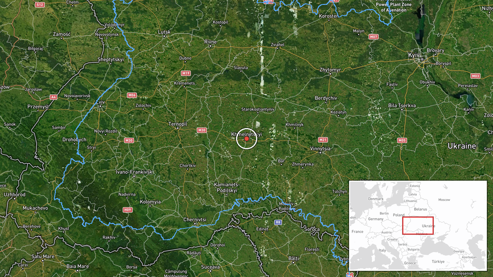
The coordinates (49.42, 26.98) correspond to the centre of Khmelnytskyi city, and the location is assigned at settlement precision with high confidence because the report names the city directly. The event is therefore placed at the city level rather than at a specific facility or street. Khmelnytskyi lies in western Ukraine, in the oblast of the same name, and the area is largely rolling farmland and forest. The Southern Bug river runs through the region. The Khmelnytskyi nuclear power plant at Netishyn is roughly 20 km away.
Related events nearby
- Ukrainian air monitoring: 1 Russian jet-powered Shahed (Geran-3) drone heading toward Khmelnytskyi.2026-10-20 09:18 UTC · Drone Transit · Khmelnytskyi, Ukraine
- Ukrainian air monitoring: 2+ Russian jet-powered Shahed (Geran-3) drones heading toward Khmelnytskyi.2026-10-20 04:31 UTC · Drone Transit · Khmelnytskyi, Ukraine
- Ukrainian air monitoring: 1 Russian jet-powered Shahed (Geran-3) drone passing Brayiliv, heading toward Khmeln2026-10-20 03:35 UTC · Drone Transit · Khmelnytskyi Oblast, Ukraine
- Ukrainian air monitoring: 1 Russian Shahed-type drone passing Vinkivtsi, heading toward Khmelnytskyi.2026-10-20 03:02 UTC · Drone Transit · Khmelnytskyi, Ukraine
- Ukrainian air monitoring: 2+ Russian jet-powered Shahed (Geran-3) drones passing Murovani Kurylivtsi, heading 2026-10-20 02:55 UTC · Drone Transit · Khmelnytskyi Oblast, Ukraine
▶ View this event on the live map

Intel Mapper aggregates open-source reports from monitored Telegram and X channels, geolocates them, cross-checks duplicates across sources and assigns a confidence score. Entries are updated as new confirmations arrive. Read how we verify events.