Jet-powered Shahed drones reported heading toward Lubny, Poltava Oblast
What happened
A Ukrainian air-monitoring report on the Telegram channel @kpszsu, timed at 16:52 UTC on 20 October 2026, states that at least two jet-powered Shahed drones, identified as Geran-3 type, were on a course toward Lubny in Poltava Oblast. The original Ukrainian wording describes reactive unmanned aerial vehicles on a heading for Lubny, using the regional label Poltavshchyna. The post gives no information on impacts, damage, or casualties. It describes a transit rather than a strike, and it does not say whether the drones were later tracked, intercepted, or lost from monitoring. The entry is a brief monitoring notice, and no other outlet in the dataset has independently published it.
Context and assessment
Lubny sits on the Sula River in northern Poltava Oblast, in central Ukraine well away from the front line, so a drone heading there is best read as part of a wider movement through the region rather than a localized threat. The related entries describe a sequence of Geran-3 and Shahed-type drones moving across central Ukraine over roughly 24 hours on 19 and 20 October 2026. Reports place drones near Semenivka heading west on the evening of 19 October, west of Poltava heading south, near Kremenchuk heading toward that city, over Cherkasy Oblast heading west, and near Myrhorod heading north shortly after midnight on 20 October. The spread of headings and the repeated shifts across several oblasts suggest multiple drones using different corridors rather than a single aimed attack. Operationally, this pattern may point to route variation, reconnaissance of air defence coverage, or an effort to saturate monitoring networks, but the data cannot establish intent or a specific target. The Lubny report fits the pattern of transit tracking rather than a confirmed strike, and any impact would need separate reporting.
Sources and confidence
The report comes from one channel, Telegram @kpszsu, which is the Ukrainian air-monitoring feed referenced in the event record. No second independent outlet in this dataset has published the Lubny sighting, so cross-confirmation is absent. The confidence score of 8.0 is relatively high because the channel is a recognized official-style monitoring source, the wording is specific about drone type and heading, and related entries from the same period show a consistent regional pattern. The score would rise if other Ukrainian air-force or regional military administration posts, or independent trackers, recorded the same drones near Lubny. It would fall if later updates showed the drones were diverted elsewhere, or if the monitoring channel corrected or withdrew the notice.
Location
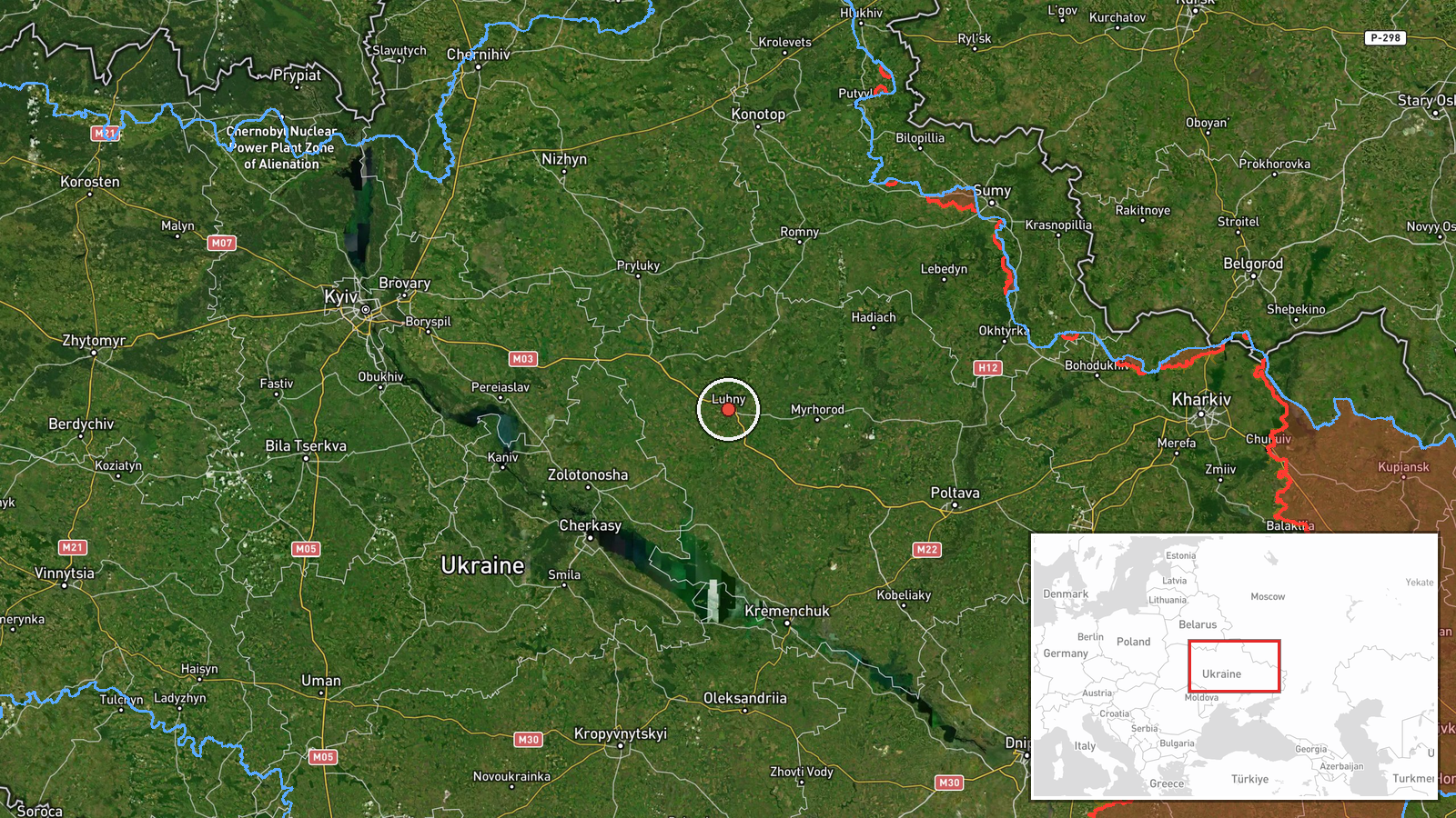
The location is a settlement-level match to Lubny, Ukraine, at approximately 50.01 N, 32.99 E, and the location confidence is rated high. The town lies in northern Poltava Oblast on the Sula River, and its position places it in flat, agricultural terrain typical of the central Ukrainian forest-steppe. The coordinates refer to the town centre rather than any specific facility, since the report names only the settlement and heading. The nearby main rail and road routes through the region are a notable feature for understanding the corridor shown in the surrounding reports.
Related events nearby
- Ukrainian air monitoring: 1 Russian Shahed-type drone passing Myrhorod, heading north.2026-10-20 00:37 UTC · Drone Transit · Myrhorod, Ukraine
- Ukrainian air monitoring: one Russian jet-powered Shahed (Geran-3) drone tracked west of Poltava, heading sout2026-10-19 20:59 UTC · Drone Transit · West of Poltava, Poltava Oblast, Ukraine
- Ukrainian air monitoring: 1 Russian jet-powered Shahed (Geran-3) drone passing Cherkasy Oblast, heading west.2026-10-20 01:49 UTC · Drone Transit · Cherkasy Oblast, Ukraine
- Ukrainian air monitoring: 1 Russian jet-powered Shahed (Geran-3) drone heading toward Kremenchuk.2026-10-19 18:46 UTC · Drone Transit · Kremenchuk, Ukraine
- Ukrainian air monitoring: 2+ Russian jet-powered Shahed (Geran-3) drones from Cherkasy Oblast toward Pereiasla2026-10-20 17:04 UTC · Drone Transit · Pereiaslav, Ukraine
▶ View this event on the live map

Intel Mapper aggregates open-source reports from monitored Telegram and X channels, geolocates them, cross-checks duplicates across sources and assigns a confidence score. Entries are updated as new confirmations arrive. Read how we verify events.