Russian jet-powered Shahed drones reported over northern Chernihiv Oblast, Ukraine
What happened
A Telegram channel, @kpszsu, reported that at about 04:07 UTC on 21 October 2026, Ukrainian air monitoring had detected at least two Russian jet-powered Shahed drones, designated Geran-3, over northern Chernihiv Oblast. The original Ukrainian-language post refers to new jet-powered unmanned aircraft in the north of the region. It names no specific settlement, altitude, or heading, and it describes no impact, damage, or casualties. The report is a short monitoring notice rather than an account of strikes. Because the event is recorded at regional level and rests on one channel, the drone count is a minimum, shown as '2+', and the track has not been independently confirmed. Monitoring notices of this kind indicate that objects are in the airspace, not where they will ultimately strike.
Context and assessment
This notice is the latest in a cluster of Geran-3 transit reports that the same monitoring stream logged over roughly 21 hours. Earlier entries from 20 October describe drones moving from northern Chernihiv Oblast toward Slavutych at 07:29 UTC, passing Slavutych heading south at 09:31, and passing Nova with at least three drones heading toward northern Chernihiv at 17:12. A further entry at 17:14 places drones heading toward Mena. The 04:18 entry on 21 October, placed at Mykhailo-Kotsiubynske, describes drones heading south. The sequence shows repeated tracks through the same northern corridor, with headings alternating between toward the oblast and back south. The Geran-3 is the jet-powered variant of the Shahed family, widely reported as faster and harder to intercept than the older piston-engine Geran-2. Operationally, repeated transits along one corridor may reflect routing toward targets farther south, or may be part of reconnaissance, decoy, or saturation tactics. The reports alone cannot distinguish among these. Chernihiv Oblast borders Belarus, so northern approach routes are plausible, but the data does not establish a launch origin.
Sources and confidence
All reporting for this event comes from a single channel, Telegram @kpszsu, which publishes Ukrainian air monitoring updates. No second outlet, official statement, imagery, or debris report appears in the data. The assigned confidence score of 8.0 is high for a single source because the channel's reporting is consistent in type and direction across the related events. The score is still limited by the absence of corroboration and by the minimum drone count. It would rise with confirmation from another monitoring channel, an official air force statement, or reports of debris or impact. It would fall if the channel corrected or retracted the post, or if other monitors reported no contacts in the same window.
Location
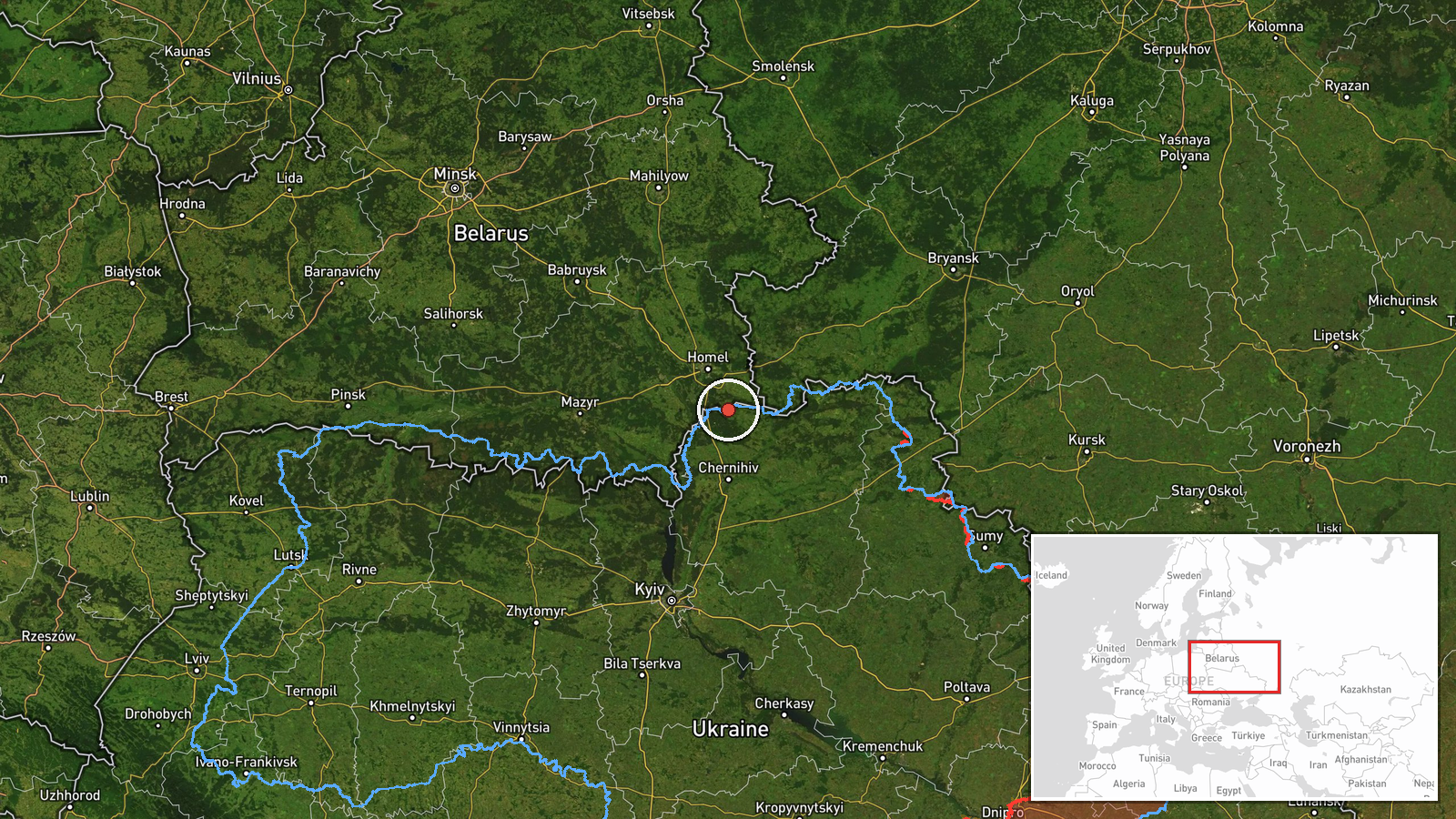
The location is region-level and marked low confidence, so the coordinates are a regional reference point rather than a specific settlement or facility. The point lies near the northern edge of Chernihiv Oblast, close to the Belarusian border. The area is part of the Polissia lowlands, characterised by flat terrain, forest, marshland, and river systems in the Desna basin. Settlements named in the related events, including Nova, Mena, Slavutych, and Mykhailo-Kotsiubynske, are approximate references and may lie some distance from the plotted point.
Related events nearby
- Ukrainian air monitoring: 3+ Russian jet-powered Shahed (Geran-3) drones passing Nova, heading toward northern2026-10-20 17:12 UTC · Drone Transit · northern Chernihiv Oblast, Ukraine
- Ukrainian air monitoring: 1 Russian Banderol mini cruise missile heading toward Chernihiv.2026-10-21 05:10 UTC · Cruise Missile · Chernihiv, Ukraine
- Ukrainian air monitoring: 2+ Russian jet-powered Shahed (Geran-3) drones passing Mykhailo-Kotsiubynske, headin2026-10-21 04:18 UTC · Drone Transit · Mykhailo-Kotsiubynske, Ukraine
- Ukrainian air monitoring: 2+ Russian jet-powered Shahed (Geran-3) drones passing Slavutych, heading south.2026-10-20 09:31 UTC · Drone Transit · Slavutych, Ukraine
- Ukrainian air monitoring: 2+ Russian jet-powered Shahed (Geran-3) drones from northern Chernihiv Oblast toward2026-10-20 07:29 UTC · Drone Transit · Slavutych, Ukraine
▶ View this event on the live map

Intel Mapper aggregates open-source reports from monitored Telegram and X channels, geolocates them, cross-checks duplicates across sources and assigns a confidence score. Entries are updated as new confirmations arrive. Read how we verify events.