Two or more Russian Geran-3 jet drones reported passing Slavutych heading south
What happened
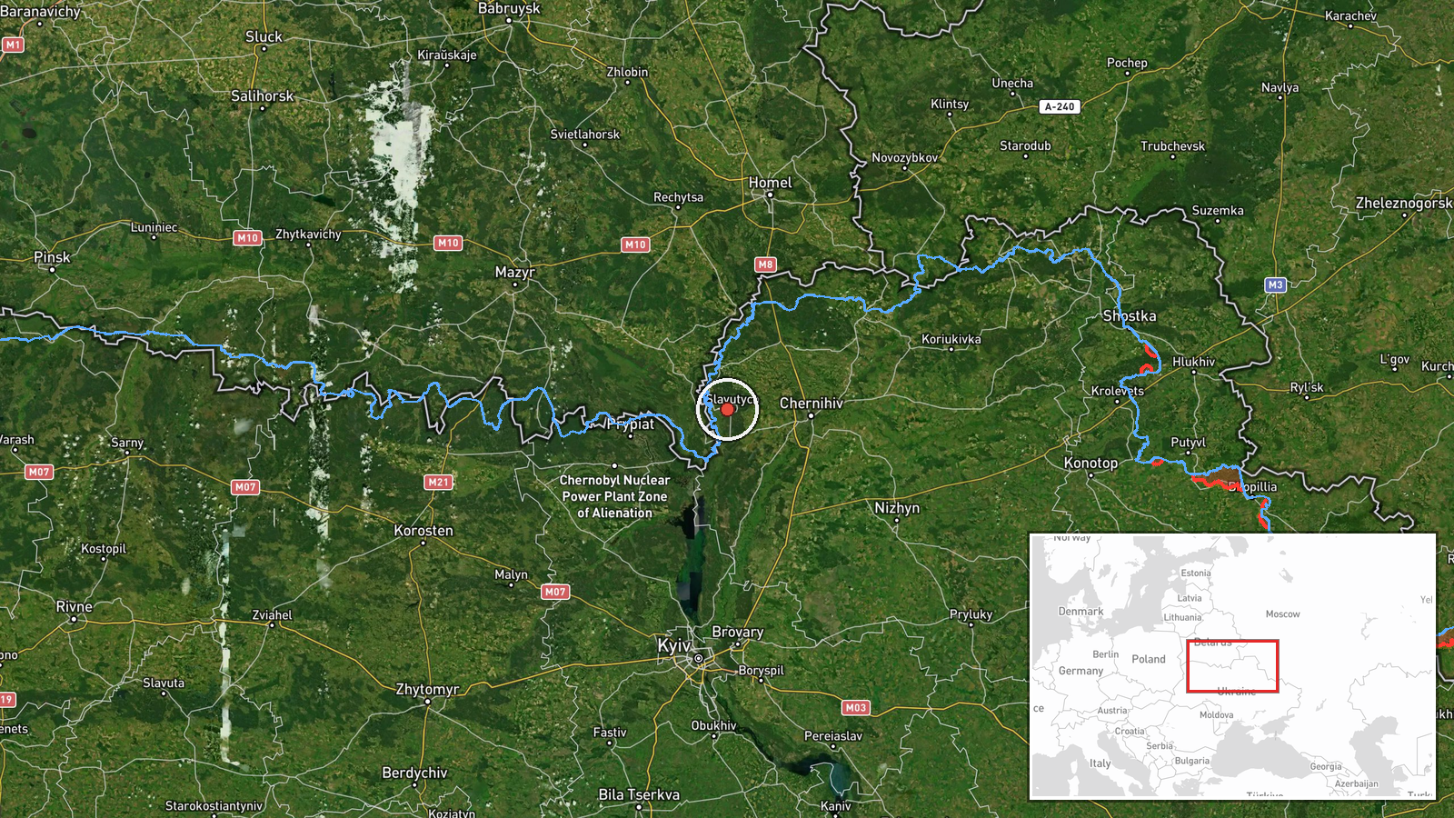
Ukraine's air force monitoring channel on Telegram (@kpszsu) reported on 20 October 2026 at 09:31 UTC that two or more Russian jet-powered Shahed drones, designated Geran-3 in the post, were passing Slavutych and heading south. The original Ukrainian-language post, filed under Chernihiv Oblast, described the drones as jet-type unmanned aircraft moving south past the town. The report does not name casualties, damage, or intended targets, and it does not say whether any drones were shot down. The event is recorded as a drone transit, meaning a sighting of aircraft in flight rather than a confirmed strike. It rests on a single channel, so the details reflect that original monitoring post and have not been independently confirmed by another source at the time of publication.
Context and assessment
This report is the latest in a sequence of drone transit reports that began the previous evening and moved through the north of Ukraine over roughly fourteen hours. At 21:01 UTC on 19 October, two or more Geran-3 drones were reported heading toward Chernihiv. At 23:44, three or more were reported passing Nova toward Chernihiv Oblast. At 03:25 on 20 October, drones were reported moving from northern Chernihiv Oblast toward northern Kyiv Oblast, and at 07:04 a group passed northern Kyiv Oblast heading south. At 07:29 drones were reported leaving northern Chernihiv toward Slavutych, and the 09:31 report places them passing the town on a southerly course. The pattern is a repeated track through the same northern corridor, with the reports cycling between Chernihiv and northern Kyiv oblasts. Operationally, repeated transits along one corridor may indicate routing toward targets further south, or an effort to stretch air defense and warning resources. The reports alone cannot establish which. Jet-powered Geran-3 variants are generally faster than the older piston-engine Shaheds, which would shorten warning times, although the reports give no speed figures. Slavutych's significance in this sequence appears to be its position on the northern approach toward Kyiv rather than any specific facility named in the data.
Sources and confidence
All reporting comes from one Telegram channel, @kpszsu. The confidence score of 8.0 reflects the channel's official-style origin, the specific and time-stamped wording, and the consistency of this report with earlier drone transit entries in the same corridor. It is held below the top of the scale because there is only one source, no independent radar or flight-tracking confirmation, no imagery, and no follow-up statement elaborating on the sighting. Confidence would rise with corroboration from other Ukrainian air force or regional military administration channels, or with radar or flight-tracking data placing drones near Slavutych. It would fall if later reports contradicted the timing or direction, or if the drone identification were revised.
Location
Location precision is settlement level, with coordinates placed at the town of Slavutych, and location confidence is rated high because the report names the town directly. Slavutych is a purpose-built city founded in the late 1980s to house workers and families after the Chornobyl disaster. It lies in northern Kyiv Oblast near the Chernihiv Oblast border and the Belarusian frontier region. The surrounding terrain is flat Polissia lowland with forests, rivers, and wetlands. The report describes drones passing over the town, not a strike site.
Related events nearby
- Ukrainian air monitoring: 2+ Russian jet-powered Shahed (Geran-3) drones from northern Chernihiv Oblast toward2026-10-20 07:29 UTC · Drone Transit · Slavutych, Ukraine
- Ukrainian air monitoring: 3+ Russian jet-powered Shahed (Geran-3) drones passing Nova, heading toward Chernihi2026-10-19 23:44 UTC · Drone Transit · Chernihiv Oblast, Ukraine
- Ukrainian air monitoring: 2+ Russian jet-powered Shahed (Geran-3) drones heading toward Chernihiv.2026-10-19 21:01 UTC · Drone Transit · Chernihiv, Ukraine
- Ukrainian air monitoring: 2+ Russian jet-powered Shahed (Geran-3) drones passing northern Kyiv Oblast, heading2026-10-20 07:04 UTC · Drone Transit · northern Kyiv Oblast, Ukraine
- Ukrainian air monitoring: 1 Russian jet-powered Shahed (Geran-3) drone from northern Chernihiv Oblast toward n2026-10-20 03:25 UTC · Drone Transit · northern Kyiv Oblast, Ukraine
▶ View this event on the live map

Intel Mapper aggregates open-source reports from monitored Telegram and X channels, geolocates them, cross-checks duplicates across sources and assigns a confidence score. Entries are updated as new confirmations arrive. Read how we verify events.