Single Shahed-type drone reported heading toward Kaharlyk in Kyiv Oblast
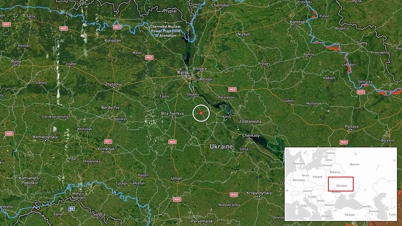
What happened
Ukrainian air monitoring channel @kpszsu reported on Telegram that one unmanned aerial vehicle was moving toward the settlement of Kaharlyk in Kyiv Oblast, in central Ukraine. The post, written in Ukrainian, reads as a brief air-alert notice: 'Kyivshchyna: BpLA in the direction of Kaharlyk.' It attributes the drone to Russia's Shahed family of loitering munitions and records the time as 21 October 2026, around 04:08 UTC. The report does not describe any impact, casualties, or damage, and it does not state whether the drone struck, was intercepted, or left the area. The event is logged as a drone transit rather than a confirmed attack.
Context and assessment
Kaharlyk lies in the Kyiv Oblast region, southwest of the capital and within the broader corridor that Russian long-range drones have repeatedly crossed on routes toward central and western Ukraine. The related events in this data set show a sustained sequence of drone transits in the same area over roughly 15 hours. Reports from Obukhiv, Pereiaslav and Doslidnytske describe single or multiple jet-powered Geran-3 drones moving through or past settlements, with several noting the Cherkasy Oblast origin of at least one group and a westward heading later in the sequence. The pattern suggests a steady stream of aircraft moving across the region rather than a single isolated strike. Operationally, such transits are often associated with routing toward targets further west or with saturation attempts that stretch air defence, though the data does not confirm either purpose. A lone drone heading toward Kaharlyk may therefore reflect part of a broader flight path rather than an intent to hit that settlement specifically.
Sources and confidence
The event rests on one Telegram channel, @kpszsu, which is linked to Ukraine's air-monitoring reporting. No second outlet in this data set independently reports the Kaharlyk drone, so cross-confirmation is absent. The confidence score of 8.0 reflects a credible official-linked channel with a clear, specific location and time, tempered by the single-source status and the lack of follow-up on outcome. Confidence would rise if Ukrainian air force statements, regional military administration posts, or local officials confirmed the track or any impact. It would fall if the track were later attributed to a different location or if the report were corrected or withdrawn.
Location
The location is a settlement-level match for Kaharlyk, Kyiv Oblast, placed at approximately 49.859 N, 30.823 E, and the coordinate confidence is recorded as high. The source names the town directly, so no facility or precise impact site is implied. Kaharlyk sits in relatively flat terrain on the Ukrainian plain, near the Dnipro basin and the Kyiv reservoir region to the east and north. The surrounding area is largely agricultural with river valleys, rail links and road corridors that drones often follow when crossing central Ukraine.
Related events nearby
- Ukrainian air monitoring: 1 Russian jet-powered Shahed (Geran-3) drone over Obukhiv.2026-10-21 02:20 UTC · Drone Transit · Obukhiv, Ukraine
- Ukrainian air monitoring: 2+ Russian jet-powered Shahed (Geran-3) drones passing Doslidnytske, heading west.2026-10-21 04:17 UTC · Drone Transit · Doslidnytske, Ukraine
- Ukrainian air monitoring: 1 Russian jet-powered Shahed (Geran-3) drone over Pereiaslav.2026-10-21 02:17 UTC · Drone Transit · Pereiaslav, Ukraine
- Ukrainian air monitoring: 2+ Russian jet-powered Shahed (Geran-3) drones from Cherkasy Oblast toward Pereiasla2026-10-20 17:04 UTC · Drone Transit · Pereiaslav, Ukraine
- Ukrainian air monitoring: 2+ Russian jet-powered Shahed (Geran-3) drones heading toward Pereiaslav.2026-10-20 15:45 UTC · Drone Transit · Pereiaslav, Ukraine
▶ View this event on the live map

Intel Mapper aggregates open-source reports from monitored Telegram and X channels, geolocates them, cross-checks duplicates across sources and assigns a confidence score. Entries are updated as new confirmations arrive. Read how we verify events.