Ukraine's Air Force reports at least two jet-powered Shahed drones heading toward Pereiaslav
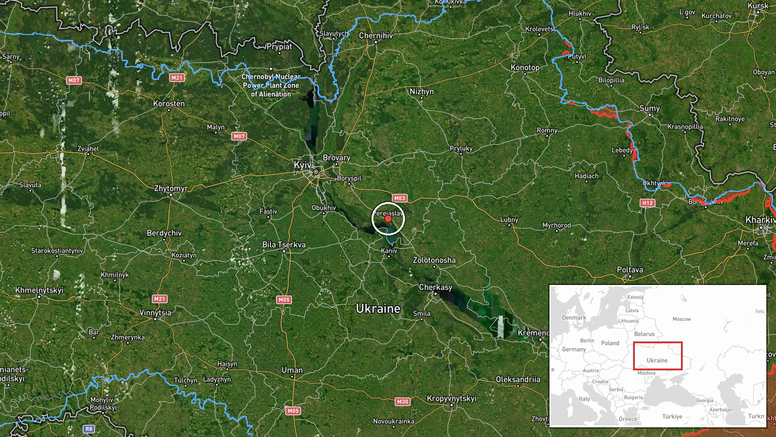
What happened
Ukraine's Air Force Telegram channel, @kpszsu, reported at 15:45 UTC on 20 October 2026 that at least two jet-powered Shahed (Geran-3) drones were heading toward Pereiaslav in Kyiv Oblast. The original Ukrainian post, headed by a motorcycle emoji, read 'Kyiv region: jet-powered UAVs on course to Pereiaslav.' It describes a track and heading, not an impact. The report does not state whether the drones struck anything, and it describes no casualties, damage or interceptions. The '2+' count reflects the channel's wording, so the number is a minimum and could be higher. This is the only source for the item, and air-monitoring posts of this kind are often updated as tracks change.
Context and assessment
Pereiaslav is a small historic town on the Trubizh river, about 80 kilometres south-east of Kyiv. It lies on a corridor that Shahed-type drones have repeatedly used when routing toward the capital region and the Boryspil area. The related events show a sequence on 20 October. An alert at 11:49 UTC described drones passing Pereiaslav toward Boryspil. An alert at 13:27 described one Geran-3 heading toward Pereiaslav, alongside another track from Cherkasy Oblast. A further alert at 15:50 placed drones on a heading toward Boryspil. On 19 October, a group was tracked passing Rzhyshchiv toward Obukhiv. Together these reports suggest a recurring approach through Kyiv Oblast, with Pereiaslav appearing as a waypoint rather than an isolated target. Operationally, this may indicate drones being directed toward infrastructure near Boryspil and the capital, or routing that avoids particular defended zones. The same day's General Staff summary of 24-hour Russian attacks places the item within a much broader campaign. These inferences remain tentative, because transit reports do not reveal final targets.
Sources and confidence
Only one channel reported this item: the Telegram account @kpszsu, attributed to Ukraine's Air Force air monitoring. No independent outlet, wire service or official statement in the data corroborates it, so cross-confirmation is absent. The confidence score of 8.0 is relatively high because the channel is an official military monitoring source that issues timed track updates, and the post specifies the drone type and heading. It is held below the top range because it is single-sourced, the drone count is a minimum, and no outcome is reported. Confidence would rise with corroborating alerts, regional military administration statements, or reports of impacts or interceptions near Pereiaslav. It would fall if later updates revised the heading or retracted the track.
Location
The location is a settlement-level match. The coordinates point to the town of Pereiaslav in Kyiv Oblast, consistent with the channel naming the town directly, and location confidence is rated high. Pereiaslav lies on the Trubizh river near its junction with the Dnipro, in a flat, wooded and agricultural landscape south-east of the capital. Its historic core and river crossings are notable local features. Precision is town-level rather than facility-level, so no specific site is implied.
Related events nearby
- Ukrainian air monitoring: 1 Russian jet-powered Shahed (Geran-3) drone heading toward Pereiaslav; 1 Russian je2026-10-20 13:27 UTC · Drone Transit · Pereiaslav, Ukraine
- Ukrainian air monitoring: 2+ Russian jet-powered Shahed (Geran-3) drones heading toward Boryspil.2026-10-20 15:50 UTC · Drone Transit · Boryspil, Ukraine
- Ukrainian air monitoring: 2+ Russian jet-powered Shahed (Geran-3) drones passing Pereiaslav, heading toward Bo2026-10-20 11:49 UTC · Drone Transit · Boryspil, Ukraine
- Ukrainian General Staff reports 24h Russian attacks: 1 missile strike, 63 airstrikes, 217 guided glide bombs, 2026-10-20 04:07 UTC · Report · Ukraine
- Ukrainian air monitoring: 1 Russian jet-powered Shahed (Geran-3) drone heading toward Rembaza, Kyiv.2026-10-20 10:18 UTC · Drone Transit · Rembaza, Kyiv, Ukraine
▶ View this event on the live map

Intel Mapper aggregates open-source reports from monitored Telegram and X channels, geolocates them, cross-checks duplicates across sources and assigns a confidence score. Entries are updated as new confirmations arrive. Read how we verify events.