Ukrainian air monitoring reports jet-powered Shahed drones transiting Kyiv, Cherkasy and Poltava oblasts
What happened
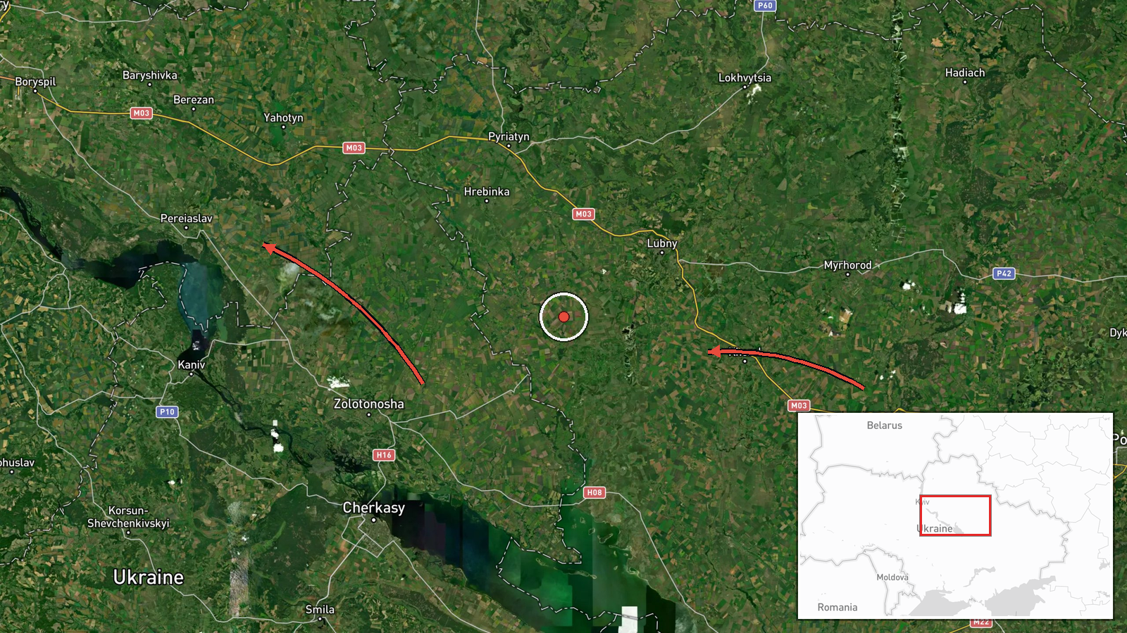
Ukrainian air monitoring posted on Telegram (@kpszsu) on 20 October 2026 at about 13:27 UTC that a single Russian jet-powered Shahed (Geran-3) drone was heading toward Pereiaslav in Kyiv Oblast. The same post, in Ukrainian, described two further drones: one from Cherkasy Oblast heading toward Drabiv, and one from Poltava Oblast on a course toward Khorol. The wording is a routine air-alert style notice of drone heading and does not report impact, casualties, or damage at any of the named settlements. The report is a single-channel post, and the summary reflects the monitoring warning rather than any confirmed strike outcome.
Context and assessment
Pereiaslav sits on the Trubizh River south of Kyiv and lies along a corridor that Russian long-range drones have repeatedly used when moving toward the capital region and the Dnipro basin. Related entries from the same day and the day before show a sequence of Geran-3 drones passing Pereiaslav and heading toward Boryspil, Obukhiv and Rembaza, which suggests drones were being tracked on several overlapping routes north and east of Kyiv rather than a single isolated track. The General Staff's 24-hour summary for the same period, listing thousands of kamikaze drones and hundreds of glide bombs, places these transits within a much larger campaign. Drones tracked toward Drabiv and Khorol, further southeast, may indicate routing toward central and eastern regional infrastructure, though transit reports alone do not establish intended targets. Operationally, such notices are most useful as indicators of approach direction and alert timing.
Sources and confidence
The report comes from one channel, the Telegram account @kpszsu, which is the official air-force monitoring account of Ukraine's armed forces and is generally regarded as a primary source for real-time air alerts. No independent outlet in the data cross-confirms the three drone positions. Confidence is scored at 8.0 because the originator is authoritative and the related entries show a consistent pattern, but the event is single-sourced and records only heading information, not verified locations or impacts. Confidence would rise with independent reporting of drone sightings, interceptions or impacts at the named settlements, or with corroborating official statements. It would fall if later updates revised or withdrew the headings.
Location
The point is placed at the settlement level for Pereiaslav, a town in Kyiv Oblast, using its published coordinates at roughly 50.07 N, 31.45 E. The Drabiv and Khorol references are named in the source but are not separately geocoded here, so the map point reflects only the first-named drone. The town lies on the Trubizh River in a flat, wooded and agricultural landscape of the Dnipro lowlands, with the wider Dnipro valley and Kyiv reservoir system to the west and north. Dense road and rail links connecting Kyiv to the south and east run through the area.
Related events nearby
- Ukrainian air monitoring: 1 Russian jet-powered Shahed (Geran-3) drone from Kyiv Oblast toward Pereiaslav.2026-10-19 15:52 UTC · Drone Transit · Pereiaslav, Ukraine
- Ukrainian air monitoring: 2+ Russian jet-powered Shahed (Geran-3) drones passing Pereiaslav, heading toward Bo2026-10-20 11:49 UTC · Drone Transit · Boryspil, Ukraine
- Ukrainian air monitoring: 2+ Russian jet-powered Shahed (Geran-3) drones passing Rzhyshchiv, heading toward Ob2026-10-19 16:04 UTC · Drone Transit · Obukhiv, Ukraine
- Ukrainian General Staff reports 24h Russian attacks: 1 missile strike, 63 airstrikes, 217 guided glide bombs, 2026-10-20 04:07 UTC · Report · Ukraine
- Ukrainian air monitoring: 1 Russian jet-powered Shahed (Geran-3) drone heading toward Rembaza, Kyiv.2026-10-20 10:18 UTC · Drone Transit · Rembaza, Kyiv, Ukraine
▶ View this event on the live map

Intel Mapper aggregates open-source reports from monitored Telegram and X channels, geolocates them, cross-checks duplicates across sources and assigns a confidence score. Entries are updated as new confirmations arrive. Read how we verify events.