Two or more Russian Geran-3 jet drones reported heading toward Boryspil, Kyiv region
What happened
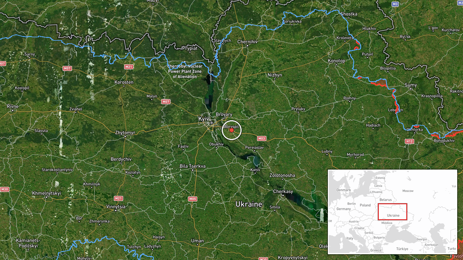
Ukrainian air monitoring reported on Telegram via the channel @kpszsu that two or more jet-powered Shahed drones, identified in the report as Geran-3 type and attributed to Russia, were heading toward Boryspil in Kyiv Oblast on 20 October 2026, with the post logged at 15:50 UTC. The original Ukrainian-language message, which translates roughly as Kyiv region: jet-type UAVs heading in the direction of Boryspil and Rzhyshchiv, names two localities, and the event record places the primary reference at Boryspil. The wording describes a direction of travel rather than an impact. No strike, damage, casualties or interception is stated in the post. The report is a movement alert, so its significance lies in the track rather than any reported result. It is one of several similar air-monitoring alerts issued that day for the Kyiv region.
Context and assessment
Boryspil hosts Kyiv's main international airport and sits on the eastern approaches to the capital, so drones tracked toward it draw attention even when no impact is reported. The wider pattern on 20 October 2026 is notable for its density. Earlier that day, monitoring posts logged a single Geran-3 drone heading toward Brovary at 00:30 and another toward Rembaza in Kyiv at 10:18, followed by a group of two or more toward Kalynivka at 10:33. A further group of two or more was reported passing Pereiaslav at 11:49 and heading toward Boryspil, the same axis as this report. A single drone was then tracked toward DVRZ in Kyiv at 14:09. The sequence suggests repeated sorties crossing the Kyiv region from different directions over much of the day, with the Boryspil corridor appearing more than once. Operationally, such staggered tracks are consistent with probing of air defence coverage, route testing or saturation planning, although the data cannot distinguish among these purposes. Alerts of this kind are typically used by air defence and civil authorities to decide on warnings and interceptor allocation rather than as evidence of a specific target.
Sources and confidence
Only one channel, the Telegram account @kpszsu, is recorded as the source, so cross-confirmation is absent at the time of logging. The confidence score of 8.0 is high for a single source because the account is an official Ukrainian air-monitoring channel, the post is specific about direction and drone type, and it fits several other alerts from the same day. It is held below the maximum because the post reports a track rather than an observed event, and no independent radar, wire or regional confirmation is attached. Confidence would rise with corroboration from other official Ukrainian air force or regional channels, or from wire reports of sirens or interceptions near Boryspil. It would fall if later official updates revised the heading or withdrew the alert.
Location
The location is recorded at settlement level, placed on Boryspil city in Kyiv Oblast at approximately 50.35 N, 30.95 E, with high location confidence. The coordinates reflect the town rather than the airport or any specific facility, since the report names a direction of travel rather than a precise site. Boryspil lies on flat terrain of the Dnipro basin east of Kyiv, a largely open landscape of farmland and settlements that offers little natural cover from low-flying aerial threats.
Related events nearby
- Ukrainian air monitoring: 2+ Russian jet-powered Shahed (Geran-3) drones passing Pereiaslav, heading toward Bo2026-10-20 11:49 UTC · Drone Transit · Boryspil, Ukraine
- Ukrainian air monitoring: 1 Russian jet-powered Shahed (Geran-3) drone heading toward Rembaza, Kyiv.2026-10-20 10:18 UTC · Drone Transit · Rembaza, Kyiv, Ukraine
- Ukrainian air monitoring: 1 Russian jet-powered Shahed (Geran-3) drone heading toward Brovary.2026-10-20 00:30 UTC · Drone Transit · Brovary, Ukraine
- Ukrainian air monitoring: 1 Russian jet-powered Shahed (Geran-3) drone heading toward DVRZ, Kyiv.2026-10-20 14:09 UTC · Drone Transit · DVRZ, Kyiv, Ukraine
- Ukrainian air monitoring: 2+ Russian jet-powered Shahed (Geran-3) drones heading toward Kalynivka.2026-10-20 10:33 UTC · Drone Transit · Kalynivka, Ukraine
▶ View this event on the live map

Intel Mapper aggregates open-source reports from monitored Telegram and X channels, geolocates them, cross-checks duplicates across sources and assigns a confidence score. Entries are updated as new confirmations arrive. Read how we verify events.