Jet-powered Geran-3 drones reported moving from Dnipropetrovsk toward Poltava Oblast
What happened
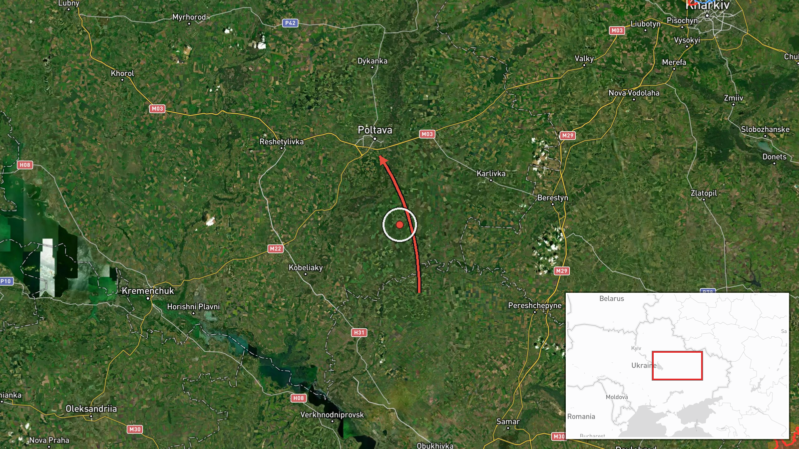
Ukraine's Air Force monitoring channel on Telegram, @kpszsu, reported on 21 October 2026 at 08:26 UTC that two or more jet-powered Shahed-type drones, identified in the post as Geran-3, were moving from Dnipropetrovsk Oblast toward Poltava Oblast on a northwest course. The original Ukrainian wording refers to jet-type unmanned aerial vehicles (реактивні БпЛА) and gives a regional direction rather than a named destination. The report describes no impacts, casualties or damage. It sits within a sequence of related air monitoring alerts from 20 and 21 October that trace drones passing through several communities in the region, including Khorol and Mahdalynivka. Because this is a transit notice rather than a strike report, the event records movement of aerial threats, not a confirmed attack on a target.
Context and assessment
Poltava Oblast lies across a corridor that Russian long-range drones have repeatedly used when heading toward central and western Ukraine, and the region contains energy infrastructure, rail junctions, and agricultural and industrial sites that have featured in earlier strike waves. The related reports show the same pattern: alerts from Bilyky and Novi Sanzhary on 20 October, followed by sightings over Mahdalynivka and Khorol in the early hours of 21 October, all describing drones on a northwest heading. That progression suggests a single group or successive groups moving through the region over many hours rather than isolated launches. The Geran-3 designation points to a jet-powered variant, which is generally faster and harder to intercept than older piston-engine Shaheds, so such transits can compress the warning window for local air defence and civil authorities. Operationally, the sequence may indicate route-probing, a decoy or saturation element, or drones en route to targets farther along the same bearing. The available reporting does not establish which of these applies, and it should not be read as a forecast of a specific strike location.
Sources and confidence
The event rests on one source, the @kpszsu Telegram channel, which carries Ukrainian Air Force monitoring updates. No second outlet, official statement or independent observer has been identified as corroborating this specific alert in the data provided. The confidence score of 8.0 reflects the official origin of the channel and the internal consistency of the related alerts, but it is not higher because the post is a single unverified notice with no imagery, debris reports or local authority confirmation. Confidence would rise with independent corroboration, reports of impacts or interceptions tied to this track, or statements from regional authorities. It would fall if the alert were corrected, withdrawn, or contradicted by later monitoring data.
Location
The coordinates, 49.59 N and 34.55 E, approximate the centre of Poltava Oblast and do not mark a settlement, so the location is recorded at regional precision with low confidence. The oblast is a largely flat agricultural landscape of steppe and river valleys in central-eastern Ukraine. The Vorskla River flows through the region, and the area is crossed by major road and rail corridors. The alert's direction of travel, not the point coordinate, is the more reliable spatial information.
Related events nearby
- Ukrainian air monitoring: 2+ Russian jet-powered Shahed (Geran-3) drones from Dnipropetrovsk Oblast toward Pol2026-10-20 16:30 UTC · Drone Transit · Poltava Oblast, Ukraine
- Ukrainian air monitoring: 2+ Russian jet-powered Shahed (Geran-3) drones from Dnipropetrovsk Oblast toward Nov2026-10-20 15:11 UTC · Drone Transit · Novi Sanzhary, Ukraine
- Ukrainian air monitoring: 2+ Russian jet-powered Shahed (Geran-3) drones heading toward Bilyky.2026-10-20 13:10 UTC · Drone Transit · Bilyky, Ukraine
- Ukrainian air monitoring: 2+ Russian jet-powered Shahed (Geran-3) drones passing Mahdalynivka, heading northwe2026-10-21 03:36 UTC · Drone Transit · Mahdalynivka, Ukraine
- Ukrainian air monitoring: 1 Russian jet-powered Shahed (Geran-3) drone over Khorol.2026-10-21 02:18 UTC · Drone Transit · Khorol, Ukraine
▶ View this event on the live map

Intel Mapper aggregates open-source reports from monitored Telegram and X channels, geolocates them, cross-checks duplicates across sources and assigns a confidence score. Entries are updated as new confirmations arrive. Read how we verify events.