Jet-powered Shahed-type drones reported moving from Chernihiv region toward Kyiv Oblast
What happened
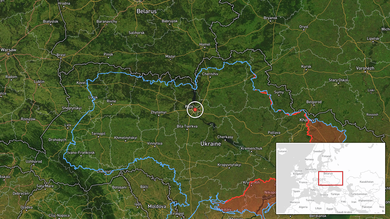
Ukraine's Air Force Telegram channel, @kpszsu, reported at 11:39 UTC on 21 October 2026 that jet-powered unmanned aerial vehicles were moving through the north and centre of Chernihiv Oblast on a course toward Kyiv Oblast. The original Ukrainian wording refers to reactive UAVs, and the related summaries identify them as Russian jet-powered Shahed (Geran-3) drones, at least two in number. The report gives no altitude, precise track, or confirmed count beyond the plural wording, and it does not describe any impact or damage. The event is logged as a drone transit rather than a strike. It is one of several air-monitoring alerts issued across Kyiv Oblast and the city of Kyiv earlier that day.
Context and assessment
Kyiv and its surrounding oblast have been a recurring focus of Russian long-range drone activity since 2022, and drones routed toward the capital are significant because they can force repeated air-raid alerts and draw interceptor resources away from other areas. The related events show a sequence on the same day. Single drones and groups of two or more were logged over or heading toward Kyiv at 02:25, 02:37 and 03:43 UTC, then passing Olyshivka toward Kyiv Oblast at 07:58, and passing Kyiv Oblast heading west at 08:55. This spacing suggests either repeated launch waves or drones that continued after passing the capital region, rather than a single incident. Jet-powered variants fly considerably faster than the older piston-engine Shahed design, which shortens warning times for air defence units and population centres. The data does not establish intent. The pattern may reflect sustained launches, decoy use, or deliberate pressure on interception, but those explanations cannot be confirmed from a single alert channel.
Sources and confidence
All of the information comes from one channel, the Telegram account @kpszsu, which belongs to the Ukrainian Air Force and is the official source for national air-monitoring alerts. No independent outlet, wire service, or second official body in the dataset repeats the report, so cross-confirmation is absent. The confidence score of 8.0 reflects the channel's official status and its consistent record of relaying such tracks. It is held below the maximum because the report is single-source and aerial tracks change quickly. Confidence would rise with independent corroboration from regional military administrations, radar-based statements, or wire reporting, and would fall if later updates revise the drone count or revise the direction of travel.
Location
The coordinates 50.45 N, 30.52 E correspond to central Kyiv city. They are used here as a regional placeholder for Kyiv Oblast, and the location is rated low confidence at region-level precision. The point therefore does not identify any settlement, facility, or specific flight path. The route described runs from northern and central Chernihiv Oblast toward Kyiv Oblast, across mostly flat terrain of farmland, forest belts, and river valleys, with the Dnipro basin lying to the east. Olyshivka, named in a related report, is a settlement whose exact position on the track was not mapped in the data.
Related events nearby
- Ukrainian air monitoring: 2+ Russian jet-powered Shahed (Geran-3) drones passing Kyiv Oblast, heading west.2026-10-21 08:55 UTC · Drone Transit · Kyiv Oblast, Ukraine
- Ukrainian air monitoring: 2+ Russian jet-powered Shahed (Geran-3) drones passing Olyshivka, heading toward Kyi2026-10-21 07:58 UTC · Drone Transit · Kyiv Oblast, Ukraine
- Ukrainian air monitoring: 1 Russian jet-powered Shahed (Geran-3) drone heading toward Kyiv.2026-10-21 03:43 UTC · Drone Transit · Kyiv, Ukraine
- Ukrainian air monitoring: 2+ Russian jet-powered Shahed (Geran-3) drones over Kyiv.2026-10-21 02:37 UTC · Drone Transit · Kyiv, Ukraine
- Ukrainian air monitoring: 1 Russian jet-powered Shahed (Geran-3) drone over Kyiv.2026-10-21 02:25 UTC · Drone Transit · Kyiv, Ukraine
▶ View this event on the live map

Intel Mapper aggregates open-source reports from monitored Telegram and X channels, geolocates them, cross-checks duplicates across sources and assigns a confidence score. Entries are updated as new confirmations arrive. Read how we verify events.