Jet-powered Shahed drones reported transiting southern Khmelnytskyi Oblast from Vinnytsia Oblast
What happened
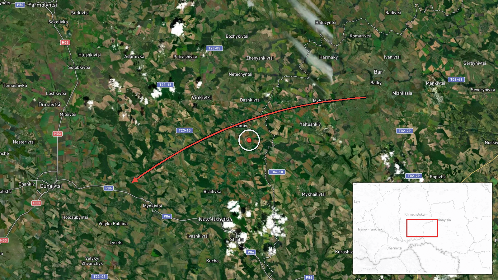
Ukrainian air monitoring reported on Telegram that jet-powered Shahed (Geran-3) drones launched from Vinnytsia Oblast were moving toward southern Khmelnytskyi Oblast on a western heading. The post, published on 21 October 2026 at about 12:13 UTC by the channel @kpszsu, is a short alert and does not state any impact, strike, or damage. The source wording uses the phrase 'реактивні БпЛА', identifying the aircraft as jet-powered unmanned aerial vehicles. The alert gives a directional report rather than a precise location, and it is the only channel carrying this specific item. The report describes transit activity, not a confirmed attack on a particular target.
Context and assessment
Southern Khmelnytskyi Oblast sits in western-central Ukraine, a corridor that Russian long-range drones have crossed repeatedly on routes toward western and central regions. The related events on the same day show a sequence of single-drone transit alerts: one near Sharhorod early on 21 October, one near Nova Ushytsya at 05:23 UTC, one from Vinnytsia Oblast toward Murovani Kurylivtsi at 09:43 UTC, and another heading toward Khmelnytskyi Oblast at 11:38 UTC. The day before, a drone was reported heading toward Khmelnytskyi itself. Taken together, the pattern suggests repeated overflights along a consistent axis rather than a single isolated event. Operationally, such tracks may reflect drones being routed through the region, air-defence and electronic-warfare pressure on the approach to western Ukraine, or decoy and saturation tactics. Those readings remain inference; the alerts alone do not show intent or target.
Sources and confidence
The item relies on a single Telegram channel, @kpszsu, which is a Ukrainian air-monitoring account. Its alerts are generally consistent with patterns seen in other reporting, but no independent channel in this dataset corroborates this specific transit. The confidence score of 8.0 reflects a single-source report from a relevant but unverified channel, combined with a directional rather than point-specific description. Confidence would rise with corroboration from additional monitoring channels, regional military administration statements, or flight-track data. It would fall if later updates contradicted the heading or if the alert proved to refer to a different oblast.
Location
The location is recorded as southern Khmelnytskyi Oblast at region-level precision, with a low location confidence rating. The coordinates correspond to a general area within the oblast rather than a settlement or facility, because the source names a direction of travel, not a point. The terrain is largely rolling agricultural plain in the Podolia area, with the Southern Bug and its tributaries drawing through the wider region. No specific installation is named in the source.
Related events nearby
- Ukrainian air monitoring: 1 Russian jet-powered Shahed (Geran-3) drone heading toward Nova Ushytsya.2026-10-21 05:23 UTC · Drone Transit · Nova Ushytsya, Ukraine
- Ukrainian air monitoring: 1 Russian jet-powered Shahed (Geran-3) drone from Vinnytsia Oblast toward Murovani K2026-10-21 09:43 UTC · Drone Transit · Murovani Kurylivtsi, Ukraine
- Ukrainian air monitoring: 1 Russian jet-powered Shahed (Geran-3) drone heading toward Khmelnytskyi Oblast.2026-10-21 11:38 UTC · Drone Transit · Khmelnytskyi Oblast, Ukraine
- Ukrainian air monitoring: 1 Russian jet-powered Shahed (Geran-3) drone heading toward Sharhorod.2026-10-21 02:55 UTC · Drone Transit · Sharhorod, Ukraine
- Ukrainian air monitoring: 1 Russian jet-powered Shahed (Geran-3) drone heading toward Sharhorod.2026-10-20 15:02 UTC · Drone Transit · Sharhorod, Ukraine
▶ View this event on the live map

Intel Mapper aggregates open-source reports from monitored Telegram and X channels, geolocates them, cross-checks duplicates across sources and assigns a confidence score. Entries are updated as new confirmations arrive. Read how we verify events.