Two or more Russian jet-powered Shahed drones reported moving from Black Sea toward Mykolaiv Oblast
What happened
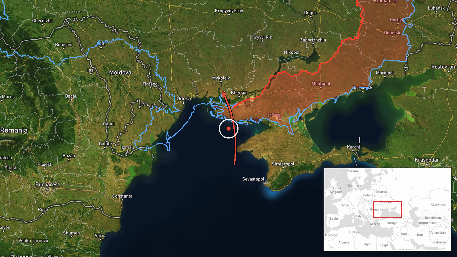
On 21 October 2026, at about 13:33 UTC, the Ukrainian Air Force monitoring channel Telegram (@kpszsu) reported two or more Russian jet-powered Shahed (Geran-3) drones moving from the Black Sea toward Mykolaiv Oblast on a northerly course. The original Ukrainian-language post describes them as jet-type unmanned aerial vehicles flying north into the Mykolaiv region. The report is an air-alert style notice rather than a description of any impact. It does not state a target, a landing, a detonation or any casualties. The post is the only source attached to this entry, and the coordinates on the map are a regional centroid rather than a specific point.
Context and assessment
Mykolaiv Oblast sits on the northern Black Sea coast and lies on the main approach corridor from the sea toward Odesa and the interior of southern Ukraine. Mykolaiv city, the oblast's administrative center, has been struck repeatedly since 2022, and its port and shipyards carry long-standing strategic weight. The related events logged the same morning show a sustained pattern. Between 04:10 and 12:46 UTC, monitoring reports tracked groups of Geran-3 drones over Ochakiv, Nova Odesa and Mykolaiv itself, with some groups described as arriving from the Black Sea and others heading north after passing through. The repeated sequence of southern coastal locations suggests a series of waves moving along the coast rather than a single isolated flight. Operationally, such transit reports are usually read as indicators of an ongoing deep-strike or saturation effort, and they are often used by air defense units to prepare for possible targeting of nearby infrastructure. Whether this particular group was aimed at Mykolaiv, at areas further north, or was simply in transit cannot be determined from the report alone.
Sources and confidence
Only one channel is attached to this event: the Telegram account @kpszsu, which is associated with Ukrainian air-threat monitoring. No independent outlet, wire service or second monitoring channel is listed in the data, so cross-confirmation is absent. The confidence score of 8.0 reflects a credible official-style monitoring source with a consistent pattern across related reports, but it is held below the top range because it is single-sourced and because the post describes movement rather than verified impact. Confidence would rise with corroboration from a second Ukrainian authority or from regional officials confirming sightings or debris, and with any independent tracking data. It would fall if later updates revised the number of drones or the direction of travel.
Location
The location is recorded at the oblast level as Mykolaiv Oblast, Ukraine, with coordinates of 46.97 N, 32.00 E, and the geo precision is marked as region. The source names no settlement, so the point is an approximate centre of the oblast rather than a place where anything was observed. The oblast lies on the Black Sea coast between the Odesa and Kherson regions, is largely flat steppe crossed by the Southern Bug and Dnipro-Buh estuary, and contains coastal lagoons and the port city of Mykolaiv near the river mouth.
Related events nearby
- Ukrainian air monitoring: 2+ Russian jet-powered Shahed (Geran-3) drones passing Mykolaiv Oblast, heading nort2026-10-21 12:46 UTC · Drone Transit · Mykolaiv Oblast, Ukraine
- Ukrainian air monitoring: 1 Russian jet-powered Shahed (Geran-3) drone heading toward Mykolaiv.2026-10-21 06:13 UTC · Drone Transit · Mykolaiv, Ukraine
- Ukrainian air monitoring: 2+ Russian jet-powered Shahed (Geran-3) drones passing Nova Odesa, heading north.2026-10-21 08:32 UTC · Drone Transit · Nova Odesa, Ukraine
- Ukrainian air monitoring: 3+ Russian jet-powered Shahed (Geran-3) drones from Black Sea toward Ochakiv.2026-10-21 08:11 UTC · Drone Transit · Ochakiv, Ukraine
- Ukrainian air monitoring: 1 Russian jet-powered Shahed (Geran-3) drone over Ochakiv.2026-10-21 04:10 UTC · Drone Transit · Ochakiv, Ukraine
▶ View this event on the live map

Intel Mapper aggregates open-source reports from monitored Telegram and X channels, geolocates them, cross-checks duplicates across sources and assigns a confidence score. Entries are updated as new confirmations arrive. Read how we verify events.