Ukraine reports Russian tactical aircraft launching guided bombs toward Dnipropetrovsk Oblast
What happened
On 21 October 2026, at about 17:21 UTC, the Telegram channel @kpszsu, which reportedly belongs to Ukraine's Air Force, said that Russian tactical aviation was launching guided aerial bombs toward Dnipropetrovsk Oblast and Sumy Oblast. The original Ukrainian post refers to launches of guided aerial bombs, and the English summary describes the aircraft as heading toward Dnipropetrovsk Oblast. The report does not name a settlement, a target, or any impact, and it contains no casualty information or confirmation of damage. Because the post is a single channel's warning rather than a field report, the event is best read as announced air activity in the region rather than a documented strike outcome.
Context and assessment
Dnipropetrovsk Oblast is an industrial and transport hub in central-eastern Ukraine. Its regional capital, Dnipro, sits on the Dnipro River and has been under repeated air attack. Related reports from the same day show a dense sequence aimed toward Dnipro: Banderol mini cruise missiles logged at 06:08 and 10:13 UTC, a further Banderol group at 10:18, and jet-powered Geran-3 drones at 13:45 and 17:28. The guided bomb report at 17:21 sits within that pattern as the latest layer of an extended day of air activity. Guided aerial bombs are typically released by aircraft at standoff distance and are most closely associated with frontline and near-frontline areas, which may explain the reference to Sumy Oblast alongside Dnipropetrovsk. Operationally, a combination of missiles, drones and aircraft-launched munitions over several hours may be intended to stretch air defence coverage and reaction capacity, but the data alone cannot establish intent or the targets selected. Firmer conclusions would normally require follow-up reports of impacts or damage.
Sources and confidence
Only one Telegram channel, @kpszsu, is listed, and no independent outlet, wire service or second monitoring source is recorded as confirming the report. The confidence score of 8.0 reflects that single-source status, together with the fact that the post is an official warning about aircraft activity rather than a confirmed impact. Confidence would rise if regional authorities in Dnipropetrovsk or Sumy, independent observers, or other channels reported detonations or damage, or if the related missile and drone reports were corroborated. It would fall if the warning were revised or if subsequent reporting showed no impacts.
Location
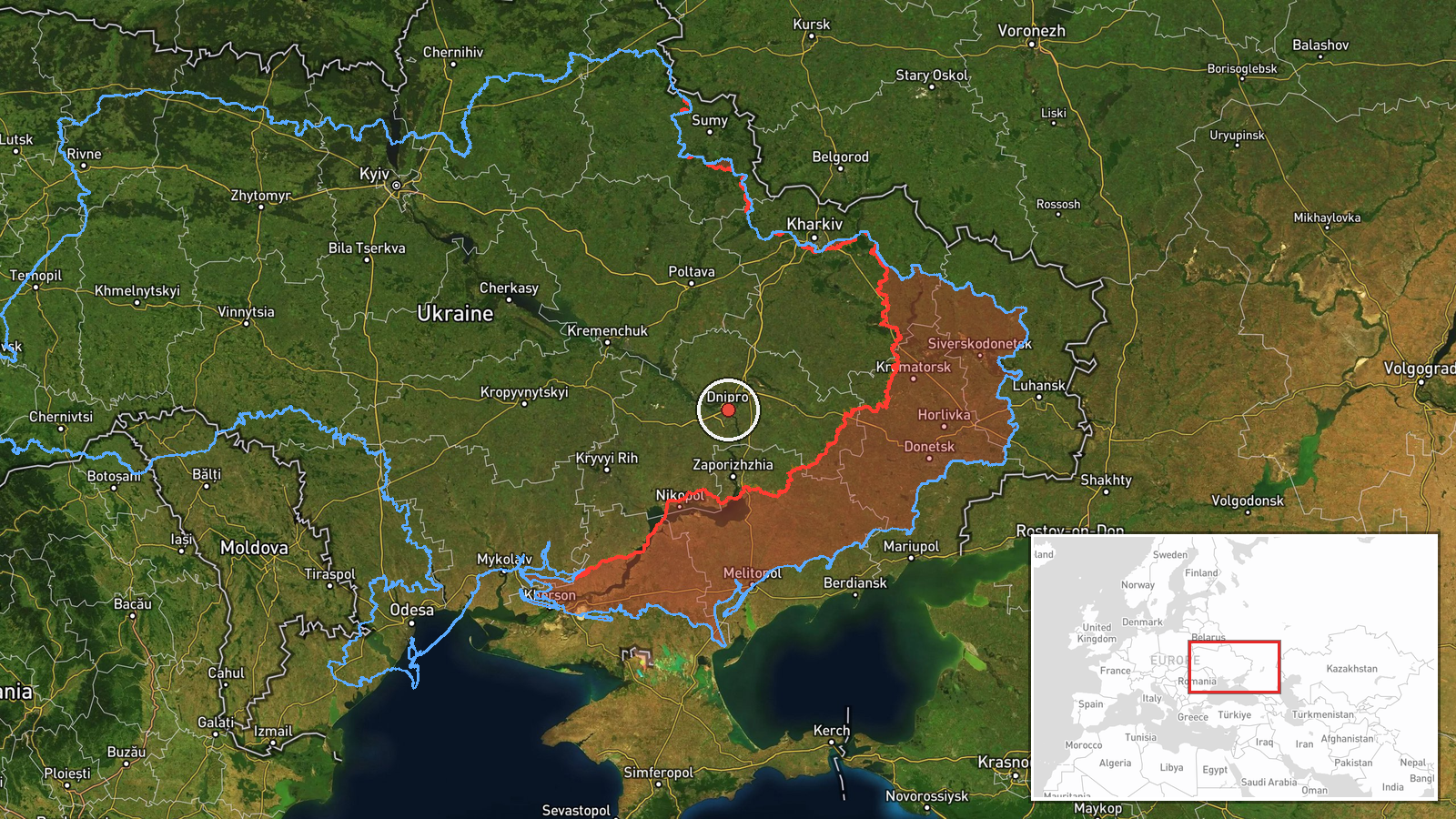
The location is recorded only at region level with low location confidence. The coordinates, 48.46N and 35.05E, fall in the Dnipro city area, but the pin should not be read as a confirmed target in the city. No settlement, facility or impact point is named. Dnipropetrovsk Oblast lies in central-eastern Ukraine and is drained largely by the Dnipro River, which runs through Dnipro city.
Related events nearby
- Ukrainian air monitoring: 2+ Russian jet-powered Shahed (Geran-3) drones heading toward Dnipro.2026-10-21 17:28 UTC · Drone Transit · Dnipro, Ukraine
- Ukrainian air monitoring: 1 Russian jet-powered Shahed (Geran-3) drone heading toward Dnipro.2026-10-21 13:45 UTC · Drone Transit · Dnipro, Ukraine
- Ukrainian air monitoring: 2+ Russian Banderol mini cruise missiles heading toward Dnipro.2026-10-21 10:18 UTC · Cruise Missile · Dnipro, Ukraine
- Ukrainian air monitoring: 1 Russian Banderol mini cruise missile from northern Dnipropetrovsk Oblast toward Dn2026-10-21 10:13 UTC · Cruise Missile · Dnipro, Ukraine
- Ukrainian air monitoring: 2+ Russian Banderol mini cruise missiles passing Solone, heading toward Dnipro.2026-10-21 06:08 UTC · Cruise Missile · Dnipro, Ukraine
▶ View this event on the live map

Intel Mapper aggregates open-source reports from monitored Telegram and X channels, geolocates them, cross-checks duplicates across sources and assigns a confidence score. Entries are updated as new confirmations arrive. Read how we verify events.