Geran-3 jet drone reported crossing southern Vinnytsia Oblast on a westward course
What happened
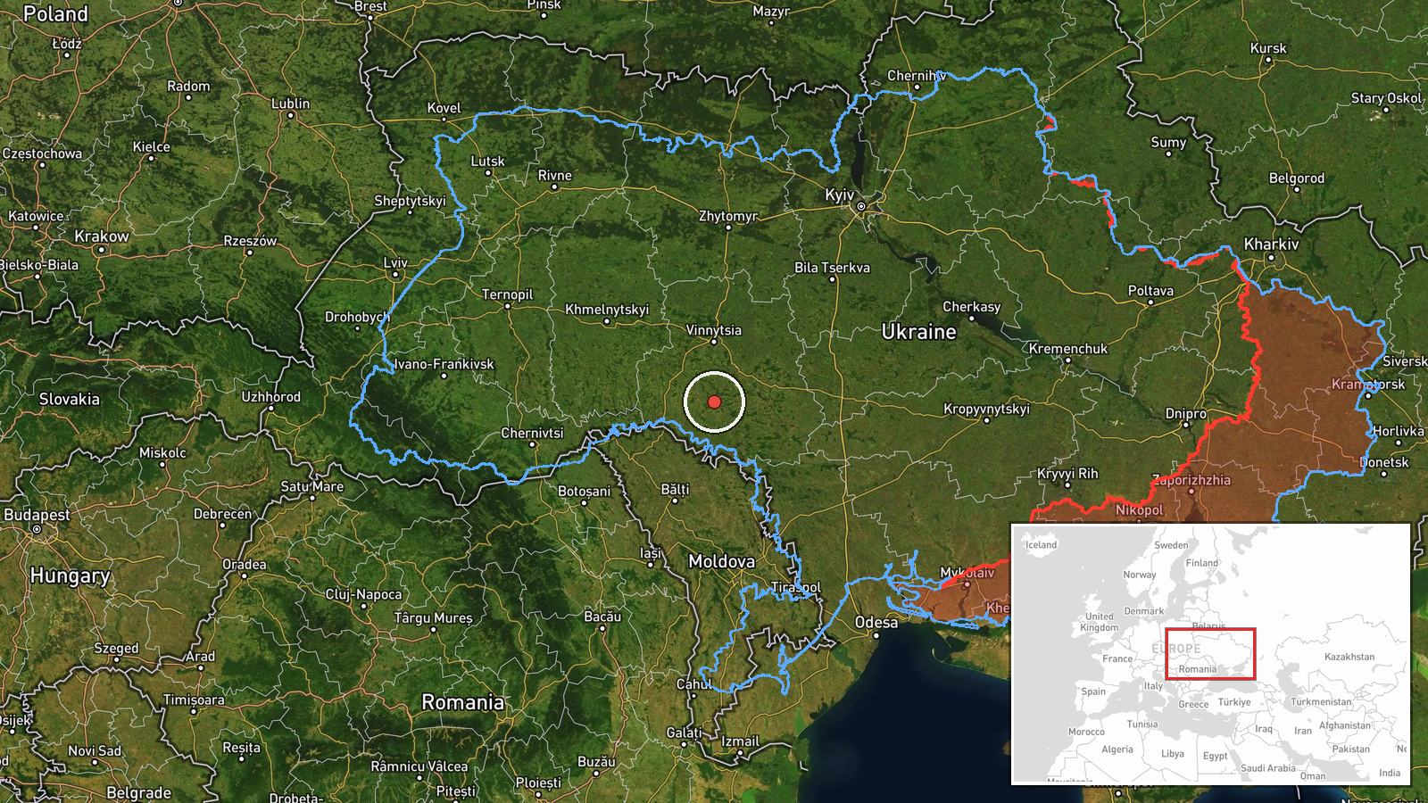
Ukrainian air monitoring reported on 21 October 2026 at 17:39 UTC that one Russian jet-powered Shahed, identified in reporting as a Geran-3, was passing through southern Vinnytsia Oblast on a course to the west. The original Ukrainian-language post, published on the Telegram channel @kpszsu, described a jet UAV in the south of Vinnytsia region heading west. A second line in the same post said a jet drone was heading toward Rivne and Zaporizhzhia from the east. The English summary mentions only Rivne, so the Zaporizhzhia reference appears in the original wording alone. The report describes a transit, not an impact, and it states no strike, damage or casualties.
Context and assessment
Vinnytsia Oblast lies on a main north-south and east-west route between Ukraine's southern and western regions, and the Geran-3 is the jet-powered variant of the Shahed family, faster and harder to intercept than the piston-engined Geran-2 used in earlier waves. The related reports show a sustained pattern on the same day. Early in the morning, a single drone was logged heading toward Sharhorod at 02:55 UTC and another moved toward Berezivka at 05:08 UTC. In the afternoon, one drone was tracked toward Ladyzhyn at 15:23 UTC and another from southern Vinnytsia toward Klembivka at 16:17 UTC. At 17:21 UTC, two or more drones were reported moving from Kirovohrad Oblast toward southern Vinnytsia. The repeated westward tracks across the same oblast suggest drones are being routed through this corridor in successive waves. Operationally, such transits may indicate movement toward targets farther west, reconnaissance of air-defence coverage, or the use of decoys within a larger package. Transit reports alone do not establish which, if any, target was intended.
Sources and confidence
The only source in the data is the Telegram channel @kpszsu, a Ukrainian air monitoring account, so the report is single-channel and reportedly rather than independently confirmed. No other outlet, monitoring feed or official statement in the provided data corroborates this specific track. The confidence score of 8.0 reflects the channel's role as a dedicated air-alert source and the consistency of related same-day reports from the same channel. It is held below the top of the scale because the source count is one and no later update or impact report is attached. Confidence would rise with corroboration from other air monitoring channels or regional military administrations, and would fall if subsequent updates contradict the track or direction.
Location
The location is approximate and recorded at region level, with low location confidence. The coordinates 48.68495 N, 28.47 E are a generalized point for southern Vinnytsia Oblast rather than a settlement, facility or position on the drone's track. The named places in related reports, including Sharhorod, Berezivka, Ladyzhyn and Klembivka, are approximate waypoints in the same area. The oblast is largely agricultural and borders Odesa and Kirovohrad regions to the south and east. The Southern Bug river runs through the wider area and may serve as a visual navigation feature for low-flying drones.
Related events nearby
- Ukrainian air monitoring: 2+ Russian jet-powered Shahed (Geran-3) drones passing southern Vinnytsia Oblast, he2026-10-21 18:54 UTC · Drone Transit · southern Vinnytsia Oblast, Ukraine
- Ukrainian air monitoring: 2+ Russian jet-powered Shahed (Geran-3) drones from Kirovohrad Oblast toward souther2026-10-21 17:21 UTC · Drone Transit · southern Vinnytsia Oblast, Ukraine
- Ukrainian air monitoring: 1 Russian jet-powered Shahed (Geran-3) drone heading toward Sharhorod.2026-10-21 02:55 UTC · Drone Transit · Sharhorod, Ukraine
- Ukrainian air monitoring: 1 Russian jet-powered Shahed (Geran-3) drone from southern Vinnytsia Oblast toward K2026-10-21 16:17 UTC · Drone Transit · Klembivka, Ukraine
- Ukrainian air monitoring: 1 Russian jet-powered Shahed (Geran-3) drone from Vinnytsia Oblast toward Berezivka.2026-10-21 05:08 UTC · Drone Transit · Berezivka, Ukraine
▶ View this event on the live map

Intel Mapper aggregates open-source reports from monitored Telegram and X channels, geolocates them, cross-checks duplicates across sources and assigns a confidence score. Entries are updated as new confirmations arrive. Read how we verify events.