Russian jet-powered Shahed drone tracked toward Dunayivtsi in Khmelnytskyi Oblast
What happened
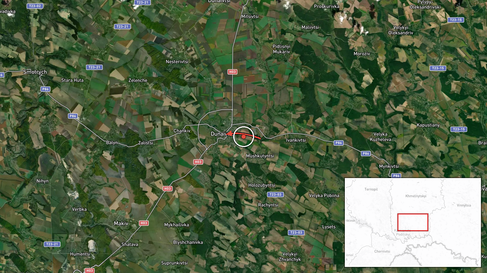
Ukraine's Air Force, reporting through its official Telegram channel @kpszsu, said on 21 October 2026 at about 17:58 UTC that one Russian jet-powered Shahed (Geran-3) drone was moving through the south of Khmelnytskyi Oblast toward the town of Dunayivtsi. The Ukrainian wording, translated, describes a jet-powered unmanned aerial vehicle in the south of the region on a course to Dunayivtsi coming from the east. The summary records the origin as southern Khmelnytskyi Oblast. The report is a routine air-monitoring notice. It does not describe any impact, damage, casualties, or interception at Dunayivtsi, and no further official update appears in the data provided.
Context and assessment
Dunayivtsi is a small town in Khmelnytskyi Oblast in western Ukraine, far from the front line in the east and south, so a drone heading toward it is notable mainly as part of a wider air-defence picture rather than as a frontline event. The related reports show a dense pattern of single and small-group Geran-3 transits across the same day. Earlier that morning, one drone was tracked toward Nova Ushytsya, and another toward Murovani Kurylivtsi from Vinnytsia Oblast. Later, drones were reported heading toward Khmelnytskyi Oblast at 11:38 and 13:31 UTC, and at 12:13 UTC two or more drones moved from Vinnytsia Oblast toward the southern part of Khmelnytskyi Oblast. Taken together, this suggests a sustained corridor of drones crossing central-western Ukraine rather than a single isolated flight. Operationally, the jet-powered Geran-3 is faster than the older piston-engined variants, which complicates interception windows. Tracking across several settlements may point to routing, decoy activity, or the search for targets along the way, but the data alone cannot confirm which, if any, was the intended objective.
Sources and confidence
The event rests on a single channel, the Telegram account @kpszsu, which is the official Ukrainian Air Force channel and is generally regarded as a primary source for airborne threat warnings. No independent outlet, monitoring service, or second official channel in the data corroborates this specific report. The confidence score of 8.0 reflects the authoritative origin, the precise timestamp, and the consistency with the surrounding tracked transits. It is held below the top range because the notice is unconfirmed by other sources and carries no impact data. Confidence would rise with corroboration from regional military administrations, radar-based tracking, or a later account of interception or impact. It would fall if the channel corrected or withdrew the notice.
Location
The location is given at settlement level, with coordinates placed on Dunayivtsi itself, and the location confidence is recorded as high. Dunayivtsi lies in Khmelnytskyi Oblast in western Ukraine, in the broader Podillia region of rolling farmland, river valleys, and small towns. The area is largely agricultural and sits well west of the active front lines. The coordinates identify the town rather than a specific facility, and the source gives no installation or site within it. Because the report names the town as the heading, the point marks the stated destination, not a confirmed impact site.
Related events nearby
- Ukrainian air monitoring: 2+ Russian jet-powered Shahed (Geran-3) drones from Vinnytsia Oblast toward southern2026-10-21 12:13 UTC · Drone Transit · southern Khmelnytskyi Oblast, Ukraine
- Ukrainian air monitoring: 1 Russian jet-powered Shahed (Geran-3) drone heading toward Nova Ushytsya.2026-10-21 05:23 UTC · Drone Transit · Nova Ushytsya, Ukraine
- Ukrainian air monitoring: 1 Russian jet-powered Shahed (Geran-3) drone from Vinnytsia Oblast toward Murovani K2026-10-21 09:43 UTC · Drone Transit · Murovani Kurylivtsi, Ukraine
- Ukrainian air monitoring: 1 Russian jet-powered Shahed (Geran-3) drone heading toward Khmelnytskyi Oblast.2026-10-21 13:31 UTC · Drone Transit · Khmelnytskyi Oblast, Ukraine
- Ukrainian air monitoring: 1 Russian jet-powered Shahed (Geran-3) drone heading toward Khmelnytskyi Oblast.2026-10-21 11:38 UTC · Drone Transit · Khmelnytskyi Oblast, Ukraine
▶ View this event on the live map

Intel Mapper aggregates open-source reports from monitored Telegram and X channels, geolocates them, cross-checks duplicates across sources and assigns a confidence score. Entries are updated as new confirmations arrive. Read how we verify events.