Single Russian jet-powered Shahed drone reported moving through Ternopil Oblast from Khmelnytskyi
What happened
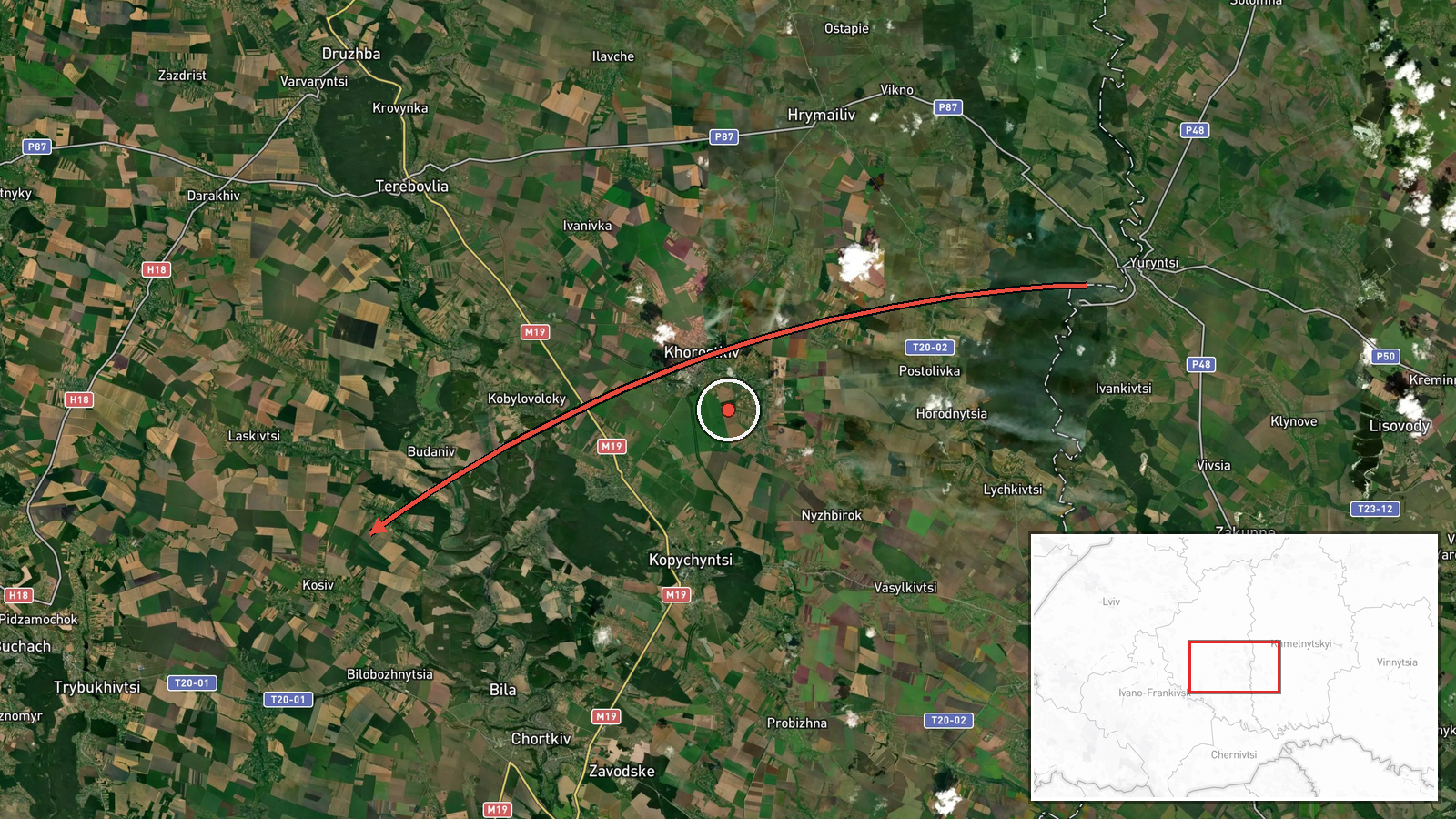
Ukrainian air monitoring channel @kpszsu reported on 21 October 2026 at 18:10 UTC that one Russian jet-powered Shahed (Geran-3) drone was flying from Khmelnytskyi Oblast toward the south of Ternopil Oblast in western Ukraine. The original Ukrainian-language post describes it as a jet-type unmanned aerial vehicle moving south of Ternopil region from Khmelnytskyi. The report concerns air movement only and does not mention impact, damage, casualties, or interception. The alert is one of a series of drone-transit reports issued through the day, and the source wording refers to the drone's direction and route rather than a confirmed target. The timing reflects when the warning was published, not necessarily when the drone was observed at each point on its path.
Context and assessment
Western Ukraine, including Ternopil and Khmelnytskyi oblasts, has appeared repeatedly in air alerts during this period, reflecting drones routed across the country's west rather than striking only frontline areas. Related reports earlier on 21 October describe Geran-3 drones passing Husiatyn in Ternopil Oblast around 02:16 UTC, then a drone heading toward Ternopil Oblast at 13:48 UTC, and another at 16:39 UTC. Earlier still, a group of two or more drones was reported moving from Vinnytsia Oblast into southern Khmelnytskyi at 12:13 UTC, and a single drone was tracked toward Dunayivtsi at 17:58 UTC. This sequence suggests a sustained flow of single or small groups using a corridor through central and western Ukraine. Operationally, such transits may indicate route-testing, distraction of air defenses, or reconnaissance of western infrastructure, though the reports alone do not establish the intended target. Single-drone tracks of this kind are often difficult to attribute to a specific objective without follow-up reporting.
Sources and confidence
The report comes from a single Telegram channel, @kpszsu, which relays Ukrainian air force monitoring of drone movements. No second independent outlet in the provided data confirms this specific track, so cross-confirmation is absent. The confidence score of 8.0 is low, reflecting single-source reporting, the absence of impact data, and the general nature of an air-monitoring alert. Confidence would rise if the Ukrainian air force official channel, regional military administrations, or independent trackers corroborated the route, or if later reports identified a strike or interception. It would fall if subsequent updates contradicted the direction or if the track were attributed to a different drone type.
Location
The location is recorded at regional level as southern Ternopil Oblast, with a coordinate near 49.10 N, 25.59 E, and the precision is marked as region rather than settlement. The coordinate is an approximation centered on the southern part of the oblast, not a confirmed drone position. Southern Ternopil is largely rolling agricultural terrain on the western edge of the Podolia upland, with the Dniester River system and the Khmelnytskyi border region to the north and east. Nearby features include Husiatyn, which appears in related reports, and the Dniester corridor, which is a common natural reference point for drone routing in the area.
Related events nearby
- Ukrainian air monitoring: 1 Russian jet-powered Shahed (Geran-3) drone heading toward Ternopil Oblast.2026-10-21 16:39 UTC · Drone Transit · Ternopil Oblast, Ukraine
- Ukrainian air monitoring: 1 Russian jet-powered Shahed (Geran-3) drone heading toward Ternopil Oblast.2026-10-21 13:48 UTC · Drone Transit · Ternopil Oblast, Ukraine
- Ukrainian air monitoring: 1 Russian jet-powered Shahed (Geran-3) drone passing Husiatyn, heading toward Ternop2026-10-21 02:16 UTC · Drone Transit · Ternopil Oblast, Ukraine
- Ukrainian air monitoring: 1 Russian jet-powered Shahed (Geran-3) drone from southern Khmelnytskyi Oblast towar2026-10-21 17:58 UTC · Drone Transit · Dunayivtsi, Ukraine
- Ukrainian air monitoring: 2+ Russian jet-powered Shahed (Geran-3) drones from Vinnytsia Oblast toward southern2026-10-21 12:13 UTC · Drone Transit · southern Khmelnytskyi Oblast, Ukraine
▶ View this event on the live map

Intel Mapper aggregates open-source reports from monitored Telegram and X channels, geolocates them, cross-checks duplicates across sources and assigns a confidence score. Entries are updated as new confirmations arrive. Read how we verify events.