Ukrainian Air Force reports one drone heading toward Dnipro from the south
What happened
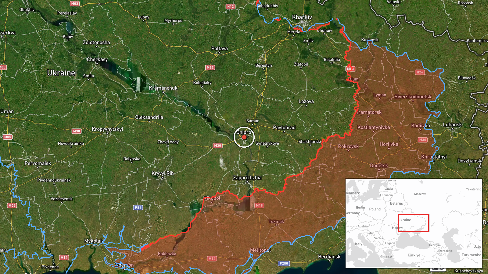
Ukraine's Air Force monitoring channel on Telegram, @kpszsu, posted at 18:32 UTC on 21 October 2026 that a single unmanned aerial vehicle was heading toward Dnipro from the south. The original Ukrainian text reads, in translation, 'UAV toward Dnipro from the south,' and does not name a drone model. The summary attached to this event classifies it as a Shahed-type drone, a label that reflects the editorial reading of the alert rather than wording in the post itself. The report names Russia as the actor and describes a transit warning, meaning a drone in flight toward the city, not a confirmed impact. The data records no strike, damage, casualties or interception for this event.
Context and assessment
Dnipro is a large industrial city on the Dnipro River and the regional capital of Dnipropetrovsk Oblast. Its rail junctions, factories and defence-related sites have made it a recurring target since 2022, so air alerts there carry more weight than alerts over less significant places. The alerts on this day form a clear sequence. At 10:13 UTC a single Banderol mini cruise missile was reported moving from northern Dnipropetrovsk Oblast toward Dnipro. At 10:18 two or more Banderol missiles were reported heading for the city. At 13:45 one jet-powered Geran-3 drone was reported heading toward Dnipro, followed at 17:21 by tactical aviation heading toward the wider oblast and at 17:28 by two or more Geran-3 drones aimed at the city. This drone at 18:32 is the latest in that run. The cadence across roughly eight hours, mixing cruise missiles, jet drones and aircraft, suggests sustained pressure on the city and its surroundings rather than one isolated launch. Operationally, repeated transit warnings may point to probing, saturation of air defences, or follow-on waves timed for later hours. They may also reflect reconnaissance or decoy use. The data does not show targets or results, so these readings stay provisional.
Sources and confidence
All information comes from one channel, Telegram @kpszsu, which is the Ukrainian Air Force's official air monitoring account. Such channels are generally authoritative for airspace warnings, but this post is brief and no independent outlet in the dataset corroborates it. The confidence score of 8.0 out of 10 reflects the official origin and high location confidence, tempered by single-source status, the absence of any second report, the terse wording and the lack of a stated drone type. Confidence would rise with a second official or regional source, such as the Dnipropetrovsk regional administration, or with later reporting that confirms the track. It would fall if the alert were cancelled, reclassified or contradicted by subsequent official statements.
Location
The coordinates 48.46 N, 35.05 E are set at settlement level with high location confidence, placing the point at the centre of Dnipro city. The alert names the city rather than a district or facility, so the point represents the whole urban area, not a specific site. Dnipro lies in central-eastern Ukraine, with the Dnipro River running through it and dividing the built-up area across its banks. Bridges, islands and the river corridor are notable features of the city's geography.
Related events nearby
- Ukrainian air monitoring: 2+ Russian jet-powered Shahed (Geran-3) drones heading toward Dnipro.2026-10-21 17:28 UTC · Drone Transit · Dnipro, Ukraine
- Ukrainian air monitoring: Russian tactical aircraft (tac. aviation) heading toward Dnipropetrovsk Oblast.2026-10-21 17:21 UTC · Combat Aircraft · Dnipropetrovsk Oblast, Ukraine
- Ukrainian air monitoring: 1 Russian jet-powered Shahed (Geran-3) drone heading toward Dnipro.2026-10-21 13:45 UTC · Drone Transit · Dnipro, Ukraine
- Ukrainian air monitoring: 2+ Russian Banderol mini cruise missiles heading toward Dnipro.2026-10-21 10:18 UTC · Cruise Missile · Dnipro, Ukraine
- Ukrainian air monitoring: 1 Russian Banderol mini cruise missile from northern Dnipropetrovsk Oblast toward Dn2026-10-21 10:13 UTC · Cruise Missile · Dnipro, Ukraine
▶ View this event on the live map

Intel Mapper aggregates open-source reports from monitored Telegram and X channels, geolocates them, cross-checks duplicates across sources and assigns a confidence score. Entries are updated as new confirmations arrive. Read how we verify events.