Ukrainian monitors report one jet-powered Shahed drone transiting Mykolaiv district northward
What happened
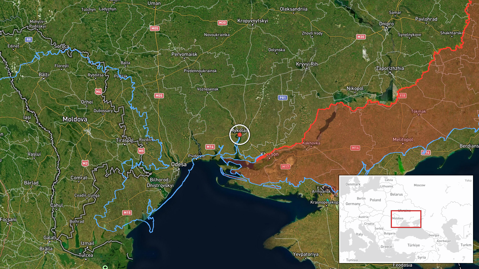
Ukrainian air monitoring, as relayed by the Telegram channel @kpszsu, reported one Russian jet-powered Shahed drone, designated Geran-3 in the source's wording, passing through Mykolaiv district and heading north. The post, timestamped 22 October 2026 at 07:15 UTC, is a short operational notice rather than a report of impact, and it describes no explosions, casualties or damage. The original Ukrainian text uses the phrase 'Реактивний БпЛА' (jet-powered unmanned aerial vehicle) and gives only the district and direction of travel, without naming a settlement. The event is categorised as a drone transit, and the record has not been corrected.
Context and assessment
Mykolaiv sits on the Southern Bug estuary in southern Ukraine, a short distance from the Black Sea coast and the approaches to Odesa. Its port, shipyards and road and rail links have made it a recurring feature of Russian long-range strike campaigns, and the Shahed family of one-way attack drones has been used widely against targets across the south. The related events show a dense sequence over about a day on 21 October. Monitors recorded groups of three or more drones moving from the Black Sea toward Ochakiv, then passing Nova Odesa, and later groups of two or more crossing Mykolaiv Oblast from the sea. Single drones were also reported from Odesa Oblast toward Raukhivka and passing Mykolaiv Oblast northward. This repeated use of a north-bound corridor suggests drones entering over the sea and moving inland, possibly toward targets further north or as part of a sustained effort. The single drone reported on 22 October may be the tail of the same traffic rather than a new wave. Transit reports describe movement rather than intended targets, so the destination cannot be inferred from this record alone.
Sources and confidence
The record rests on a single Telegram channel, @kpszsu, and no independent outlet or second channel in the data reports this transit, so cross-confirmation is absent. The confidence score of 8.0 is high for one source because the channel is established, the wording is specific about drone type and direction, and related reports form a consistent sequence. It stops short of the maximum because the post gives no detection time or track. Confidence would rise with a second monitoring channel or an official statement, and would fall if the report were revised or withdrawn.
Location
The coordinates are assigned at settlement precision and place the point in the Mykolaiv area, though the source names only the district. The point lies near the Southern Bug estuary, where the river and its tributaries cross low, flat terrain south of the city. The Black Sea coast is a comparatively short distance south. The actual track may lie away from this point.
Related events nearby
- Ukrainian air monitoring: 2+ Russian jet-powered Shahed (Geran-3) drones from Black Sea toward Mykolaiv Oblast2026-10-21 13:33 UTC · Drone Transit · Mykolaiv Oblast, Ukraine
- Ukrainian air monitoring: 2+ Russian jet-powered Shahed (Geran-3) drones passing Mykolaiv Oblast, heading nort2026-10-21 12:46 UTC · Drone Transit · Mykolaiv Oblast, Ukraine
- Ukrainian air monitoring: 2+ Russian jet-powered Shahed (Geran-3) drones passing Nova Odesa, heading north.2026-10-21 08:32 UTC · Drone Transit · Nova Odesa, Ukraine
- Ukrainian air monitoring: 3+ Russian jet-powered Shahed (Geran-3) drones from Black Sea toward Ochakiv.2026-10-21 08:11 UTC · Drone Transit · Ochakiv, Ukraine
- Ukrainian air monitoring: 1 Russian jet-powered Shahed (Geran-3) drone from Odesa Oblast toward Raukhivka.2026-10-21 09:46 UTC · Drone Transit · Raukhivka, Ukraine
▶ View this event on the live map

Intel Mapper aggregates open-source reports from monitored Telegram and X channels, geolocates them, cross-checks duplicates across sources and assigns a confidence score. Entries are updated as new confirmations arrive. Read how we verify events.