Ukrainian air monitoring reports jet-powered Geran-3 drone transiting Khmelnytskyi Oblast
What happened
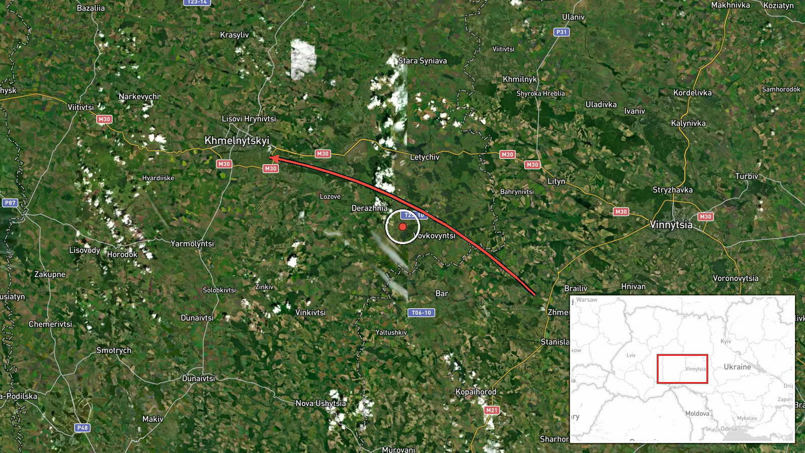
Ukrainian air monitoring, relayed through the Telegram channel @kpszsu, reported one Russian jet-powered Shahed, designated Geran-3, passing near Zhmerynka and heading toward Khmelnytskyi Oblast on 22 October 2026 at 16:59 UTC. The original Ukrainian-language post uses the headline 'Vinnytsia region: jet drone passes Zhmerynka, course toward Khmelnytskyi region,' and describes a drone in transit rather than a strike. The report does not state impact, damage, casualties or interception. The event is recorded as a single-source report with no independent confirmation at the time of compilation. Its timestamp sits within a short sequence of similar air monitoring notices logged over the preceding day across western Ukraine.
Context and assessment
Western Ukraine has become a recurring corridor for Russian long-range drone activity, and this entry belongs to a run of closely spaced transit notices. Related entries place single Geran-3 drones near Dunayivtsi and southern Khmelnytskyi Oblast on 21 October, heading toward southern Ternopil Oblast that evening, then near Vendychany on the morning of 22 October, Shepetivka from northern Khmelnytskyi Oblast about two minutes before this report, and Zhmerynka in Vinnytsia Oblast at nearly the same time. The pattern suggests several individual drones moving along north-south and east-west axes through the region rather than a single attack wave. Railway junctions, logistics nodes, energy infrastructure and air defence coverage gaps are plausible reasons for such routing, though the data does not establish the intended target. The jet-powered variant is generally faster and harder to intercept with older systems than piston-engine Shaheds, which may be why such notices are issued at all. Operationally, the sequence may indicate reconnaissance, route testing, or drones aimed at targets further west, but these readings remain hypotheses. Each transit notice reflects an individual air monitoring observation, so the cluster is best read as a trend in reported activity rather than confirmed intent.
Sources and confidence
The entry rests on one Telegram channel, @kpszsu, which carries Ukrainian Air Force monitoring updates. No second outlet, wire service or official confirmation appears in the provided data, so cross-confirmation is absent. The confidence score of 8.0 reflects a credible official-style source with a clear, consistent message format and matching related reports, offset by the single channel and the absence of any independent verification. Confidence would rise with corroboration from additional Ukrainian official channels, regional military administration statements, or open-source flight tracking. It would fall if the related transit reports were later revised or if the drone identification could not be confirmed.
Location
The location is recorded at regional precision, with coordinates of 49.42 N, 26.98 E, which is a generalized point within Khmelnytskyi Oblast rather than a fix on the drone's position. The source names Zhmerynka, a railway town in Vinnytsia Oblast, as the point of passage, so the marked point should not be read as the exact drone track. The surrounding area is largely agricultural plain in western Ukraine, with major rail and road links running through the region. The low location confidence reflects this mismatch between the named towns and the regional coordinates.
Related events nearby
- Ukrainian air monitoring: 1 Russian jet-powered Shahed (Geran-3) drone heading toward Khmelnytskyi.2026-10-22 17:24 UTC · Drone Transit · Khmelnytskyi, Ukraine
- Ukrainian air monitoring: 1 Russian jet-powered Shahed (Geran-3) drone from northern Khmelnytskyi Oblast towar2026-10-22 16:57 UTC · Drone Transit · Shepetivka, Ukraine
- Ukrainian air monitoring: 1 Russian jet-powered Shahed (Geran-3) drone heading toward Zhmerynka.2026-10-22 17:02 UTC · Drone Transit · Zhmerynka, Ukraine
- Ukrainian air monitoring: 1 Russian jet-powered Shahed (Geran-3) drone heading toward Zhmerynka.2026-10-22 16:58 UTC · Drone Transit · Zhmerynka, Ukraine
- Ukrainian air monitoring: 1 Russian jet-powered Shahed (Geran-3) drone from Khmelnytskyi Oblast toward souther2026-10-21 18:10 UTC · Drone Transit · southern Ternopil Oblast, Ukraine
▶ View this event on the live map

Intel Mapper aggregates open-source reports from monitored Telegram and X channels, geolocates them, cross-checks duplicates across sources and assigns a confidence score. Entries are updated as new confirmations arrive. Read how we verify events.