Jet-powered Shahed-type drones reportedly tracked westward through Chornobyl Exclusion Zone
What happened
Ukrainian air monitoring reported on 22 October 2026 at 17:12 UTC that new jet-powered drones, described in the event summary as Russian Shahed-type Geran-3 aircraft, were tracked moving west through the Chornobyl Exclusion Zone in northern Ukraine. The original Ukrainian-language post, published on the Telegram channel @kpszsu, uses the term 'реактивні БпЛА' (jet-powered unmanned aerial vehicles) and states only a westward heading. It gives no drone count, altitude, or intended target. The event data attributes the drones to Russia, but the post itself does not name a launch site. The event is classed as a drone transit rather than a strike, and no impact or damage is reported in the available material.
Context and assessment
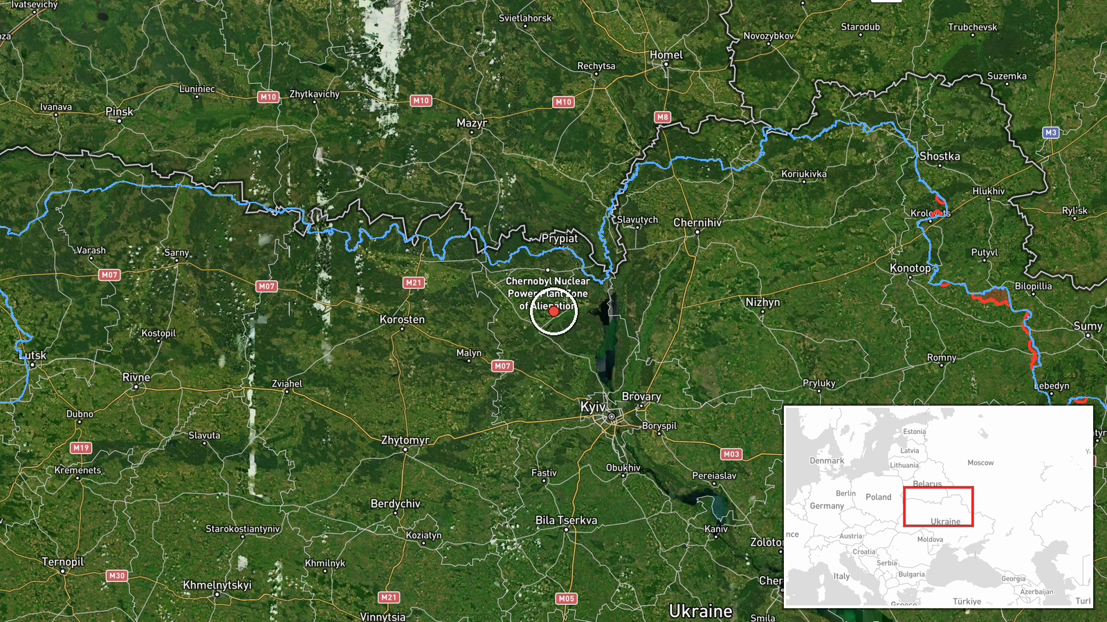
The Chornobyl Exclusion Zone is a largely depopulated area of forest, wetland and abandoned settlements surrounding the decommissioned Chornobyl nuclear plant, and it sits close to the Belarusian border north of Kyiv. Its sparse population and lack of ground infrastructure make it an unusual corridor, and reports of aerial movement through it draw attention because of its nuclear-related sensitivity. The related events show a busy morning of drone activity in the same northern Kyiv Oblast area on 22 October. Reports of two or more Shahed-type drones moved toward Slavutych at 07:15 UTC and again at 09:31 UTC, and a separate transit was logged toward Bucha at 08:23 UTC. A ballistic missile was reported over Kyiv at 00:09 UTC. These entries come from the same type of monitoring and do not confirm that the same aircraft were involved. Operationally, a westward track through the zone could reflect routing that avoids densely defended areas, or a broader multi-axis pattern across the region. Any specific target cannot be inferred from the available material.
Sources and confidence
The event rests on a single Telegram channel, @kpszsu, and the data records no independent cross-confirmation from another outlet, monitoring service or official statement. The confidence score of 8.0 reflects the channel's position as an official Ukrainian air monitoring source, the specificity of the post, and its consistency with same-day reports from the same source. The single-source status and absence of corroboration keep the score below the highest level. Confidence would rise with confirmation from independent tracking data, regional authorities, or wire services citing military statements. It would fall with a correction or retraction, or with evidence that the aircraft were not drones of the described type.
Location
The coordinates 51.05 N, 30.00 E are region-level, placing the event at the approximate centre of the Chornobyl Exclusion Zone rather than at a specific point. The location confidence is high because the zone is a clearly defined administrative area. The zone lies in northern Kyiv Oblast along the Belarusian border and includes the Chornobyl plant, the abandoned city of Pripyat, and extensive forest and marsh along the Pripyat River basin. Slavutych, a city built for plant workers, lies just outside the zone to the east and appears in related reports.
Related events nearby
- Ukrainian air monitoring: 2+ Russian jet-powered Shahed (Geran-3) drones from northern Kyiv Oblast toward Buch2026-10-22 08:23 UTC · Drone Transit · Bucha, Ukraine
- Ukrainian air monitoring: 2+ Russian jet-powered Shahed (Geran-3) drones heading toward Slavutych.2026-10-22 09:31 UTC · Drone Transit · Slavutych, Ukraine
- Ukrainian air monitoring: 2+ Russian Shahed-type drones heading toward Slavutych.2026-10-22 07:15 UTC · Drone Transit · Slavutych, Ukraine
- Ukrainian air monitoring: 1 Russian ballistic missile over Kyiv.2026-10-22 00:09 UTC · Ballistic Missile · Kyiv, Ukraine
- Ukrainian air monitoring: 1 Russian ballistic missile over Kyiv.2026-10-22 00:09 UTC · Ballistic Missile · Kyiv, Ukraine
▶ View this event on the live map

Intel Mapper aggregates open-source reports from monitored Telegram and X channels, geolocates them, cross-checks duplicates across sources and assigns a confidence score. Entries are updated as new confirmations arrive. Read how we verify events.