Ukrainian air monitoring reports 2+ jet-powered Shahed drones heading toward Slavutych
What happened
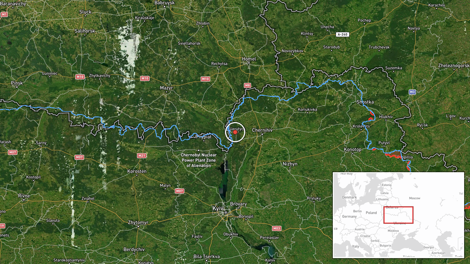
Ukraine's Telegram channel @kpszsu, the official account of Ukrainian air-monitoring reports, posted on 22 October 2026 at 09:31 UTC that a group of two or more jet-type drones was heading toward Slavutych, a city in northern Ukraine close to the Chernihiv Oblast border. The original post, written in Ukrainian as a group of jet unmanned aerial vehicles bound for Slavutych, is the only source in the record. The summary identifies the aircraft as Russian jet-powered Shahed (Geran-3) drones. The wording describes an inbound track and warning rather than confirmed impact, and the data reports no strike, damage, or casualties. An earlier air-monitoring alert at 07:15 UTC the same day also referenced two or more Shahed-type drones heading toward Slavutych.
Context and assessment
Slavutych was built in the 1980s to house workers from the Chornobyl nuclear plant after the 1986 disaster, and it sits in northern Ukraine near the Chernihiv border, so its strategic value lies less in its own industry than in its position along a northern approach corridor. The related reports show a sequence of drones moving through the region over roughly a day. A single jet-powered Geran-3 passed south of Chernihiv heading west at 10:04 UTC on 21 October. A group of two or more passed northern Kyiv Oblast heading west at 15:51 UTC. A single drone was tracked toward Chernihiv at 18:03 UTC. A group was then reported over northern Chernihiv Oblast at 09:19 UTC on 22 October, followed by the Slavutych warnings. The pattern suggests tracks moving through the Chernihiv and Kyiv northern border belt, with aircraft reported as they approach settlements in turn. Operationally, this may reflect routing choices by the launching side, attempts to saturate or distract air defenses, or the monitoring network reporting successive segments of the same flight paths. Jet-powered variants are faster than piston-engine Shaheds, which shortens warning time, so the reported type matters. The data does not establish intent or a specific target.
Sources and confidence
The only channel listed is Telegram @kpszsu, an official Ukrainian air-monitoring account, with a source count of one. No second outlet or independent confirmation appears in the record for this report. The confidence score of 8.0 out of 10 reflects an official, direct-source channel with high location precision, tempered by the lack of cross-confirmation. Confidence would rise with a second monitoring source, radar data, or a regional military administration statement, or with a report of interception in Slavutych. It would fall if later updates revised the drone count or type, or if the track was identified as a false alarm.
Location
The location is recorded at settlement level, using coordinates for Slavutych city in northern Ukraine, with location confidence rated high. Slavutych lies in Kyiv Oblast close to the Chernihiv Oblast border, on the flat Polissia lowlands with forest and wetland cover typical of the region. The planned town layout and the nearby Chornobyl exclusion zone are notable features of the area.
Related events nearby
- Ukrainian air monitoring: 2+ Russian Shahed-type drones heading toward Slavutych.2026-10-22 07:15 UTC · Drone Transit · Slavutych, Ukraine
- Ukrainian air monitoring: 1 Russian jet-powered Shahed (Geran-3) drone heading toward Chernihiv.2026-10-21 18:03 UTC · Drone Transit · Chernihiv, Ukraine
- Ukrainian air monitoring: 2+ Russian jet-powered Shahed (Geran-3) drones passing northern Kyiv Oblast, heading2026-10-21 15:51 UTC · Drone Transit · northern Kyiv Oblast, Ukraine
- Ukrainian air monitoring: 2+ Russian jet-powered Shahed (Geran-3) drones over northern Chernihiv Oblast.2026-10-22 09:19 UTC · Drone Transit · northern Chernihiv Oblast, Ukraine
- Ukrainian air monitoring: 1 Russian ballistic missile over Brovary.2026-10-22 09:40 UTC · Ballistic Missile · Brovary, Ukraine
▶ View this event on the live map

Intel Mapper aggregates open-source reports from monitored Telegram and X channels, geolocates them, cross-checks duplicates across sources and assigns a confidence score. Entries are updated as new confirmations arrive. Read how we verify events.