Ukraine's Air Force reports 2+ jet-powered Shahed drones over northern Chernihiv Oblast
What happened
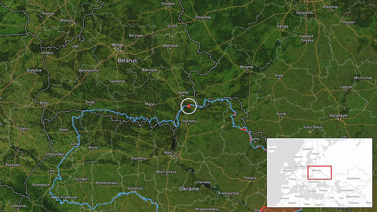
Ukraine's Air Force reported on Telegram on 22 October 2026 at 09:19 UTC that two or more Russian jet-powered Shahed-type drones, identified as Geran-3, were moving over northern Chernihiv Oblast. The original Ukrainian-language post described jet-powered unmanned aerial vehicles in the north of Chernihiv region, following a course along the border with Belarus. The report does not name a settlement and gives no information about impacts, damage, or casualties. Its wording points to a transit observation rather than a strike report. The event is catalogued as a drone transit attributed to Russia, based on the Ukrainian military's identification of the Geran-3 type. Updates may follow if the drones change course or leave the area.
Context and assessment
Northern Chernihiv Oblast lies along the Belarusian border, so drones moving through it are tracked as they enter Ukrainian airspace from the north and head toward targets further west or south. The related reports show a wider sequence. On 21 October, a single Geran-3 was reported heading toward Chernihiv city at 18:03 UTC, another was logged passing south of Chernihiv heading west at 10:04 UTC, and a group of two or more was seen crossing northern Kyiv Oblast heading west at 15:51 UTC. Early on 22 October, two or more Shahed-type drones were reported heading toward Slavutych at 07:15 UTC, a town in northeastern Kyiv Oblast close to the Chernihiv boundary. Together these reports describe repeated movement along a northern corridor, with several drones moving westward across both oblasts over roughly 24 hours. That repetition suggests a sustained launch or routing pattern rather than an isolated flight. Operationally, it may indicate an effort to reach targets in the northwest, to route around air defence concentrations, or to probe detection coverage, though the data does not confirm any of these aims. The Geran-3's jet propulsion makes it faster than earlier propeller-driven Geran-2 variants, which can shorten warning times for local communities.
Sources and confidence
All information comes from a single Telegram channel, @kpszsu, the official account of the Ukrainian Air Force, which published the original post. No other channel or outlet in the dataset independently confirms the report. The confidence score of 8.0 reflects the official status of the source and the consistency of surrounding reports, but it is not higher because the event rests on one post without corroboration, imagery, or a precise location. Confidence would rise with independent confirmation from radar reporting, Belarusian or regional authority statements, or visual evidence. It would fall if later updates contradict the reported type, direction, or number of drones, or if the post is revised.
Location
The location is approximate. The coordinates (52.08459, 31.29) mark a region-level point rather than a specific settlement, and location confidence is recorded as low. The report places the drones along the northern edge of Chernihiv Oblast near the Belarusian border, so their true position could be anywhere along that strip. The terrain is largely flat lowland with forests, marshes, and river systems, including the Desna basin. Few large urban centres lie in the border zone, and Chernihiv city is situated to the south.
Related events nearby
- Ukrainian air monitoring: 1 Russian jet-powered Shahed (Geran-3) drone heading toward Chernihiv.2026-10-21 18:03 UTC · Drone Transit · Chernihiv, Ukraine
- Ukrainian air monitoring: 2+ Russian Shahed-type drones heading toward Slavutych.2026-10-22 07:15 UTC · Drone Transit · Slavutych, Ukraine
- Ukrainian air monitoring: 1 Russian jet-powered Shahed (Geran-3) drone passing south of Chernihiv, heading wes2026-10-21 10:04 UTC · Drone Transit · south of Chernihiv, Ukraine
- Ukrainian air monitoring: 2+ Russian jet-powered Shahed (Geran-3) drones passing northern Kyiv Oblast, heading2026-10-21 15:51 UTC · Drone Transit · northern Kyiv Oblast, Ukraine
▶ View this event on the live map

Intel Mapper aggregates open-source reports from monitored Telegram and X channels, geolocates them, cross-checks duplicates across sources and assigns a confidence score. Entries are updated as new confirmations arrive. Read how we verify events.